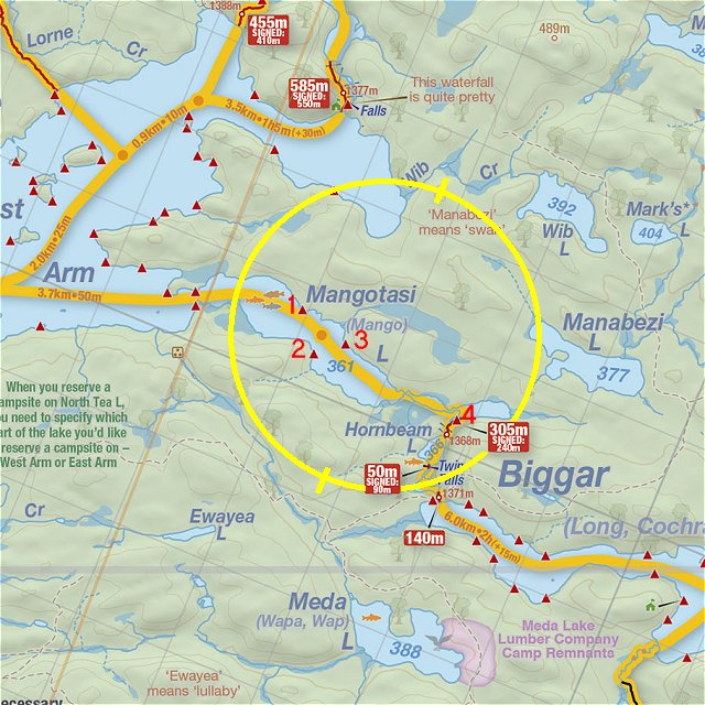
 Portage 305 meters - Mangotasi (signed as North Tea) To Hornbeam
Length of portage: 305 meters (signed 240 meters).
Portage maintenance regular or low: Regular.
Landing on Mangotasi Lake / North Tea Lake (elevation 361m)
Topography of under-water approach: Sand and gravel, shallow water.
Impediments to disembarking from and/or unloading a canoe: None.
Topography of the ascending grade: Well worn, smooth dirt path.
Impediments to moving gear to portage trail: None, plenty of room to stage rear at the side of the trail.
A nice easy landing ...

Portage Trail (peak elevation 368m)
General description: Relatively flat and smooth trail with a campsite located at the Mangotasi Lake side of the trail.
Topographical impediments to traveling: None.
Areas susceptible to impact by periods of rain or beaver flooding: As the trail is relatively flat, there would be many areas where mud puddles would occur.
The campsite along the Mangotasi end of the trail ...


Landing on Hornbeam Lake (elevation 366 meters).
Topography of under-water approach: Soft, sandy bottom, shallow water.
Impediments to disembarking from and/or unloading a canoe: Lower water levels would yeild slightly more room to load/unload a canoe.
Topography of the ascending grade: Smooth dirt path.
Impediments to moving gear to portage trail: None
It could get crowded ...

Thanks to Jeffrey McMurtrie of Maps By Jeff for supplying the base map.
Submitted by Chris Taylor, visited May 2015, submitted October 27th, 2019