Ted Strolenberg's
May, 2003
|
I'd originally planned to take 8 days to do this trip but the Ministry was doing testing and netting in Little Crooked Lake so I skipped by that lake and reduced my trip to 7 days.
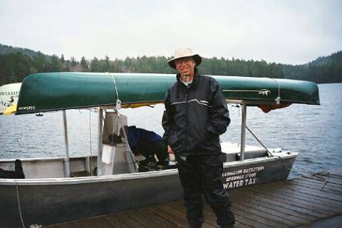 Photo: Ready to start trip with water taxi to North east arm of Opeongo.
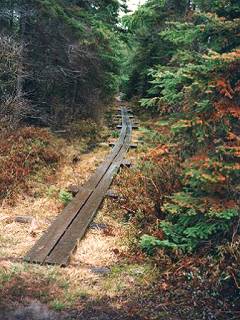
It was raining on Friday when I headed out and it rained on and off the whole day. I started at Opeongo by using the water taxi out to the east arm, having reserved it in advance. I got lucky because there was another party heading out at the same time, so it only cost me $26. If I had been the only booking it would have cost $60. It took 20minutes by taxi to go the distance. It was pretty impressive compared to the 4 hours plus it took me to paddle the length of the lake when I came out. There's two ways to go to Dickson Lake, a cart path or a portage. I took the portage because it was 5300 meters compared to over 7000 meters for the cart path. It took me about 5 hours to do the portage ..one carry with canoe and one with backpack. The portage has several log/board walkways over swampy/wet spots. It was raining all day Friday when I was on this portage so I found it quite slippery. Photo: The start of the Bonfield Dickson Portage. There are several board-walks, some being quite long. I reached Dickson Lake about 3:30 and headed for Little Dickson. The portage to Little Dickson is easy and well used. I spent the first night at Little Dickson Lake. I tried fishing it and caught a lousy perch for my efforts. I used the 1st campsite on the north side past the portage. Nice site. I headed for White Partridge the next day and fished along the shore of Little Dickson on the way out, but got nothing. The east end of this lake is very shallow.
 The portage to Sundassa is long (2800 meters). Some of the best huge white pines that I've seen are along this portage. The portage is in good shape despite being low maintenance. At about the half way point you drop down a steep hill and have to cross on a beaver dam. I fished Sundassa Lake as I paddled through it but got nothing. The portage to White Partridge is also very easy to follow. White Partridge is a big lake with nice clear water and a good beach on the north east end. There aren't many campsites on it. The three sites on the east side were full, so I stayed at one on the north shore that looked like it had not been used in about 2 years. I found that the shoreline is quite steep for most of the lake. I started fishing right from the put in off the portage and managed to catch a good sized speckled trout over 3 lbs. within 100 yards of the portage. I thought that the fishing might be real good on this lake. It turned out to be the only fish I would catch on this lake. Trout were surfacing in the north east bay all evening but I could not get them to bite. There were several other people on this lake. It was the long weekend and they had come in via the horse and buggy route cart trail. None of them could get the surfacing fish to bite either. I spoke with one of the other parties on the lake that evening and they indicated that they too had some luck with speckles but no one had caught any lake trout. There was a mayfly hatch rising and I suspect that's what these trout were feeding on. Next day I portaged and paddled the Whitepartridge creek down to Lavague Lake on the Crow river. I had been warned at the Opeongo office that no one had been down this route since last spring. The portage turned out to be an old road for the most part which made it very easy to do. At about the halfway mark the road comes to a T shape. There are signs indicating that the portage continues to the left. Within about 400 yards of the put in on the creek, there was a spot where trees had fallen across/into the creek and I had to find/cut a way around on land. Good thing I brought a Swede saw. It came in real handy. The creek was fast flowing. I actually enjoyed this part of the trip the most, catching some pretty good panfries (8 to 10 inch specks). In addition to the tree obstacle there were two short portages which are marked but not shown on the canoe route map. The creek is fast flowing and at times narrows to the point where you need to pull yourself through the tag alders. I believe I counted 7 beaver dams but I was able to shoot all but one which required a liftover. I would not recommend trying to take this route in an upstream direction. The fast current and narrow spots would result in having to get out and walk through some very thick underbrush. The meeting point with the Crow is much different than expected. On the map it shows a small lake(widening ) where the portage up the Crow begins. It does not exist. The portage is at the beginning of a log jam/rapids where the creek and the river meet. The portage up the Crow to Lavague is scenic but tough. It's all uphill and it was the hottest day of the whole trip. The Crow is all rapids and falls along this stretch and there were some great views along the portage. Because of the increase in temperature, the bugs came out and this was the only day that they were a nuisance to the point that I had to put on some Muskol.
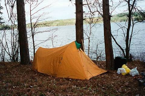
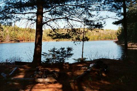 Photo: The campsite I used on Lake Lavague. On Lavague Lake there was a beaver lodge right at the campsite I stayed at. I had noticed some small fish (4 to 5 inches) in among the wood in the water there when I returned from fishing on the Sunday evening. The next morning while I was having a coffee there was a loon in there feeding on them. This bird got within 10 feet of me and didn't flinch. I could see it underwater chasing the fish. It was quite amazing to see. This small shallow lake has 3 campsites. I found that the east most campsite was the best.
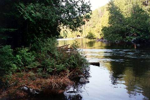 Photo: One of the portage and paddle hops along the Crow from Lavague to Lavieille. The next portage is the opening in the trees in picture center. Note the current. Some sections were even faster. I continued up the Crow the next day. This stretch consists of short portages followed by short paddles (9 in total) with the longest paddle being Mallic Lake. In several spots you can see the next portage about 100 to 200 meters upriver from your put in. I found that several of the paddling sections have very fast current (swifts) and you really have to work to make any progress going upstream (especially solo). I tried fishing at the foot of several rapids along the way but got nothing.
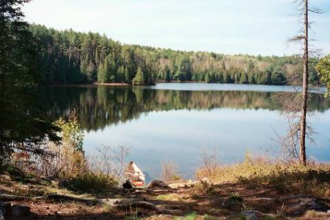 Photo: The put in at Mallic Lake on the Crow. I reached Lavieille and paddled down the east shoreline. I found a nice campsite on this shoreline directly opposite a group of islands and decided to camp there. I spent the rest of the day fishing the islands and got nothing. The next morning I fished islands and east shore until wind picked up around 8:30. I got two speckles around 1.5 to 2 pounds each.
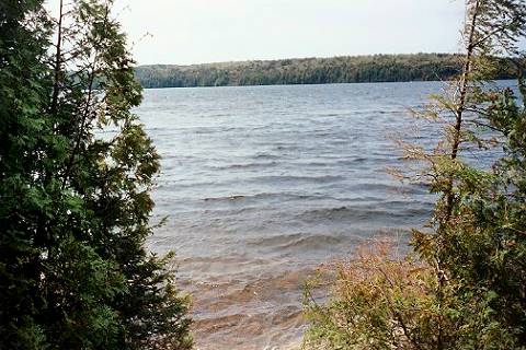 Photo: Lavieille on a windy day. It got real windy ..about 70Kms with whitecaps coming from the south. So, I stayed put at this site on Lavieille. It howled all through the night with rain on and off. The next morning was cold and the wind although still strong, had switched and was coming from the north east. I headed out of Lavieille for Dickson. It snowed for about an hour while I was paddling down this lake. I got to Dickson and even though it was mid week, all the campsites I passed on the west side were occupied.
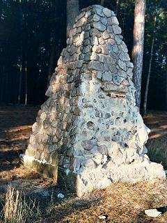
I fished my way along and headed for the portage and went straight through to Opeongo. Figured I might as well take advantage of the cool temperatures and do the portage on a cool breezy day. Took the cart path just for a change of scenery. It turned out to be a better route because its an old road and much easier to walk on than the portage. There is one tough steep hill right where the portage and cart path separate about 1500 meters west of Dickson Lake. After that its all smooth roadway with a few damp spots. At Wright Lake, the cartpath runs right along side the lake and there is a spot where you can get to the lake. I took this route rather than go to the end of the cart path and paddled to the short portage to Opeongo. It cut about 1500 meters off the walk. I had the whole east bay of Opeongo to myself. Photo: This stone cairn that stands on the shore at the portage on the Northeast arm of Opeongo. Its in rough shape. The plaque is gone and I have no idea why its there. Thursday morning the wind was from the east so I had a nice tail wind for half of my trip down Opeongo. Oh, about 5 in the morning on Thursday I was woken by this thumping on the ground and it seemed to be getting closer. I opened the door to my tent just in time to see a bull moose come running right through the campsite within about 20 ft of the tent. I have no idea what scared him into running through like that. Comments: I just had to try this trip because I had heard and read so much hype about Dickson and Lavieille but in my opinion it is more hype than reality. These lakes wouldn't make it on my list of nice lakes to go to in Algonquin. They certainly don't make it on my list of good fishing lakes. Of course if one had a week or more to spend on either lake, they might find the good fishing spots but the key is that they are big lakes and it would take a lot of time to locate the better spots. Also the long portages and big lakes (wind) are tough when you're solo. I was also surprised at the condition of the Bonfield / Dickson portage. I had read that this was a well used and relatively flat portage. It is well used but it is far from flat. It doesn't have a lot of hills in it but it has a lot of rock/root sections that make the cart path a much more appealing route to walk on. I should have taken more pictures.
|