Contents
North SideFrom Steven Bobrowicz, Peterborough, Ontario: One of my favorite routes is the northern corridor of Algonquin Park - Kioshkokwi L (Access #29) to Wendigo L (Access #25) Portages - 16 (6660m ttl)
Route - Kiosk - Mink - Cauchon - Laurel - Cedar - Petawawa R. - Radient - Clamshell - N. Depot - Wendigo. Difficultly - I did this route in six days with seven 15 year old boys who had never paddled a canoe before. Flatwater only, but the bigger lakes, esp. Cedar have some stretches of open water. Features - easy paddling, easy portaging and great scenery. Cedar lake is, in my opinion the most beautiful lake in the park, as long as your not there on a Friday night! This route also has a great deal of variety - big lakes, rivers and marsh paddling. Drawbacks -1) follows the CN railway from Kiosk to Radient 2) the road from Hwy 17 to Wendigo lake is pretty awful. From A. MacNaughtan, Holland Landing, Ontario: If one is looking for a great (at least that's what I thought) time try Cedar Lake > Catfish > Burntroot > Big Trout and back. Big mile and a quarter portage a grueller! All uphill, but a wide and well worn path, and it still beats the hell out of the 2320 to Ink, (no swampy areas or boardwalks to cross). River part is great and a few of the small portages can be beat by walking the canoe upriver (mostly small rapids). Watch low water level upstream from Catfish. If too low you have to walk through 8 inches of water for a quarter mile or so but you do so on sand! Not too bad. Blueberries along the way. Moose near the Snowshoe rapids. Otter in the river, beaver on the banks, herring in the shallows. Definitely worth looking into. For the best time leave 10 days. From John Thompson of Brampton: I've done about 25 - 30 interior trips in the past 10 years, most of them solo. Following is a description of my favourite route, from Access Point 1 to Kioshkokwi and back. Over the past few years, I have done this trip three times, SOLO, so anyone in reasonably fit shape, who is willing to cope with a couple of long days and a few muddy / rocky spots, shouldn't be put off by the length of the loop. May or June is the best time to go because of low water between Biggar and Erables later in the summer. Despite the fact that some of the portages are "unmaintained," none of them is particularly long or difficult. The loop takes 6 - 7 days; the reason I like it is the wide variety of conditions you'll encounter. If you can take seven days, break up the section from Biggar Lake to Maple Lake into three days; this is the toughest part of the trip. All the paddling is flatwater; the portages are around parts that are impossible to canoe. Day 1: From Access Point 1, cross Round (Kawawaymog) Lake into Amable du Fond R., on through N. Tea, Mangotasi, Hornbeam, and Biggar. An early start the first day and a steady push will get you to Biggar by mid-to-late afternoon. Camp on Biggar as close to the east end of the lake as possible. Day 2: Up Birchcliffe Creek. A few rough spots, especially at the Biggar end and especially late in the summer when the water's low. It gets better...if you're lucky enough to reserve one of the two sites on Birchcliffe Lake, camp there. This is a shallow lake; in May I've seen up to eight moose simultaneously feeding here, and heard wolves early in the morning. If not, then plough on to Coral-root (very pretty), but expect to be TIRED when you get there. Do stop long enough to have a look at the old logging camp on the unnamed pond just before the 200 m portage (the two black squares near "P200" on the map) - remains of several old buildings, log hauling sleds, hardware, etc. can be seen. I met a bear here once. Day 3: All the portages in this section are marked as unmaintained, but they are not that bad. The worst part about these particular unmaintained portages is usually FINDING them, since only rarely are the yellow markers replaced. Go on through N. Raven (the water is amazingly clear), Tillie (the water is amazingly UNclear), and east on Maple Creek, continuing to Erables Lake, and up into Maple. Camp at the north end if possible. This is a long haul if you camped on Birchcliffe; you may choose to break it up by stopping at N. Raven or Tillie. Day 4: From Maple, down Maple Creek to Kioshkokwi. Be careful on the portages; there are some steep bits, but at least you're going DOWNHILL. Maple Creek is very beautiful; easy paddling between the 5th and 6th portages, with good chances of seeing moose. Kioshkokwi can be rough if it's windy; don't go into Kiosk expecting to find a store, because there ISN'T one. Day 5: From Kioshkokwi, up the Amable du Fond, through Manitou, and back to N. Tea. Despite the fact that the 550 m portage is longer and uphill, I'd recommend it because the shorter one is steeper and very rocky in places; also, the creek along the 550 m route is pretty, where you can see it. Camp on N. Tea. Day 6: Back out Amable du Fond River and across Round Lake to the Access Point. For some reason (The West Wind?), the paddle back across Round Lake always seems to take FOREVER... West SideFrom Lester Kovac, Nepean, Ontario: Tim River to Magnetawan Lake loop Excellent weekend trip (flatwater) especially for early Spring (May) trip. Later, there may be low water level problems. The most beautiful part of trip is Tim River between Longbow Lake and portage to Queer Lake. Expect to see some interesting animals (we managed to see 9 moose and one black bear). Note that P 90 on Tim River before big portage to Queer Lake is easily runable in early spring - stop there and check before you go. Route Description: Access point 2 of Algonquin Park - Tim River Drawbacks: Gravel road can be in very bad shape in early Spring; When coming on Friday evening in 2 cars expect to spend at least 70 minutes carpooling one car to Magnetawan Lake parking lot plus at least 40 minutes to get to the closest campsite on Tim Lake. From Don Whitbeck: My family have been to Algonquin nine times. The most interesting trip I have have taken was with my 7 year old son, the 2nd week in Nov 1995. We traveled light and cooked with a small fire of dead twigs. We put in Butt Lake and put up our tent in the dark at Queer Lake. The second day we camped half way down the Tim River. There were Gray Jays and Grouse that were absolutely unafraid of us. We missed the first portage, as we couldn't get stopped, and it wasn't too bad so we canoed the next rapids also. We went as far as upper Burnt Root Lake and camped on an island. The next morning there was a driving rain blowing in our faces as we paddled to a camp site between Big Trout and Trout lake. We saw a pair of otters there. We went back to Butt Lake via the Petawawa River, going through McIntosh, Timberwolf, Misty, Little Misty and Daisy Lakes. During this time we saw no other people. My son has been to Algonquin every year since he was two but I think this was his most memorable trip. In nine trips we have only seen two bear, no wolves but lots of moose. We will be going back again this August and plan to just stay on Islet or Jubilee and just fish and take day trips including a hike or two. From Donna Woods, Gowanstown, ON: Fall is our favourite season of the year but unfortunately, until retirement, the longest fall trip we are able to squeak out is over Thanksgiving weekend. This fall (1997) was certainly the best yet! We usually travel up to Arrowhead Park on Friday night and sleep in our van, ready to be on the water early Saturday morning. We go in at the Magnetewan access and do two reasonably short and easy portages into Butt Lake. There are numerous campsites available at this time of year but we like to head for the west or north shore sites. They offer protection from any storms that may roll in. These sites also provide a fairly easy exit on Monday morning, especially if the winds pick up as they usually do in the fall and Butt Lake is known for its rough waters at the best of times. This year, the red colour of the maples had passed, leaving a blanket of maple leaves over the forest floor, making it very easy for hikes up and away from the shoreline - those walks that you are unable to make in the summer for all the undergrowth. With reds gone, we were left with the rusts, bronzes, yellows and golds of the oak, elm and birch. What a sight against the blue sky this weekend. The leaves almost sparkled as a slight breeze would catch them as they glistened in the sun. What a treat we had...no wind at all. It was a very calm and quiet weekend. Thanksgiving dinner was perfect. We always take in a small chicken and cook it over the fire. With instant potatoes,stove top stuffing, carrots and even cranberry sauce, the meal is perfect. We really treat ourselves with food that we wouldn't think of hauling in on a summer trip. After all, it's only two days and two short portages! From John Thompson of Brampton: Another good route is from Access Point 4 to Misty, then Timberwolf (beautiful!), MacIntosh, White Trout, Big Trout, Longer, Shippagew, Tim River, Shah, and then back out again. On this loop, if you camp on the site just below the first "e" in the word "Jubilee" on Jubilee Lake, there are very faint marks in one place on the surface of the rock that slopes down to the water that look like pictograms of a sun, a moose, and some kind of hut or something. Honest! Oh man, it's all coming back to me now; and to think it's only JANUARY... From Martin van Driel: July 25-27, my friend Brett and I did a trip from Rain Lake up through Casey Lake to Daisy Lake, across the Petawawa River to Misty Lake, then back to Rain Lake through a series of small lakes and portages. The scenery was really nice, saw lots of wildlife, and the crowds were very sparse, the quietest trip I've ever done. Day 1
Day 2
Day 3
From Bob Woods A most leisurely trip accessing at Rain Lake, has been one of our favourites to date. We stayed out five nights and enjoyed the most perfect weather. The only difficulty this year was that there has been a total fire ban on in the park, meaning that meals plans had to be altered somewhat and we had to pack out all of our garbage. We didn't get on the water until after lunch so paddled just from Rain Lake to Jubilee before stopping to set up for the night. This trip has only eight portages ranging from 185m to 550m. The dry weather this summer has made water levels lower and the portage from Jubilee into Juan was a challenge. It was quite the struggle getting canoe and equipment over the rocks in order to put in. There was also a narrows into Juan that we had to walk and I'm sure by August one would have to carry their canoe over the rocks. We made our home base on Moccasin Lake.There are only two campsites on the lake and the one on the north shore is by far the best. As a result you have the lake to yourself. The campsite is situated up on a rocky point looking over the lake in both directions. It's a small lake and well protected. It's lovely for swimming and once in a while canoeists pass by as they round the point. Day trips can be made into Bandit Lake, Wenona and north towards the Petawawa R. I have never seen as many blueberries as I saw this year. We had blueberries in our cereal and blueberries in our apple sauce. We even cooked down some blueberries with sugar and applesauce and made jam to have on our English Muffins! Near the end of our stay we took all the fruit we had left, melon, apples, oranges and cherries, added blueberries and an apple cider drink mix with water and enjoyed a wonderful fruit cocktail. The trip out of Rain Lake should be done early in the day as it is a long lake and the wind picks up presenting a challenge as you paddle up wind. An interesting campsite is located on Rain Lake on the island at the east end. It is quite large and one can see an old stone fireplace on the point.It was once a cottage that hasn't been lived in since the 70's. This site provides many trails to explore, a rocky point, a sandy beach and a rock ledge to jump off. I understand it is a favourite for large groups. Caution...if it's windy, as it was when we were there, be prepared to nail everything down tight. Novice canoeists would enjoy this trip or anyone just wanting to get away from everything. Highway 60 Corridor AreaFrom Lester Kovac, Nepean, Ontario: The whole idea of this route belongs to Dot Bonnenfant, who led the YMCA/YWCA Canoe Camping Club group there in September 1996. Oxtongue River is nice flatwater canoe route along the highway 60, suprisingly not frequented. There is no whitewater expertise required. All dangerous places have portages around them and are not rideable anyway. The most beautiful part of the route is two waterfalls, Gravel Falls and Ragged Falls (both outside the boundaries of Algonquin Park). One drawback is definitely the lack of campsites along the way; there are only 3 about in the middle of the route which makes the route suitable only for the weekend trip. The number and length of the portages per day makes this trip a relatively tough one. Recommended start of the trip: Tea Lake campground (first night) Alternatives: Canoe Lake, Smoke Lake (both make trip bit longer), Tea Lake Dam, start of Western Uplands Backpacking Trail (both shorten the trip) Recommended end of the trip: Oxtongue Lake (at Algonquin Outfitters building; north of highway 60) Alternative: paddle through restaurant (at the spot where the Oxtongue River passes under highway 60) From Scott (a.k.a. "Chaotic"): Algonquin Park 1997 Summer Trip: June 20 - June 29 ROUTE: Canoe Lake - Burnt Island Lake - Otterslide Lake - Great Trout Lake - Burntroot Lake - Great Trout Lake - Macintosh Lake - And Out On Canoe Lake. 8 Night / 9 Day Canoe Trip -- 88.5 KMS Paddling -- Approx. 15 - 20 KMS Portaging (including double trips) 2 People, 2 Large Backpacks, 1 Knapsack (daysack) and Canoe!!! The key to our enjoyment of the trip was having from 1 p.m. on to pitch camp and relax. This also allowed us to travel before the winds picked up on the lakes. Day 1 Day 2 Day 3 Day 4 Day 5 Day 6 Day 7 Day 8 Day 9 Weather Expect a shower each day for a short spell.
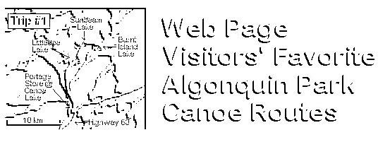
From Kevin Farley, Newmarket, Ontario: This is one of my favorite canoe routes because of the large amounts of river and swamp paddling. This route tends to offer some of the nicest nature shots for photographers, wildlife or scenic alike. This is all flatwater paddling, unless you decide to scrap several of the portages, which tends to be a lot of fun. Beginning on Canoe lake just off the Hwy. 60 Corridor, East Arm of Joe L., Baby Joe L., Burnt Island L., Little Otterslide L., Otterslide L., Otterslide Creek and Big Trout L. This is where the trip gets a bit harder, this area is also less traveled. After White Trout L., there is a set of three different portages totalling more then 3.5 km, all of which are not in the greatest condition, and all separated by small 50-100m paddles. They lead into Sunbeam Lake, it is a small lake but worth a night, one of my favorites! Last come Vanishing Pond, Little Doe L. (Check water levels, alternate route; Tom Thomson, Little Doe L.) This stretch offers photographers some amazing opportunities! This is the home stretch; Baby Joe L., Lost Joe L., Little Joe L., Joe L., Canoe L. Leave approx. 5 good paced days, 7 for an easy, relaxed trip. From Tom Gutoski, Waterloo, Ontario: Basic route: Water taxi up Lake Opeongo north arm, Proulx Lake, Little Crow Lake, Big Crow Lake, Crow River, Lake Lavielle, Dickson Lake, Portage back to East Arm Lake Opeongo, Water taxi back. We took this route in August 1996 with 8 people including 2 preteens, 2 teenagers and 4 adults. We went in on a Tuesday and got back on a Sunday. No problems and we went at a leisurely pace with the kids. Saw 8 moose on the Crow river (most in pairs of cow and calf). Lots to see and do on this route (check map). Long portage at the end (5300 meters) but we were prepared and it went smoothly. Three men did two trips on portage and women and kids did one trip. Had it done in about 3 hours. Crow river is nice but there is only one campsite on the river so plan accordingly. From Michael Reese: Smoke Lake to Rock Lake via Ragged Lake, Big Porcupine Lake, Laurence Lake, and Lake Louisa. Approximate distance: 35 km Features: In many years of canoe tripping in Algonquin, Big Porcupine and Louisa are two of my favorite lakes. Both are quiet and beautiful. Big Porcupine features clear green water in its southern section with a great rocky shore with open pine forest for camping. Louisa also has rocky shores and island camping great for sunsets. Drawbacks: One way route requiring bike or car shuttle. Short but steep portage from Laurence Lake to Rod and Gun Lake. One long portage of 2895 m from Louisa to Rock Lake - long but not hard. From Jeremy Blumenstein: Algonquin Park is my favorite place to canoe trip. I was introduced to the park when I was 10 years old as a camper at Camp Arowhon, my father also went there as a child. When he brought me there the first time it was like he was sharing a secret with me. I went to camp there for 7 years, then didn't return for about 3 years (college), and now that I'm an adult (well in age only) I bring friends to the park and let them in on the secret! The following trip was attended by myself, and one friend (ex-friend after the trip). The friend, lets call him Kevin (it is his name!) wanted to go on a real adventure, a "challenging trip". Kevin is a true city slicker though, and doesn't have much experience in the woods. My goal was to plan a somewhat hard trip, but not as difficult as he claimed he could handle. What did we bring: 2 packs, freeze dried food (enough for 2 good meals a day), single burner stove, 3 man tent, first aid kit, etc... The route: DAY 1
We spent the first night on Third Island on Rock lake. It was a torrential downpour, cold, extremely windy. DAY 2 A word on Canadian hospitality: Around the middle of the way back the second time (I had the boat on this trip) I ran into someone on the trail. He had a pack that appeared to be light, and he offered to do a double carry with me to get my boat to the other side. He was a Canadian mailman from Ottawa. When we arrived at the other side we found Kevin sound asleep under a tree. We commented on his laziness, and my new friend opened his pack and brought out an ice cold beer!! (actually ice in it!) We enjoyed the beers, and he left. Oh yeah: WE PACKED OUT THE CANS!!! I can't tell you how good that beer tasted after covering 8,685 meters!! (This portage crosses an old logging road. The mailman and his buddies come up on a trip once a year and stash beer on the road so they can go get it as their trip progresses. They stay a whole week on Lake Louisa). We camped on Lake Louisa that night. DAY 3
A few words on this day's travels....I carried the boat and my pack this entire day as well, so you can imagine how beat I was, BUT the scenery on these lakes is truly beautiful. These lakes are so secluded that I bet its rare to see other people there. We saw a couple bull moose on Kirkwood Lake. Very serene area, DON'T DRINK THE WATER on any of these small lakes; it seemed to be stagnant. We camped on Big Porcupine Lake that night. Kevin had a great time that night. I went to bed early. While I was sleeping he drank the bottle of Jim Beam that he had brought (1/5 size bottle). He woke me up at midnight because it was raining and he hadn't stowed or hung his pack and now he was to drunk to do it. I am not going to say anything else about that night, except that our activities involved an axe, a real sharp knife, rope, AND remember that first aid kit I mentioned???? Good thing I had some sutures in there!! I put about 30 good stiches in my arm that night; the doctor in Huntsville said I did a pretty good job too! DAY 4 Due to the previous nights "fun," paddling was hard for me, especially because Kevin had refused to paddle! I covered this entire route in 6 hours, hauling everything over all the portages. (He also refused to carry his pack... I would have left it behind, but he borrowed it from me!!) Alright, here's the moral to the story: The outdoors is a great place to be if youve been there before and you know how it works. I should have tested Kevin a little bit before bringing him on this trip, so I don't completely blame him. Oh yeah, AND alcohol is ok if you don't get carried away, but be very wary of anyone who brings a 5th on a 4-day trip!! EDITOR'S NOTE: Drinking and canoe-tripping can be as dangerous as drinking and driving... the example above also contravenes the "no cans or glass in the interior" rule. From Michael Reese: Loop trip: Rock Lake, Pen Lake, Welcome Lake, Lake Lousia, back to Rock Lake. Approximate distance: 35 km Features: On two separate trips in late summer I have heard wolves howling at night while camping on Pen Lake. Welcome Lake has a beautiful beach for swimming. Lake Louisa has rocky shores and island camping great for sunsets. Drawbacks: One long portage of 2895 m from Louisa to Rock Lake - long but not hard. From John Thompson of Brampton: The first trip I EVER DID was from Access Point 16, thinking that the UNMAINTAINED PORTAGES between Cauliflower and Clydegale would help me avoid crowds for a TRUE WILDERNESS EXPERIENCE; boy, I was sure right about avoiding crowds, AND remember, this was the first time I'd ever done this, AND I was SOLO; oh yeah...). From Paul Karbusicky, London, Ontario: I've got so many favorite routes I don't know where to start. My favorite would have to be from Crotch Lake up to Booth because of the scenery good fishing lots of historical areas to check out and the wildlife. I've made numerous trips through this area and I just can't get enough. It is a very easy trip for novice canoers. There are only two portages (a 25 and 550 m) the 550 you can bypass by lining your canoe up the rapids which aren't that fast except in the spring. Then you just toss your canoe around the dam. There is a lot of history on this stretch and if you have the time stop and explore. Once on Booth Lake there are many beautiful sites to choose from and if you preferr a roof over your head you can paddle up to Tattler Lake and stay in the old fire tower cabin. This was used by the ranger who manned the fire tower on the hill behind the cabin. The tower no longer exists. There used to be a logging camp here before the cabin. There is also an excellent COLD spring about fifty meters behind the cabin, just follow the trail. There is also excellent bass fishing right from shore and all over Booth Lake. Also good lake trout fishing in Booth and there is a secret speckle hole on the Opeongo River above the cabin, but that's my secret. Well anyway, I could ramble on here forever about the Booth Lake area and it's fishing and history. I've got tons of info. if anyone is interested.
|