Hay Lake to Billings Lake
May 29 – June 1, 2013 by - "Gregory4" (Forum ID)
May 29 – June 1, 2013 by - "Gregory4" (Forum ID)
( Click on images to view larger versions )
|
|
Hay Lake to Billings Lake
May 29 – June 1, 2013 by - "Gregory4" (Forum ID) |
|
( Click on images to view larger versions ) |
||
When I was preparing for this trip I tried to find some info on the internet about this seldom traveled route but could not find much at all. So I figure I should post something now on my return, so that anyone else eyeing a trip through these parts will have a better idea of what to expect. The route began at the Hay Lake access point, to Little Hay, Little Longer, Little Branch and Billings Lakes, and then back out the same way. One could use this route as a through trip to the Kingscote Lake / York River area in the southernmost tip of the park, by following this route as described and taking one more long portage and creek paddle past Billings Lake. The area was not nearly as rough as I expected. Park staff were almost certainly through there last year. Portage trails were good and easy to follow, almost as good as the maintained portages that you see further away from the access points, but with a few more narrow, marshy or rough spots. Some put-ins are not the best, but manageable. A few fallen trees since staff were through, but none presented much trouble. However, if you are reading this report a few years down the road, you likely won’t know how long it has been since deadfalls were last cleared. They put up yellow markers for points where the trail might be ambiguous. A few have already come down. Even if most come down, I don't think the trails would be hard to follow anyway. Creeks should be navigable for most of the season. In late summer it might be a mud-shluk (or bank portage) for perhaps 50-150m after the south end of the portages from Hay to Little Hay and from Little Longer to the creek. A couple of other spots may bottom out in low water. But overall I expect it would be a viable trip for someone looking for a haven from summer crowds. This is just my guess, though. I don't know for sure how deep these creeks would be in late season, but I expect the beaver dams would probably regulate the levels pretty good. Now for more specifics: Hay Lake is one of the less used access points. There is no permit office. The park website directs users to pick up a permit from the East Gate. However, I had enough driving to do and was not eager to backtrack, so I stopped in at Pine Grove Point along the way, which is the permit office for the Kingscote Lake access, and they were kind enough to sell me the permit (and a life saving bug jacket too). Parking and launching is easy at the access point, and it’s about a 3-4 km paddle across choppy Hay Lake to Hay Creek, which runs wide and easy for another 4-5 km until you arrive at the 985m portage to Little Hay Lake. This seemed to be the buggiest portage of the route, especially by the south end. It has rough spots but is not bad overall. At the end of the portage, the first 100m or so of the creek is shallow and winding until you come to a beaver-made waterfall about 2 feet high. After lifting over this (bring those waterproof boots), the creek is deep and wide until the lake. It looks like there may be an overgrown branch of the portage that at one time may have gone all the way past this dam from the logging road, at which the portage presently ends. If traveling in low water, bushwhacking this final stretch of shadow-portage might be easier (though it might be too thick for a canoe), or portaging along the bank to the dam. Or line through the shallow water. It’s not far to go in any case. Once past the dam, the creek is deep and wide until you arrive at Little Hay Lake .. a small but lovely lake. There is only one campsite on the lake, and it’s a very nice spot. It would make a nice weekend getaway, although the water is a bit murky and not ideal for swimming. 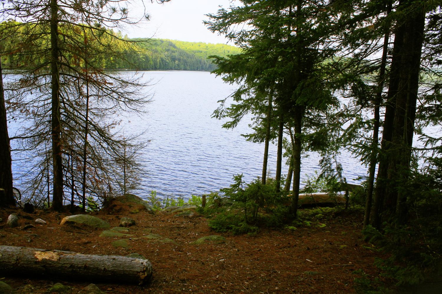 Campsite on Little Hay The next portage, the 1220 meter one from Little Hay to Little Longer, is similar and ends with a nice roomy put-in that makes a good rest spot. 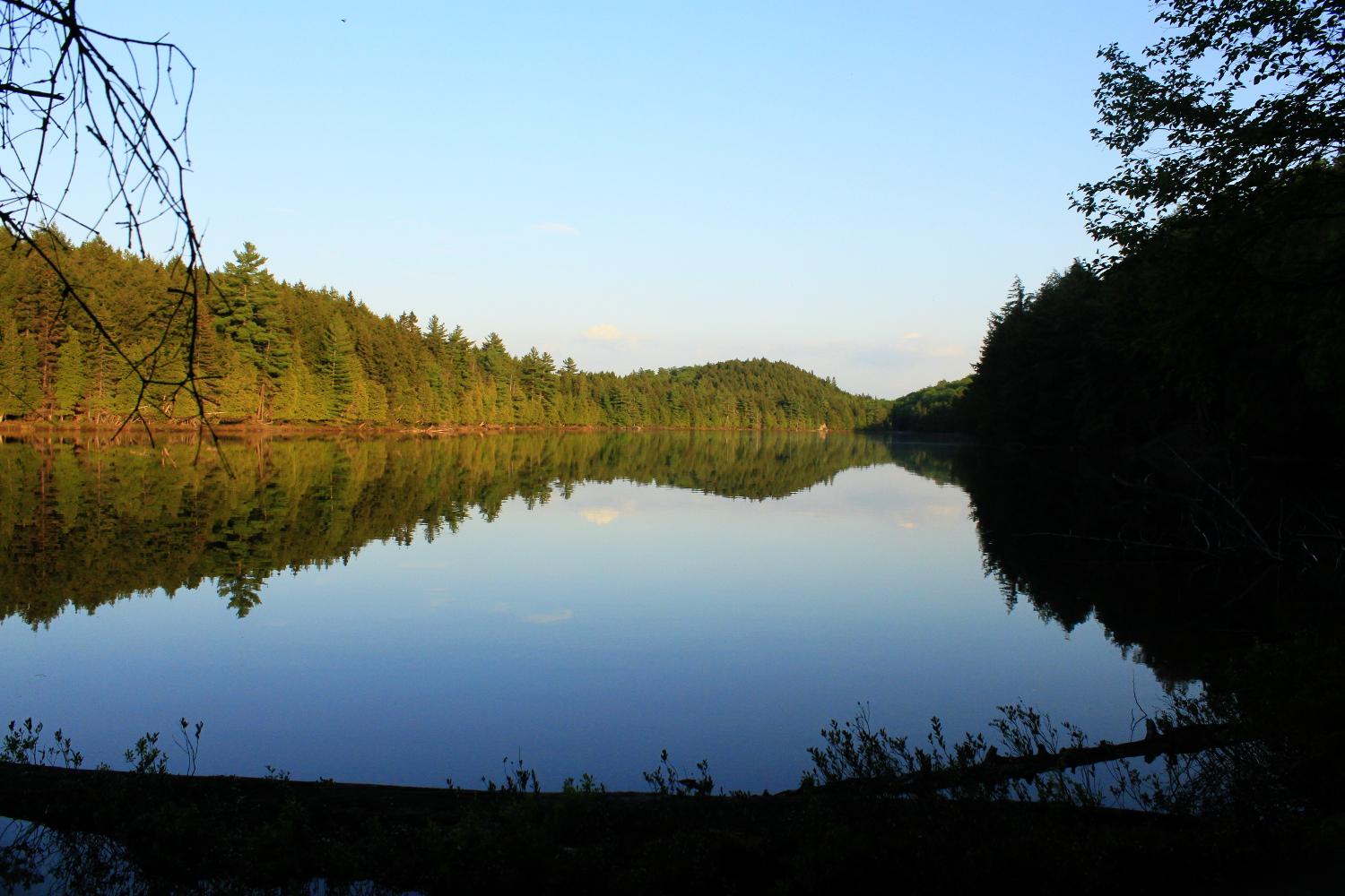 Little Longer Lake from the north The next portage is a bit shorter at 780 meters, but it seems to be the most difficult of all. There are a couple sections where the trail is basically a tiny creek and is probably perpetually muddy, and rather steep for a bit. Mud-monster took my boot right off with a canoe on my head. Nasty! At one point you have to use a log to cross a creek, but high branches prevent you from carrying the canoe, so you have to put the canoe down across the creek and pick it up on the other side. Not too hard really, all part of the adventure. The portage ends at a beaver-rich creek. Coming the opposite way, i.e. from the south, it would be hard to find this take-out as the sign was missing and the trail head is not easy to see from the creek. The creek here opens into a nice beaver pond, at the end of which is quite a marvel of rodent engineering. Pick one of several spots to lift over this artful construction, and on you go. From here, the first 100 meters or so are quite shallow but very picturesque. In low water it may have to be portaged or lined, but then again the beaver dams might regulate the flow and ensure adequate water at this point all season long. In any case, travelling downstream, it is not long before it opens up wide again. Then you arrive at another rather industriously built 2-3 foot beaver dam. An easy 225m portage circumvents this dam and the shallows that follow, but the portage was completely unnecessary at this early point in the season, though it may be the better option later in the year.  Shallow Creek  Wide Creek At last, you are in Little Branch Lake, a place that really feels remote. There is one campsite, complete with benches, ample room for multiple tents, a good fire pit, a brand new top of the line thunderbox (but not the most private), a grill, and even a nice wood saw hanging from a tree (am I spilling the beans on somebody’s hidden gem?). The ruins of an old log cabin are behind the site, though it looks like it had been built only for storage. Sadly, beer bottles were also lying around, even in this remote and little travelled place. 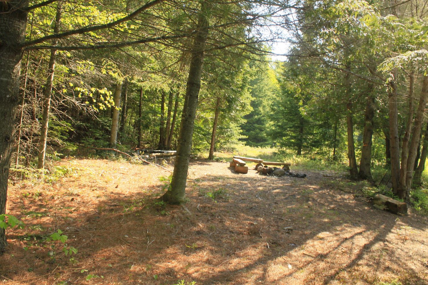 Little Branch Campsite  View from Little Branch Campsite Through a narrow channel and across the larger part of this uniquely shaped lake, you will find the 1830m portage to Billings Lake. The first half of the portage follows an old logging road that is only beginning to be overgrown by shrubs. It is easy and could be almost cartable if not for the handful of fallen trees and small stream crossings along the way. About halfway you cross a real logging road, and the portage continues along a trail that is narrow but not difficult. The forest is diverse and it would be quite a lovely walk if not for that canoe and gear weighing you down.  Stream by the portage to Billings Arriving at Billings Lake, there is a campsite right at the end of the portage. There is not much to it, but at least it’s there if it’s too late to go on. 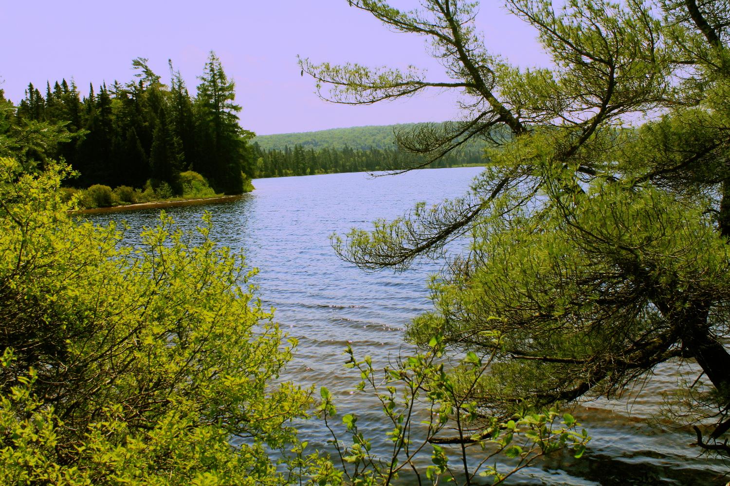 Billings Lake from the campsite. Sorry for the funky colors, the sky wasn't really purple . . . . But it was close to 30 degrees and humid and it about looked this way to me after the portage. Billings has sandy shores in many spots, but I wouldn’t say it’s prime for swimming. In May you can measure the beaches in inches, though later in the year you might find enough sand to actually lie down on. There is a nice shallow sandy bottom going out from the campsite and the water is tea colored with decent clarity. But weeds seem to be all over the place which doesn’t make me want to jump in. In any case, it’s a nice scratch-free canoe landing.  Sandy shore near the Billings Lake campsite That’s as far as I went. If one were to cross Billings Lake, take the 2395m portage and then paddle down the York River, one would end up at Branch Lake, which is part of the well travelled collection of lakes and rivers by the Kingscote Lake access point. In fact, a party could park a second vehicle at this access point and make it a 'vehicle-loop-trip' (or to be more environmentally friendly, park a bike at the end point and send the loser of the bet back to the start point to get the vehicle). To summarize this area of Algonquin, I would say it is not outstanding for its beauty relative to the rest of the park (except in the sense that I have yet to find a backcountry lake that is not outstandingly beautiful). If exposed rock is your thing, you won't find much of it around these lakes, except around the Little Hay campground. Shorelines are mostly mud and vegetation, and the water is murky or tea colored and not all that inviting for swimming. However, what struck me was the diversity of vegetation. The creek portions of the route are quite picturesque, and the scenery is always changing. There are great wildlife habitats (and great mosquito habitat I think). On this trip I saw the usual Algonquin menu of moose, beavers and herons. The portage trails were lovely, with many varieties of ferns and other shrubs, which are a beautiful shade of green this time of year, and nice creeks flowing across or beside. And of course, the solitude is great. I saw nobody on my entire trip, and judging from the muddy segments of the portage trails, it looked like only one party of 2-3 had been through so far this year. I would bet that in the peak of summer, if you don't mind possibly a few short mud drags along the route, you could quite easily book any of these lakes and have them all to yourself. |