|
Prologue: My friend and I felt the pull of the North although some would describe what we felt as simply the need to get away. Whatever the reason I’ve learned to appreciate the encounters with wilderness and not second guess the 8-1/2 hour drive from Cleveland to the Algonquin area. Perhaps the drive North has now become a part of the therapy as much as the planning and carrying out of the canoe or backpacking trek. Route Planning: When deciding where to head, we pull out the memories of prior trips, then scour the trip guidebooks, maps and send email to friends and acquaintances. Do we want to paddle or hike somewhere new or possibly somewhere "old"? Previous to 1999 Dick and I had paddled from Cache Lake to Lake Louisa via Head, Harness, Pardee, Lawrence and Rod & Gun Lakes on two other occasions. My daughter, Abigail, was getting married the weekend following this trip. And as I reminisced over nearly 25 years of change, I mentioned to Dick that I wanted a "warm and comfortable" trip with the option for a bit of day tripping. Dick agreed to paddle into Louisa, possibly to earn leverage for his supper creativity. How could I say 'no' to his stovetop suggestions when he was so agreeable with my route choice? Once on Louisa we would decide whether to check out our twice-used island campsite or paddle further east in search of an open bluff at which we had rested on an earlier day trip to and from the Rock Lake area. Thursday - Departure: Once again, we had motel reservations in Barrie, ON which would enable us to get on the water mid-morning Friday. We left about 6 P.M. from Cleveland’s East Side and made good time along Interstate 90. Near Erie, PA. We stopped for a roast beef sandwich and somewhere on Route 5 near Buffalo we filled the gas tank. This trip there were few construction delays and crossing the border at Fort Erie took about 15 minutes due to the surge of auto traffic. The Ontario Information Center is located just to the right as you exit the customs booths but it was closed at this time of night. Also, the small currency exchange just beyond the booths and in the middle of the asphalt jungle closed as we were waiting for our turn at customs. We watched the lights go off as we sat in the line of vehicles so plan C was drawn up as we calculated how much cash we might really need. Dick and I swung off QEW at the first exit and searched for a way to get to the currency exchange at 9:35 P.M. Apparently, the only entrance is off the QEW heading east and once we entered the new facility we were locked into the lanes heading back to the USA upon leaving the new Duty Free Shop and Currency Exchange. We had to turn around just short of the Peace Bridge and go through customs a second time, although by the time we got into line again the traffic was not backed up. We arrived in Barrie late, perhaps after midnight, but our trips have begun to run into each other as I advance in age. We have arrived in Barrie as early as 10 PM and as late as 1 AM, all depending upon when we can leave work Thursday and how much construction is being undertaken along the way. Over the years, stopping in Barrie has become a tradition as much as having a meal at one of the local restaurants in Huntsville. Friday - Huntsville: Upon awakening Friday morning, we dressed in our paddling clothes and arranged our gear so as to facilitate a quick departure once we were at the access point. Driving from Barrie, ON to Huntsville is about a 2.5-hour trip depending upon weather and what we decide to eat for breakfast. As often as not we stop in at the Huntsville McDonald's for the cuisine.As soon as breakfast was over we zipped off towards Oxtongue Lake and the home of Algonquin Outfitters where we loaded a Chestnut Prospector, a new version of an old and familiar name to Canadians. This model being offered by Swift / Algonquin is made in the Muskoka area and weighs in at about 45 pounds suitable for 2 paddlers and gear but not a craft for 3 travelers. As we drove along Highway 60 towards the park's West Gate we had a chance for last minute speculation on the weather and how many others might be paddling at this time of the year. In perhaps half an hour we had purchased our park permits and were feeling the park's pull in ever-increasing measure. Since we pulled into Canoe Lake for the permits we got to scan the bay leading out to the main body of the lake which is always a wonderful sight. It has been some years since I last paddled on Canoe Lake but it is where I first came face to face with the park back in 1983. There is always activity at this location where many individuals, families and other groups begin and end their visits to Algonquin Park. Once off Canoe Lake the masses disperse but it can appear as if a regatta is underway as the craft maneuver through the channel and past the Portage Store and Restaurant near the small beach in front of the permit building.
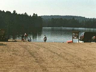
Photo: Looking due south across Cache Lake, from the parking lot. Pretend we know what we're doing... people are watching: I want to write that Dick and I quickly loaded our two Lowe Alpine Morningstar internal frame packs, Lowe Alpine Walkabout day pack, PFDs and spare paddle but that would be an exaggeration. I think I fiddle and fuss more between the trunk of the Civic and the dock area more than anyone. I keep thinking that there must be a better way to load everything, even after 20 years of paddling. If I never changed any of my gear or clothing that might be true. However, I replaced my sleeping bag in 1999, got a new tent, obtained a fleece jacket to go with the fleece vest of the previous year and it just doesn't pack the same. The Baron showed great patience in the face of my adjustments and eventually we shoved off quite gracefully. I took the bow seat for the trip through Cache, but we usually trade off each day, or at various points on a trip. Cache Lake is a nice paddle although it does have cabins and various types of motorized watercraft. It is actually a good starting point since the lake is broken by various channels and islands which often provide shelter from wind. Also, it is a challenge to Jester to remember which channel to take, around which island to hang a left or a right, not to mention locating the portage landing on the South shore leading to Head Lake.
Photo: Jester on the Cache - Head Lake portage. The long (1640 meter) portage to Head Lake is a very nice walk. Though the longest walk on our trip both Dick and I find that we enjoy this trail. It is well used and kept up due in part to the cottage dwellers who take the walk, eating lunch at trail's end and the many school or camp groups which use this route at various times during the year. In some places it is reminiscent of a forest road but I guess I like it since it has few significant hills to climb. We stopped for a quick lunch break at the Southern end of the Cache-Head portage. It was about 11:45 A.M. so we ate our dried apricots, cherries, berries and yogurt covered raisins. This trip, partially as an experiment, we chose to not bring pita bread and peanut butter. We did bring the squeeze bottle of honey to use in other meals and to sweeten Baron’s morning tea.
Photo: South end of Cache - Head Lake portage. It is about a 25-minute paddle in quiet water across Head Lake and to the mouth of Head Creek(?) which leads to the Harness Lake portage. When departing the Head Lake - Cache Lake portage landing an immediate left turn will take the canoeist to the portion of Head Creek, which parallels the backpacking trail. At the Eastern end of Head Lake, almost a straight-line paddle from the portage out of Cache, there is another creek which I have always called Head Creek although I don't know if it is identified as such on the park canoe routes map. Each year there is a series of beaver dams and shallows, which during this year created a more difficult set of obstructions for our progress. At the second beaver dam, which was partially broken, I finally stepped out into the creek and played Humphrey Bogart to the Baron’s Katherine Hepburn ... sortof, kinda, maybe. Baron disembarked and bushwhacked along the northern bank in an effort to make his way to the actual portage. The area around this creek is made up of those rough mounds of grass and for every two hummocks there was one spot where your foot would go further down than expected and walking was particularly tough. Actually, with those few exceptions where the creek bottom dropped back to several feet, I think I had an easier time of it simply walking in the creek. After hauling the canoe across some small sandbars and pulling the craft through a few deep pools, I was at the rocky landing beginning to dry off while waiting for Baron to arrive and cross from the opposite side of the creek. It was about 12:45 P.M. and the temperature already quite warm so the moisture brought welcome relief. As soon as Baron and I unloaded the canoe we began to walk the trail toward Harness Lake. With every step, the water squishing around in my hiking shoes reminded me that I had just walked through the creek. Baron, too, had moisture in his shoes although not as much as he had avoided following my lead through the creek. Actually, Baron was wearing a pair of leather high top hiking shoes made by Salomon while I wore a pair of Columbia low cut light hikers. Over the years I have worn a variety of mid weight hiking shoes such as Vasque, Asolo or Salomon as I prefer the extra ankle support afforded by these designs. During 1999 I began testing a pair of Columbia "river" shoes which have drainage holes and are lighter than the shoe designs worn previously. During our earlier trip through Algonquin these shoes performed quite well and I was pleased. This trip I was testing a pair of low cut Columbia hikers, which I had used on a trip to Maine in July. The design was a cross between heavier hiking shoes and the more flexible river shoes. The portage from Head to Harness Lake is shorter than is the Cache Lake to Head Lake trail at 1035 meters but on some trips through this section I succumb to the initial hill climb and want to take advantage of the canoe rest which awaits the tired climber. One year on a solo I had carried the pack and canoe simultaneously from Cache to Head Lake but after the first uphill climb on the Head to Harness trail, I gave in to the desire to split the load. Harness Lake is one of my favorites, especially if I have time to stop at the open campsite at the narrows. As you paddle south this campsite is on the left and has a grassy area above the lake which affords nice views and great space for tents. This site expands back into the woods and it is located near the backpacking trail so is possibly used by hikers as well as paddlers. Close to the woods is a huge rock which looks like someone's outdoor grille. There is a rocky landing facing the North but a small notch on the Western-facing shore which provides an easy access to the site. I once sat out a strong windstorm at this location and often just get out to walk around, slowing down my life to listen to the sounds of nature. Baron and I have developed several "favorite spots" in our years of travel and we believe that everyone should cultivate actual or metaphorical favorites. Although oriented almost straight Northwest to Southeast, Harness Lake has a bit of "banana" shape when you include the small bay where the portage out of Harness to Pardee Lake is located. This shallow, weedy bay often smells of stagnant water and the landing is quite muddy presenting the paddler with a challenge of unloading or loading in less than pristine conditions. Well, who is to say what Algonquin pristine really should be? If I wanted excellent, dry footing I would stay home. Perhaps this landing is pristine and just the way it should be. Once up the short hill the portage crosses a logjam via planks and the waters of Pardee Lake are soon reached. There is a good beach landing with plenty of space for canoes as well as gear. However, before heading off across Pardee, hike back to the side trail off to the left located just before you cross the "bridge". Dick and I always take a few minutes to stroll down to the creek, sit on the cool stones and imagine what it would be like to set up hammocks some how and read a good book, take an afternoon snooze or while away the time in this beautiful spot. As soon as we dip our paddles in Pardee's water, we begin to act like horses smelling the barn and roll across the waters in anticipation of the short portage into Lawrence Lake. I think the landing at this spot is one which requires either a willingness to get your feet wet or the balancing ability of the King. As we nose the canoe up to shore, we debate the approach but settle for a left to right landing with bow up on rocks. The decision as to how to land takes longer than the actual portage which is about 10 meters. We take our large packs out of the canoe and carry them over returning for the canoe in which we leave our small pack, PFDs, paddles and other gear. In some years the Lawrence Lake landing is quite grassy although there are rocks here as well. For those looking for a lunch spot this short portage can be a nice location. Don't be fooled by the campsite and portage into Kirkwood Lake which is close by this trail to Lawrence. If you land at the campsite for a break, be certain to hike off to the East from the campsite otherwise you walk a long way in the wrong direction.The general direction of travel on Lawrence Lake is a East or East Northeast until you turn the corner and head South or Southeast until the portage becomes evident. I recall on our first trip through the area we slowly paddled while scanning the far shore for any hint of a landing. From 1000 yards away my friends and I make silly statements such as, "Just to the right of that different shade of green ... do you see it?" or "What about that brown spot? Doesn't that look like a small beach?" Right!! Ten more paddle strokes and you realize you were going to land the canoe on some stump or rock in the water and the yellow portage sign appears 50 to a hundred feet off to the side. When Dick and I were still several hundred yards off shore, we saw a steady stream of canoes coming through the woods, downhill and finally emerge at water's edge. A school group was coming down the steep portage from Rod & Gun and getting ready to shove off as we approached the landing. That was the only year we have seen anyone else along the Lawrence to Rod & Gun Lake trail. We have walked this trail a total of 5 times over 2 years and this first carry was the only time we have not had the trail to ourselves. Also, the trail has been relocated to avoid the sheer climb or descent at water's edge and the trail is a bit easier. It is a 45% grade rather than a 60% grade. This trail climbs upward for the first half or so of the 415 meters so you appreciate the level spots as you head for Rod & Gun Lake. After a short downhill section through dense woods the trail winds along the lakeshore for some distance before ending at a small dock. When you first see the size of this lake you may feel a bit of disappointment knowing you have another portage so quickly. However, be of good cheer, for you quickly realize that what lays before you is the last portage trail of the day and be assured that both Baron and Jester know by now that it is 90% downhill as you head towards Lake Louisa. Just about the time you get your paddling rhythm down on Rod & Gun you are at the landing which has rocky stepping stones which make a secure landing in low water a bit tricky. The trail is slightly uphill initially but then descends steadily downward with a creek on the right hand side. At the bottom of the hill is a plank which affords good footing over the creek and then the trail proceeds along the right hand side of the creek and then there is a slight uphill. Soon the trail is once again heading down toward Lake Level but crosses a logging road a few hundred feet prior to reaching the Louisa shoreline. It was in this section that we saw a deer two days in a row. Friday Campsite: Arriving at Louisa, Baron and I paddled South away from the portage area and as we moved down the bay slowly Louisa opened up to show the Western areas. On our 1999 trip we saw evidence of storm damage and terrific blow downs along the shore in several places as we headed out into the main body of Louisa. If you paddle Southeast across Louisa there is a campsite on the opposite shore that is a favorite of some paddlers. When we have passed by it looks intriguing but has always been occupied.As we slowly turned east and pointed our canoe towards the islands which will be our destination for today, we wondered how many others were enjoying the good weather and the beauty of Louisa this year? There have been others on Louisa each visit but the numbers have not been as high as we would have guessed. This year, however, we saw more paddlers looking for sites and we were quite happy that this Friday afternoon we found the site we were aiming for quite unoccupied.
As we pulled up to the South-facing landing on "our island" we felt at home. Quickly the Sierra Designs Comet CD tent was set up and within a short time we also had hammocks set up, hiking boots off to air dry and the Tevas were out of the packs. We were enjoying the clear air, the virtually cloudless sky of Algonquin and felt that we had earned our place in the Sun!! After squandering, er, enjoying the late afternoon, we decided to prepare our supper. Usually this takes the form of measuring the amount of water to add to all our ingredients, pre-soaking some freeze-dried items, boiling the remainder of the water, mixing up the base meal and then adding our freeze-dried elements. We are not talking brain surgery here!! However, from time to time, when the urge to experiment runs amok, the wrong seasoning or the improper balance of additives has been known to occur. Our track record has been quite good since the late 1980's when we adopted the current menu. Most evening meals are built around Lipton's Rice and Sauce, with some freeze-dried beef or chicken tossed in to bulk up the meal. To this we add freeze-dried peas, corn or other item to add color and a bit more variety. Dick often is the one to crack the meal whip as Jester is often found horizontally inclined in his small hammock. Around 6 P.M. we began our culinary efforts and soon we were smelling the aroma of Eau de Lipton and the obligatory Baronial seasonings and tomato soup additives which always appear from the wilderness spice rack. I can recall only one trip when we actually had a dessert so when we finish our servings, we usually go back to the one pot and dig in for seconds. Saturday Morning Variation 1: Each trip through this area we have chosen to paddle different routes on Saturday. This year we knew the weather was going to be iffy so we slowly retraced our route, stopping for lunch on Harness Lake at the campsite nearest the Head Lake portage located on the small island. On our first trip to Louisa during May 1997 we made a day trip out of the loop from Louisa out the Southern portage into North Grace Lake, through McGarvey's East end and out toward North Lemon Creek. From here we paddled West in order to take the portage into the Southeast end of Bonnechere Lake. Once on Bonnechere we followed a fairly well used route north and east through Phipps, Kirkwood Lakes and hooked up with our route into Louisa from the day before. The paddle on this MacGarvey loop was an interesting since many of the portages seemed to us to be "under" used. This may have been due to our paddling early in the season as it was the US Memorial Day long weekend. We seemed to have been the first to portage out of Louisa on this trail for quite some time. The trails in the area between Louisa and MacGarvey seemed to us to be longer than marked but this was our first paddle of the season ... everything seems longer, steeper or harder on the first trip. The 1460-meter carry from Louisa to North Grace Lake is a trail marked by small hills, undulating terrain and a variety of conditions. We saw no one along this stretch, in fact, we saw no one until North of Bonnechere later in this loop. North Grace is a nice paddle and while not isolated its location means people have to work to get back in to its waters. Perhaps that is overstating the situation but we have seen so few occupied sites or activity in our trips that it has a special appeal. We exited North Grace following the 165-meter trail to Lemon Lake where we did the short paddle and then the 810-meter portage into McGarvey Lake. Once on MacGarvey Lake we headed North and the stretch of water and trail between MacGarvey and Bonnechere which is more walking than paddling. Once on Bonnechere, the long portages are behind you and the middle section of this day loop affords several nice campsites for lunch stops. Depending upon your start time and your rate of travel or how much gear you've brought along, you might be looking for a good rest spot anywhere from McGarvey on and there are multiple locations to be found. It began to mist over and by mid-day, Baron and I were paddling in a light rain for a short time. We encountered a pair of men fishing in the North end of Bonnechere and we leapfrogged them at the portages as we had less gear to carry but we stopped for a quick lunch on Phipps Lake once ahead of their canoe. Phipps and Kirkwood Lakes are great lakes for practicing your solo paddle strokes as you make your way East through this section of the park. At the far end of Kirkwood, depending upon the water level, you may have to work your way up to the 715-meter portage leading to Pardee and Lawrence Lakes. This trail is another undulating walk and for a portion you hear the stream off to your right. The latter half is downhill to the campsite marking the end of the trail to Pardee. The trail to Lawrence continues on for another 100 feet or so. Lawrence Lake's paddle repeats the route taken on the first day so you actually know what to look for as you head out and eventually round the bend and head South again. Even knowing where the portage out of Lawrence to Rod & Gun Lake is located, Baron and I are usually almost on top of it before we see the tell tale signs of the sand and mud landing. One thing for sure, heading for the hill climb with only a daypack is more fun than the previous day when we had all our gear on our backs. Once the crest of the hill is reached, walking through the woods is fun again. Whoever said climbing that hill with just a daypack is fun is crazy and if I wasn't so tired as I headed for the small dock on Rod & Gun, I'd give 'em a piece of my mind. Baron seems to handle the hill climbs far better than the Jester does. Either that or he zips on ahead of me so he can sneak a rest out of sight. Once on Rod & Gun I know we are in the home stretch during this loop and can even visualize the trail into Louisa. It starts out up from the water's edge over some boulders and then descends along a well-worn trail with the creek on its right. Near the bottom of the first hill there is a marshy area which has accumulated some deadfalls recently. Eventually the trail crosses the creek and ascends the Western edge and forks to the right where the trail has been rerouted. Another small rise and then you descend to the logging road. You can see the waters of Louisa even before you cross the road and it is hard not to pick up speed as you descend to the landing. Usually this is where the Jester makes his error and if he is going to spill his load this is the stretch. The portage landing itself is quite nice with room for gear, canoes and tired bodies having one last swig of filtered water r a handful of dried fruit prior to the paddle back to the island campsite. If you've chosen the campsite on the far, or southern, side of Louisa the paddle home is almost a straight line. We headed around the point to the left or east and continued on to the cluster of islands where we left or gear. Weather permitting, you should have enough time to swim and get in some hammock time prior to cooking supper. Saturday Morning Variation 2: Our second visit to this beautiful spot found us paddling due east and exploring campsites down the length of Louisa. On the way toward the eastern end of Louisa we stopped to put on rain gear which guaranteed that the light rain soon stopped. However, as we looked back down Louisa to the West, we were greeted by a beautiful view. The islands which dot the mid-section of Louisa were lined up in such a way as the resulting photos are some of our favorites. We portaged into Rock Lake and ate our lunch on one of the small islands in the area adjacent to the portage landing. Although we encountered greater activity it was not so intrusive as to ruin or own search for tranquility.
On the return we stopped at campsites on the southern shore and found some an attractive site up on a large clearing. I remember it as grassy with great shoreline rocks making it an inviting spot and a worthy goal for a destination site. I imagined my hammock set out in the sun and a good book to read and only steps from the shoreline. In my mind it is picture perfect, but I have many such places after visiting Algonquin over the years. Saturday Morning Variation 3: Another variation which provides the option of camping at a different location OR another day trip note that Baron, Gill and Jester paddled from Big Porcupine Lake through to Louisa via the Whatnots. Taking the southern portage out of Big Porcupine, paddling Little Coon and climbing the Devil's Staircase, we paddled through McGarvey Lake and headed east across Lemon Lake, North Grace Lake and made Louisa our overnight on a long weekend paddle. If a day trip is being considered, reverse this direction and head for Big Porcupine and then connect with Bonnechere for a continuation of the loop described above, returning to Louisa from the North out of Lawrence and Rod & Gun Lakes.
Saturday Morning Variation 4: Photo: The long portage trail to Rock Lake. Though we have not done so, other day trip options include paddling East to Rock Lake, paddling south and portaging into Pen Lake, working up the Galipo River, then enjoying the paddle through Welcome and Harry Lakes. The return to Louisa would be following the Galipo River to Rence Lake then turning North to Frank Lake and Florence Lake. From Florence Lake the 1725 meter portage would place you back on Louisa in the southwestern bay. Saturday Night: Having paddled all day long, it was great to arrive back on "our island" and be greeted by the equipment all ready for us. Of course when we agreed, "Supper at 6 PM", both of us figured the other would jump to the task and one of us could laze around for another 30 minutes or so. Eventually, we got out the one-burner Coleman Peak stove and had water boiling. Baron and I have similar methodologies for wilderness traveling including a desire to keep the food end of our planning quite simple. We build our suppers around Lipton Rice and Sauce or similar packaged dishes, enhancing this core with freeze-dried chicken or beef. Baron handles the spices with the same eagerness as a racer uses oil additives but we have more than survived.
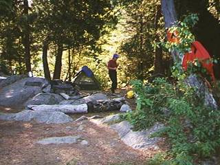
Sunday: Photo: Head Lake campsite. No matter what options you choose or create, when we leave Louisa on Sunday it is normally our third day in the bush. Since we have a long drive ahead of us when we do reach the access point one of our patterns has been to find a campsite close enough to our takeout so we have a fairly short paddle the last morning. Since we started this trip at Cache Lake we like to camp on Head Lake which puts us one portage away from the parking lot. We usually take an hour plus or minus 15 minutes depending upon factors such as temperature, additional camera gear or just plain "return to city" phobia. Head Lake has several sites, which make it a logical choice for a layover, and we have enjoyed investigating the hiking trail, the waterfall as well as Head Creek. Monday-The End Is Near:
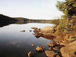
Photo: Looking due west across Head Lake from the site. Once on the water we have another 30 minutes or so of paddling around and between islands as we head back to the welcome site of the Cache Lake parking lot. Soon we are overtaken by motorboats ferrying the summer cabin or lodge occupants to and from the dock area. We gradually realize that another trip has been completed and all the map reading, book reading, picture sharing and catalog browsing has paid off in another reminder that sometimes being "good tired" is the best medicine. No matter what the weather or exertion level, within weeks of returning home my friends and I are starting to reach for the map when we have a moment of spare time. Truth be told, I tend to create spare time just so I can trace another route and release my imagination. Happy paddling and happy dreaming!
Writing and photography by David G. Pile
Web design and online hosting by Algonquin Adventures
|
 A short drive down Highway 60 we turned off into the Cache Lake parking lot. How many cars would be here this time? How many cottage dwellers or Camp Tanamakoon folks would be at the landing, coming or going? The Cache Lake lot, like other access points, often is like transportation hubs as long time visitors and newcomers arrive and depart Algonquin.
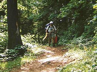 After 30 minutes or so of paddling we find the grassy area to the right of which we sight the staircase with a semblance of a dock. There is just enough of a structure to fool you into thinking it will be an easy landing! Often the water levels force a landing alongside of a log, which has been carefully positioned by nature or friendly natives so the canoe can be unloaded while losing your balance at the most inopportune moment.
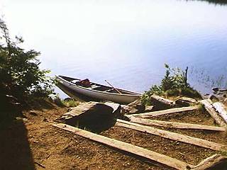 Friday Lunch Stop:
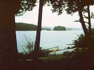 Photo: Louisa looking back west from one of the campsites on the northern shore.
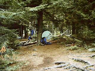 Photo: Another Louisa Lake campsite.
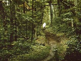
 After another sweep of the campsite we descend to the shoreline and paddle off across Head Lake. Perhaps 20 minutes of working out the kinks from another ThermaRest evening and we've reached the portage landing. Once our gear is up the incline and out of the way we are off walking one of the better portage trails. From time to time the Cache Lake end of this walk is bug infested so we generally leave our gear at the top when we've reached the stairway down to the water. Baron and I have found ourselves alone at this spot as often as we have encountered others heading in the opposite direction.