Thursday, August 2, 2001: What a delightful evening! It is now 8:56 PM and dusk. The clouds have rolled in, yet I can still see and write. However, that will soon change. I'm seated in an Adirondack chair out on a floating dock, just in front of our lakefront tent on a wooden platform at the outfitters. This is a great place to be writing. I wish I could do all my writing under such calm and inviting conditions.
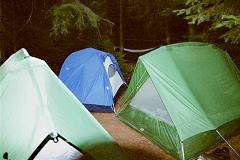
Our group arrived in Huntsville, Ontario about 4:15 PM. After making some stops for last minute items, we ate supper at the Navigation Company down at the town docks in Huntsville. I did not remember that the outfitter closed at 8 PM Thursday, thinking that in the busy season they would remain open until 9 PM. When we arrived shortly after 8 PM we were told by one of the staff members, who happened to be standing in the parking lot, to take 2 of the empty platform tents.
Friday, August 3, 2001: Friday morning we were up at about 5:45 AM to typically serene calmness everywhere, unbroken but for the occasional auto travelling along highway 60.
This morning we are preparing breakfast in front of the wooden tent platform that is our home for the pre-trip gathering. The outfitter opens at 8 AM and I certainly hope we are on our way by 9 AM since the shuttle can be 1 1/2 hours or so even without logging road delays. Last year we had to wait a short time on the logging road due to log clearing and road maintenance.
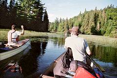
After a drive of an hour and a half, which included a stop in the small town of Kearney where the park's permit office is located, we arrived at the access point. Here we quickly unloaded the canoes from the Algonquin Outfitters van's roof rack and staged our gear along the path near a large rock away from the canoes and gear belonging to other groups. One by one our canoes were loaded and launched with the typical combination of confusion, excitement and apprehension that's often mixed together on the first day of the first trip of the year. In the second canoe to launch, Gerry Kramer and I initially paddled lazily around waiting for the remaining canoes to leave the park dock on Magnetawan Lake. But soon we were headed along the curving shoreline towards the first portage.


Magnetawan Lake provides a good introduction for travelers new to paddling, as the segment is so short that there is not much time to think about how one is doing. Almost as soon as you look around to see how you compare with the others, you're unloading your canoe at the first portage. "Hey that's not too bad, is it?" I can almost hear the little voice which travels with all paddlers congratulating us on simply making it to the first hike through the woods.
The portage from Magnetawan Lake to Hambone Lake is an easy 135-meter carry downhill over bedrock and roots. It's almost a disappointment since the unloading of the canoes and reloading of the canoes can almost take longer than the walk down the trail. It's an easy walk, but could be quite slippery in wet weather.
Hambone is a small lake, perhaps smaller than Magnetawan but of similar size. The paddle around Hambone Lake's shoreline toward the second portage is a slow right hand turn, what I have come to call a "banana to the right".
Prior to turning into the bay and heading for the yellow sign, I recalled the portage landing as grassy but there was a small sand and gravel beach along the right hand side of Hambone Lake. This trail was 55 meters and led to Acme Lake. I don't recall anything which stands out along this trail, so it must have been an easy or uneventful walk. Having walked this trail from north to south two years in a row and from south to north a couple years before that I should remember something about it's difficulty or beauty but I find that this trail has become like so many others in the north and has blended into a montage of experiences which now draw me back again and again. Perhaps this is a case of the whole being more significant than the parts.
Acme Lake was quickly crossed and we were soon walking the trail to Daisy Lake, the first "large" lake of the trip. The trail into Daisy Lake is a good backpacking type trail and not long at 420 meters. The last third of the trail was gradually downhill and finished with a steep descent to a small dock located part way up Hambone Creek, just north of the main water of Daisy. Although the dock is not the best of put ins with its clumps of grass and mud throughout the area, the spot was peaceful the day we came through.
 After paddling through the short stretch of Hambone Creek we entered Daisy Lake's main body and made the left hand turn towards the outlet to the Petawawa River. Since Daisy can some times be windy we were fortunate to find only mild breeze as we paddled through Daisy's northern section. There are some nice campsites on the lake and we found an interesting lunch spot on the island.
It took us a while to get tied up as the landing for our lunch spot was less than desirable and the swimming, while discussed, was skipped. The campsite was sloped up and away from the water quite steeply but there was enough ground for most of those in our party who were ready for a horizontal respite. It is amazing how easily we are satisfied when we find any rocks, pine covered ground or even a tree trunk against which or on which to rest. As I recall, only one or two of our party ventured up the hillside in a show of youthful exuberance, to loosely paraphrase Alan Greenspan, Chairman of the US Federal Reserve.
The first lunch is always an interesting experience as people discover Pita bread, jam, jelly and honey spread for the first time. This is particularly fun if, like this year, the temperature is quite high. The spreads often leak or run out of the pita and clean t-shirts soon have "lunch menu" all over them. This day the lunch was welcomed with, if not open arms, certainly moderately outstretched arms. On the first day, the shout of "Pita bread" had not yet worn cold and we tore into the zip-loc bags like campers who had been back in the woods for days even though we had eaten only 5 hours earlier.
After lunch and the obligatory pseudo-naps, we embarked for the Petawawa River section of the route. We had been on the Petawawa the whole trip thus far but it is marked on the canoe route maps by the lake names or as Hambone Creek. However, as it leaves Daisy Lake it becomes the Petawawa River on most maps as well. The portage of 135 meters, which follows the water, is a fairly good trail all the way between Daisy and Misty Lakes.
Upon arriving at the opposite end of the trail we were greeted by a couple who warned us of the low water ahead. They indicated that 30-40% of the section had been walked. We found that perhaps at least that much and maybe more of the distance was walked but the water at least cooled our legs. The section walked also has a good sandy bottom which made it easier to slog along without fear of losing one's balance or footwear. Tevas would have been fine for this stretch.
 During this tracking effort some of us found that wedging the plastic paddle blade into the canoe's stern deck made it easier to maneuver the canoes without bending over and holding onto the canoes. Of course, if we had remembered to tie on painters we could have been walking upright as well.
The lead canoe was reminded we were heading for Misty Lake and to check the map. However, when Gerry and Jester came around one bend in the Petawawa there was a canoe pulled up on the bank of a portage which seemed out of place. "That is funny, the next portage should have been on river left, not river right." Upon arrival at the landing the collected brainpower of the second canoe confirmed our suspicions. Jester read the portage sign which indicated an 805-meter trail to "Pond". We were not headed for "Pond" so Jester sent Jerry with whistle to find the errant party.
During the period of uncertainly the Nagys, father and son, came upon the scene and were instructed to continue downriver until the Misty Lake portage of 900 meters. If any portages were encountered which did not say "Misty Lake" they were not to take them. Jester was now thinking of the worst case scenario so by the time Jerry returned down the trail, Jester had gotten out some paper and written a note to Baron warning not to take the portage just in case they possibly would be tempted to make the same mistake.
When Earl and Jim returned I asked them to wait at this portage, rest up and proceed with Dick and Gil when they arrived. Jerry and Jester set off to catch up to the Nagys. Eventually all four parties regrouped along the 935 meter portage into Misty, the fanny pack had been recovered and the portage side trip had caused little additional delay.


Upon arriving at Misty Lake we found last year's site occupied so we continued on to the next site up Misty's west shore. The campsite is mediocre but we did find 3 spots for tents which proved to be OK.
 No one complained in the morning and even Gil made it through the night and was full of excitement as he shared his view of the moon over the water. He went to sleep under a canoe using his mosquito net.
It is 9:57 PM and it is warm enough air that I plan to start sleeping simply by laying on top of the sleeping bag. Tomorrow AM we will make a decision as to which route, the north or south, we will paddle. We wish we knew more about the water levels.
Saturday, August 4, 2001: Saturday morning, day two, found us on the southern route from Misty to Timberwolf. Paddling from our campsite we headed in the general direction of the portage to Timberwolf. The southern shore did not have an obvious break so the first canoe went straight south and turned east up the shoreline. The remaining canoes set out as they were loaded and diagonally crossed Misty aiming somewhere between the lead canoe and a small bay which provided us a known landmark beyond the portage location.
The portage was found near a point which was not easily seen from our campsite and which did not become apparent from our canoes as we approached from the west until we were right on top of its location. The portage out of Misty was a nice wooded trail of 765 meters. By the time we were on the water it was already hot and the walk and paddle had begun to slow us down. Crossing Timberwolf we felt the heat and all day long we were reminding each other to put sun tan lotion on. Remarkably the bugs were not bad.
At the southeastern end of Timberwolf Lake the 405 meter trail to McIntosh Lake was found. We pulled in just after another canoeist that had a large bottle of Pepsi. As we headed out with our gear, he returned for what looked like a tent bag and the Pepsi. King commented that, "The Pepsi looked inviting" but the poor fellow did not catch the King's humor.
The Timberwolf area was nice but when we arrived at McIntosh Lake we were afforded a display of islands which was quite beautiful. McIntosh is a worthy goal but each of the three routes used to reach its shores has differences or difficulties of their own. Coming from the south or Canoe Lake via the Tom Thomson Lake route there is a long portage to reach Ink Lake and then another, though shorter, portage to McIntosh itself. I do not know the distance but it would be a long, long one-day paddle and hike or, more likely, a two-day trip. From the east, there is a paddle out of White Trout Lake and upstream on the meandering Grassy Bay and McIntosh Creek prior to portaging into McIntosh Lake. This route is a three-day paddle, starting at Canoe Lake and using the Otterslides to reach Big Trout and White Trout lakes. We exited McIntosh by this route. Our route to McIntosh is a two day trek and is about the same difficulty level as arriving from White Trout. Since our travel plans usually include starting at the outfitters, one could possibly paddle from Magnetawan Lake access to McIntosh in one day, especially if the water levels were normal and you were on the water between 8 AM and 9 AM.
 Upon reaching McIntosh Lake we were all remarking on its beauty, enhanced by its many islands. After navigating the islands we decided to eat lunch on McIntosh prior to starting the portage. We found a site north of the McIntosh Creek portage to be a good site, not only for lunch but a lovely overnight stop for a group of eight if we had been staying.
We met some other paddlers who indicated there were a few beaver dams but the creek was a nice change from both the lakes and the section of the Petawawa that was shallow. Before we expected it, the portage of 745 meters was in sight and after carrying over the trail, we had our first encounter with the western end of Grassy Bay.
We had only one section of low water along McIntosh Creek that forced us to walk the canoes so the southern route was a good choice. Grassy Bay has more open water than might be indicated from the canoe routes map and although it meanders, progress seemed better than other such sections. However, when I saw the Hawkins Lake sign from a distance at first I thought we were at the Petawawa connection at the lower end of Grassy Bay so I soon was disappointed
As we entered White Trout Lake we were checking campsites and, although the first site in the middle of the junction of White Trout and Grassy Bay was occupied, the man was leaving. By the time Jim and I arrived, those who had paddled up the West Side had discovered that the site was only marginal for the 8 of us. We finally scoped-out a spot along the eastern shore of White Trout near a small island and just above the area where White Trout opens up.
 When everyone was collected and on the beach at the site near the southeastern corner of White Trout, we agreed to make camp here. There was a sand beach, grassy clearing and a nice seating arrangement near the fire area. Gil and Dick pitched the Comet on the beach without the fly and enjoyed a night of great weather. The tents are much cooler in this weather without the rain fly that traps air and prevents good circulation. I slept with the Kramer brothers in the older Eureka while the Nagys and King bunked together.
The site was better than our first night as it was an open grassy site with nicely developed fire ring seating and space for our three tents although Gil and Dick used my Sierra Designs Comet down on the small beach.
Near dusk, a beaver swam by looking almost like a slowly trolling fishing boat. The beaver�s focus was intent on something up the lakeshore and it seemed oblivious to the eight of us standing along the beach.
Sunday, August 5, 2001: Our third morning started with the usual humor prompted by the pancake breakfast. Oil or no oil? One burner or two burners? One flipper or two flippers�. er, Baron only packed one pancake turner and Czar was in charge so there was no doubt as to what was going to happen in the kitchen. The end result was more "slow" progress. To be polite about it, more than the pancakes did a slow burn today!
During breakfast, a mother duck with maybe seven chicks or so strung out behind her gracefully swam by our site. Actually, the young were not so much strung out as jammed together so that they looked like one continuous animal with multiple heads or they appeared to be a toy which had the young velcroed to the back of mom.
We were off at 9:00 AM and paddled toward the islands. As we slowly passed through the channel, White Trout opened up to display the hills along its northern and western shore. The lake is far different from the scenery of day one and two when we paddled the small lakes and river sections of the Petawawa.
The map indicated that an old depot farm from the lumber era was located here and some day it might be fun to tramp around imagining the activity of another age. The hillside of trees has a major area of grass which appears as an obviously different color green when observed from the south and seated in the canoes.
 The middle section of White Trout has large rocky shorelines on the eastern side and as we moved north we entered the small channel which connects it to Big Trout. At the Big Trout end of this channel there are several islands campsites and we were looking for the spot where we had taken a break last year. However, we completely missed this site as we paddled through the area so we pulled up at an island north of the channel and near the Blue Lake portage. Once up on the island we found a beautiful spot which afforded enough shade for a brief respite from the heat. Some of the guys explored the hillside and others of us sat down with our backs against the relatively cool boulders and sipped water. it was an impressive view which greeted us from the main camping area. I thought I was in New Hampshire on one of the larger lakes such as Winepesaukee.
We quickly carried over the 300-meter portage to Longer Lake and then plodded, er, paddled along looking for a lunch spot. We ended up selecting what I think was the last campsite on the east shore which proved to be a nice location on a point or perhaps it was a narrows about 2/3 down on east shore. Though not a destination lake in my book, this spot was on high ground with a good clearing and some shade as well. A few of the guys went for a swim while others, including me, were grateful to slump in the shade. "Some intrepid paddlers we!" pant, pant�..


After lunch of tuna fish salad courtesy of the �Chicken of the Sea Tuna Fish Kit� (three packs are OK for 8) we "meandered around the corner" and soon were at the first portage in the narrows. At 40 meters the portage is not long but landing with the rocky footing is difficult. We arrived at the first portage at about 1 PM or so and carried the gear and canoes around the rocky area as the combination of the low water, the narrow and curved slot through which the water flowed and the quite bad footing prompted caution. At the second portage downstream we tracked the canoes down the rapids as there was more water in a wider area although we had successfully run this rapids last season. Tracking here gave us the opportunity to cool off our legs as we slogged through the rapids.
Entering Burntroot Lake's Redpine Bay, we decided to skip a little shortcut due to the low water and paddled around a large island that actually looks like a part of the mainland. Approaching the island where we camped last year we weren't certain of the site's suitability so Gil and Dick volunteered to check out the sites down on the next point and they ended up at a site on a point which we settled upon.
 The site had two small "beach" landings on opposite sides of the point that was more isthmus-like than point like at the area where we did our cooking and pitched the two four-person Eureka tents. Gil and I explored an area near the end of the point perhaps 50 feet away that had an area for Gil's mosquito net palace and my Comet 2 person tent. By now the heat has gotten to most of us and since I am really dragging through the portages to avoid incidents of stable angina I realize no one is sleeping with me as they don't want to wake up and find a dead man in the next sleeping bag. I make a concerted effort to milk this opportunity for all it is worth.
I eventually got my hammock up after taking a swim. In hot weather just how DO we bathe on a trip such as this? Let me count the ways. We swim as often as the weather allows, wearing our t-shirts. And, when possible, a proper soap-up and rinse in the bush with biodegradable soap. Truthfully, in this kind of very hot weather it is next to impossible to feel clean.
I washed my shorts and t-shirts then put up my short clothesline. I always carry a short line with a carrabiner on each end since I am klutzo with knots. I had dried off and put on clean shorts but no t-shirt, as it was quite hot. Almost like oven heat and the breeze, when it came, did little to cool us off.
I had just about gotten to sleep in the hammock when I heard my name being called ... like out of the mist of a dream. King and I had agreed about 3 PM to have a "wine" finishing gathering at 4 PM. We arrived at the campsite about 2:40 PM (but we were at the first site at 2:20 PM) and after setting up tents and getting some water filtered we settled into our separate routines. I started to write but was conking out when I was summoned to the King's presence.
I was afforded the dregs of the wine and then King began another Bulwer-Lytton reading session. Fossil Nagy and Earl Kramer handled supper chores, which tonight was a Knorr potato meal with chicken and the Jester-Baron regular additives.
We switched suppers as we made the tuna fish mix for lunch on Longer Lake which was a big hit. We used the bundle which was made up of the three pack and it disappeared quickly. The next tuna fish lunch will be based upon only 2 pouches, as we could not find a third meal prior to departure. We do have extra tuna in foil pouches so we are able to extend the amount.
After supper we got Nick Nagy to relate his experience of growing up with the Second World War raging around him in Hungary. He emigrated to the US with family as a high school aged boy in 1951 and his experiences were quite interesting. I have had an easy life in spite of the family illnesses and other controversies.
So far the heat has been the main enemy of our paddling and stamina ... possibly of our attitudes as well. I had warned about day 5 and today I was asked again about "the impending ordeal". It's my thinking that the group should go into Hogan and camp overnight. Then rather than heading north through the rugged or more rugged section to Manta, Sunfish, etc., we should all turn around and paddle back out through La Muir, Redpine and directly into Burntroot where we could camp two days, day paddle for Wednesday around the lake or read, right at or near the same campsite we used last year.
It is almost 10 PM and I am still sitting in the tent pitched without the rain fly in my ThermaRest chair and wearing my whole nothing. It is too hot to sleep yet I should be resting. Hopefully, the stillness of writing will help the body's restoration. A short time ago a loon did one of its mating dances. They are incredible birds to view when just floating along, diving for cover and popping up hundreds of yards away but when you get to hear the cry, the wings splashing the water as they seemingly rise up and warble, that is a super memory maker. I only heard the song and dance as the light was so dim and the pines blocked the view available. Just outside the tent, perhaps three or four feet, the earth drops to Redpine Lake and I hear the ripples of the lake created by fish jumping to the surface to feed on bugs or ducks moving about in the evening dusk. What an honor to be a guest in God's creation.
Time to get horizontal completely although my long john top is in the gear loft which hangs above me so I will be laying on top of the sleeping bag once more in an attempt to cool down sufficiently for sleep. Also, it is my hope that I will awaken if rain begins so I can hurriedly toss on the rain fly and snap it in place.
Monday, August 6, 2001: Last night was uneventful and I slept better than previous nights. However I still slept in spurts. Also, I haven't quite recreated the perfect pillow from last May's trip. To cut weight down I left my small Slumberjack Quallofil pillow at home and am stuffing my fleece vest and flannel shirt into a Cascade Designs / ThermaRest pillow case. However, it is an art to finesse any clothing items into a comfortable pillow. In years past I would use the Slumberjack pillow but it is too soft so I began stuffing the pillow into the ThermaRest case which is just a bit smaller than one would normally use for the Slumberjack pillow. I found that this combination made the pillow a bit firmer or stiffer as the pillow did not have room to expand or flatten out. The added weight of the pillow would not have been appreciable and the enhanced sleep would have far outweighed any down side, no pun intended.
The paddle from Redpine through to Hogan was actually a fun day. We paddled out of Redpine Bay and found the portage to Lake La Muir in the small bay in the eastern end of the lake. This trail was a nice 735 meters walk in the woods but is uphill, then level and ends in a downhill section. That means whichever way you travel, you have an uphill climb initially. I found a section where the trail came around both a corner while making a descent and near a foot bridge or a walkway I waited for my prey and got some shots of Alex Nagy. The pictures along the trail some times remind us all of how much we work on these trips.


The paddle on Lake La Muir was fine as the wind was at our backs and, while we did have some work, near the eastern end of La Muir we encountered some paddlers headed west into the wind. The wind did not prove dangerous or difficult but I am always reminded of how we are at the mercy of the weather on trips. As I recall this portion of the trip, I was paddling with Gil, which is why I had time to use the camera along the portages. Gil carried the canoe and the food pack so I was carrying my personal pack and then was free to roam while the others did most of the real work.
If getting out of carrying the canoe or the lunch pack were not enough, another reason for remembering that I was with Gil relates to our "straight route" down La Muir in the wind. Gil must love sailing. In fact, he mentioned helping to crew a doctor's boat some time back. Well, we tacked and we tacked and we tacked trying to get the wind to help push the side of the boat as we paddled at the perfect angle. Of course, we arrived at the other end of the lake at the same time as everyone else. So all I can figure out is Gil wanted to see every square inch of the park on this trip.
At the eastern end of La Muir there is a jog so as you are drawn to the sandy beach you curl right and go beyond this inviting spot and continue on through another small lake that during our trip smelled putrid. It was a good thing the winds were blowing. Soon we arrived at the dock along the Little Madawaska River and began unloading our four canoes in turn. The dock has room for two or three canoes but the gear from two boats is about all that can be handled without getting in each other's way.
There are wooden planks for the first 20 feet or so and then the trail down to the lower stretches of the Little Madawaska turns into a nice walk in the woods. At the upper end of the portage opposite the dock is an Osprey nest way up in one of the trees. At first we thought it was an eagle's nest, but later we confirmed it was built by Ospreys.


When I arrived at the end of the trail I had more time to myself so I pulled out the camera again and found a side trail to the water and walked out onto the small boulders and rocks which marked the end of the rapids through which the Little Madawaska trickled. The tall, green river grass was amazing to see from this spot and every now and then a cattail was seen along the edge of the river. I do not use the term riverbank as we possibly could have paddled part way into the tall grass. I have a couple of pictures which turned out nicely and the view of the canoes lined up on the landing and showing the narrow river with a sea of green grass is impressive in its own right.
Most of us would agree that this trip has provided the opportunity to see river, wide lakes, smaller lakes and creeks which remind us of the variety of nature and what a gift we have been given here on earth. The park is one way to protect this wilderness but changing our attitudes toward resource management can go a long way toward using nature wisely as we face changing needs in our society.
Surprisingly, the waters of Hogan Lake were much calmer as we paddled out of the grassy meandering of the Little Madawaska River section. Actually, the river was a pleasant paddle and I don't remember paddling for too long before we saw the open waters of Hogan. Hogan is an impressive lake and may be the largest of the lakes on this trip.
We stayed to the right or southern shore and paddled towards the islands where we knew there were some campsites. As we neared the islands we decided to paddle around the first island clockwise, as defined by citizens of the analog age. The campsite recommended in one of Kevin Callan's books was occupied by a group of women.
Approximately opposite this site is another site which was vacant and we chose to land our canoes, investigate the site and at least take a lunch break. This site turned out to be a good place for our group as there was a sandy beach, a level grassy area near the water and then enough level ground up the hill and in the trees to provide shelter for the night.
By the time we decided to stay, the wind had begun to pick up and we had to watch our zip loc bags during lunch. Apparently we were developing a new weather scale which on our trips will replace the Beaufort Scale. If a single zip loc blows across the campsite it is a Zip 1 wind. If more than one bag blows away and is chased down it is a Zip 2 and so on. Before long as we stood in the trees and looked back to the west watching for hints of weather changes we saw white caps rolling down Hogan and on by our point down the length of Hogan.
We successfully made it through another pita, honey spread and peanut butter lunch. However, by day four I think we were all ready to admit that a turkey sandwich would have been a nice change of pace. Which one of us would want to haul the lunchmeat with necessary refrigeration?
Where we had chosen to camp was partly exposed at the higher elevation on the hillside but down at the shoreline, although breezy, the lee side of the island provided some shelter for our site. There was enough of a breeze at all times that bugs were not a problem and soon various states of horizontal repose had been attained.
 Baron had another hammock fiasco. Unlike Isle Royale when a sapling bent over, today a sapling cracked and tipped over from the 90degree mark to the 75 degree - 80-degree point. No one really saw other than the Jester who was standing there with camera and who promised, right before he took a picture, that he would not take a picture. What can I say? I am taking high-powered medicine for my heart.
White caps are out in force and we may be here more than one night. The campsite is actually quite nice with a sandy grassy area below the area where we pitched out tents back in the woods and up a hill. The tents are all in a cluster unlike last night where we had the two Eureka's nearby each other, perhaps 25 feet apart and the Sierra Designs was off in a solitary area. It remains to be seen if the "level" quality at night feels the same as when we collapsed on the ground like pirates washed up on the beach who will seemingly lay on the ground no matter what.
I have pitched my hammock and clothesline just behind the tents and have just returned from taking pictures of most of the guys. The sun is still high in the sky at 3 PM. and in a short while my hammock area maybe too hot. It is about 85 - 87 degrees depending upon who reads the thermometer. Several guys are reading Agatha Christie, Tom Clancy, etc. and I have a copy of The Wounded Healer nearby. When I have open eyes but a sore wrist I will read. Translated: eyes are slowly shutting due to energy expended paddling to reach Hogan in the hot weather and when I've written enough in the hammock to cause writer's cramp I'll shift to reading others' thoughts instead of writing my own.

The wind just died down and the others have just been forced into tents due to mosquitoes. Just moments ago I was the only one in the tent area, alone and writing in my sloping tent. The ground cloth works fine except when it is on any slope and since I am on a slope, by morning I expect to be downhill and up against the tent wall.
The others are talking in one tent regarding canoe tripping and Baron is expounding on our previous trips while in the next tent King has broken out his copies of Scott Rice's "Dark and Stormy".
All day the wind blew strongly and almost battered us as we set up camp. But now the wind has turned cooler though it is slowing down and varies in intensity. The wind was behind us this morning and increased as we traveled La Muir but it was almost non-existent on Hogan where we arrived. It began to pick up shortly after we identified the island that was our original goal and where a nice campsite was reported to be located. We found a lovely spot with tent sites near the beach area as well as sites up the hill and in the shade. Now the noise of three tents in close proximity is too much. Of course, my tent has contributed only the sound of pen scratching paper.
Drizzle for ten to fifteen minutes that may be all we get but winds and clouds indicate possibly more. That means I have to drop one side of the rain fly but even though it is unzipped the air flow is cut down and air flow or lack of moving air is a killer in tents. One side of the tent�s rain fly has two flaps that are zipped down the middle. I have snapped the bottom together and used a guy line to string the fly outward. The other side of the tent has a design using two zippers so you stake the bottom of the fly out and leave the "door" rolled up. This provides an element of protection with ventilation. I may be putting the design to the test tonight.
It is 9:48 PM on Monday night and we will probably head back by the reverse of our route and camp on Burntroot Lake ... possibly for two nights if we find our island site vacant and the weather is good. It appears we will skip the Manta, Sunfish, Perley section due to heat and water levels.
It's our intention to be on the water by 8 AM since we wish to paddle the "open water" portion early enough to possibly avoid the late-morning or mid-day breeze. The rain sounds like it will be a slow sprinkle, building to a drizzle but the weather has so far been unpredictable and certainly strange for the season. Perhaps the dry weather may be ending tonight.
The beautiful lakes and islands are reached by hard work so the stinky tee shirts, wet socks and rough conditions are the "coin of travelling". Since there are other ways to enjoy some of this, I'd love to plan future trips which include all of my bank friends. However, the "end of day tiredness" is so special and almost welcome, that when the weather cooperates this is hard to beat.
Once again I hope I don�t remain hot and sticky during the rain. It would be great if the rain cools off the air just enough to be comfortable while still sleeping on top of the bag all night in my long underwear. Depending upon weather and bag material, some times long underwear is useful more for preventing the skin from sticking to the sleeping bag than for protection from the cold.
As I sit with the others I'm thinking about how some measure success in vacations or property ownership. Even as a child I remember comparisons overtly or covertly made with people who "owned" a place or always rented the same cabins from friends. I have never owned vacation property or rented the same special place. I have been different, not "better", just different. I have rented a canoe, paid a fee to travel by water or by foot and have discovered much about nature and human nature including my own being. How does one measure that wealth?
Tuesday, August 7, 2001: Early Tuesday morning I heard thunder and saw lightning over to the south. The lightning was more like heat lightening and not bolts of lightning. Today we got up at 6 AM again and actually were on the water by 8:15. King was rather Kingly in his timing so we had two of the 3 tents packed and breakfast started before he appeared. During the night the wind died down, then gusted. But the coolness, which at first made promise of great sleeping weather, dissipated into another hot night. There was heat lightening over the west-northwest that was interesting to observe.
We were packed and headed out without further discussion of our route and it was unanimous without voting that in the heat we paddle back from Hogan Lake to Lake La Muir and through Redpine Bay to Burntroot's main body. I was just watching one or two loons off our campsite. They are beautiful birds and seeing them in a natural setting or habitat is worth the sunburn, windburn and muscle fatigue.
Since yesterday the wind blew us down La Muir and eventually Hogan, I was concerned that we would have great difficulty in heading west. However, we found both Hogan and Lake La Muir to be calm and the occasional breeze was most welcome. We navigated the Little Madawaska River without difficulty and the first portage was reached at perhaps 9 AM.
I carried the canoe up the initial hill then set it down, needing a rest. I went back down to the portage landing for my pack but rather than picking up the canoe and leaving the pack when I returned to the top of the hill I knew that walking all the way with my pack would be better. So I continued on a slow pace. I returned from carrying my pack and did find I needed the whole walk to gain normal breathing and feelings.
Alec Nagy was my partner today and he did great work in the bow and carried the canoe as we portaged from Lake La Muir into Redpine Bay, which was a longer portage trail with more of an elevation change. Just before leaving La Muir we stopped for a break and some story telling of former trips. Once on Redpine Bay, we checked weather as the clouds were predicting thunderstorms within 24 hours. Since it remained fairly clear, we continued on to the main body of Burntroot Lake. Actually, the Kramer weather station is the source of our weather information so we all took comfort in Jerry's prediction for rain in 24 hours. He has been wrong all week.
The site on Burntroot Lake with sandy beach which we had wanted was occupied so we went to the other end of the island to eat lunch and then 2 of our 4 canoes paddled off to scope-out a couple of campsites marked on the map. We found no sign of the first site so we paddled to the islands near Whistle Bay and found one site which was much better than where we had lunch. Using our canoe paddles as signalling devices, we waved the others over.

Back in the woods we pitched three tents. We set up our tarp fly in the clearing around the cook area. I've finished setting up my tent and rigged a clothesline, hammock and gotten in a swim. Now I'm chasing the shade as the sun moves the shadows away from me.
I have finally decided that the ThermaRest chair sounds like a cowboy moving in the saddle. King ribbed me last night about this noise but I hear Alex Nagy in the King's chair and the noise is the same. From where we are camped, I can hear voices across the lake but I am unable to see anything, as there is a nice patch of pine trees blocking my view. People often forget how far voices carry over open water.
When we arrived here, there was thunder-cloud-like sky but in spite of hearing recurring thunder south and west of us, the weather is nice again ... almost too sunny and bright. Although we all swam, it's possible we will do so again around suppertime. Though I am not drawn to swimming and I am often in and out of the water quickly, it feels quite good to be in the water this year. If the bugs were worse (and they have bee less of a problem than expected) I think many of us would be in the water more and longer. Czar has been in most mornings prior to breakfast.
The place of contentment may be an elusive concept. But as I listen to the gulls, the loon's cry and the splashing of water as various animals play or work, I find great peace in the serene outdoors. Watching a loon try to take off in flight reminds me of Howard Hughes' Spruce Goose, which took forever to fly just an altitude of 3 feet. Howard's design cost millions while the loon, as funny as graceful, is almost free to those who seek them out.
The sun disappeared behind the western shoreline quickly and there was the pink hue on the eastern shoreline for a moment before the colors began to blend into dark gray and black. It is quiet now except for the occasional voice of the guys talking along the shore or someone yawning from the woods where my old Eureka tent was pitched.
It is now 9:15 PM and the rain has started again. I will wait until it's either coming in the windows or intensifies to the point of needing to make a decision once and for all. So far the placement of the tent back in the woods has helped prevent the "light" rain from entering.
I did take a swim about 10 minutes ago which would put it at about 9:35 PM. I went down to the lake with a headlamp and backpackers towel and turned the lamp off so as not to attract bugs when I reached the shoreline. Of course, it's awkward enough swimming in these lakes when one can see and even more so in the dark. When I splashed into the water and slowly allowed myself to rise to the surface I realized I had stopped a few feet short of a plankton- or algae-covered boulder. Our shoreline does not encourage safe swimming.
Wednesday, August 8, 2001: There was light rain prior to 6 AM when I got up. I quickly packed my personal gear. Actually, before that, I got the stove going and we started the water for oatmeal. It's another delightful day. However, today's temperature is quite nice. Also, the breeze has kept the mosquitoes down. It is the flies that are bad and they get us around the feet and ankles.
This morning the pancake routine struck again. In such conditions, excellent weather, it is a riot. The Czar, with his Hungarian accent bellowing "come and get it", only to then make the follow-up announcement that he has done one pancake for one person is a stitch. There is more cackling by more members of the group than most other times on the trip. We used up some more grape jelly, strawberry preserves as well as honey. And then, I'm off on a short paddle to Whistle Bay in hopes of finding answers to a few questions such as is there a sandy beach nearby, why does the canoe route map show an island which does not appear to exist, etc.
Gerry Kramer and I paddled together, Jim Servis was joined by Alex Nagy and Dick Erickson and Gil Kelling made up the third tandem while Earl Kramer and Nick Nagy stayed on the island. I have now put on my Smartwool socks to attempt to ward off the flies and tucked my green cotton nylon pants into the socks so I look like a little kid going off for the first day of school in cold weather.
The wind is picking up again and the Kramer weather station is predicting rain on our island by 4 PM. Already I find myself thinking of what I have seen, done and what I might have already forgotten. How to share all of the range of beauty, not to mention the emotions, is a task! A trip like this is full of sounds from the expected such as wind, waves or animals to the unexpected such as zippers being pulled open or shut and the pot lid which clatters since it was left propped in the wrong position.
Since I have the time, I am going to get the map out and try to follow the route and remember some of the incidents or encounters along the way. It is now almost 2 PM. I really never did get the map case out but almost dosed off finding myself in that quasi life-like state.
It has begun to cloud over again. The heat remains intense and I have retreated into the woods near my clothesline where I am mostly in the shade. I've removed my cotton nylon pants in the hope that I won't need the cover to ward off the flies.
Burntroot Lake is an interesting lake as it is divided into a northern potion marked by many islands and bays. The southern portion apparently was known as Redpine Lake as the old topos show it. This area, where we stayed two nights ago, has a more ragged shape with a few islands but it is smaller, and while beautiful, it has less majestic sweep to the views.
A canoe is about to set off down to portal rapids and a hike to the portage trail end at Perley Lake. The rest of us are recouping from the trip, sun and wind or are reading various books. Someone has Tom Clancy, another one of my David Howarth books and still another has a copy of Agatha Christie. I've dabbled in the Wounded Healer by H. Nowen.
 I have dreamed of place names and read accounts describing how names have been created. I've slowly developed travelling skills, cooking simply but eating fairly well. I've also developed the art of patience and the skill of knowing my limits. Today I stayed in camp when three went on an afternoon day trip. The morning paddle was enough in the hot weather. And as the wind built up, I knew it would be wise to save my strength for tomorrow when we might have wind on some of the lakes. The rain has stopped so I once again have the rain fly rolled up to allow more air in the tent. It's amazing (a boom of thunder!) how the mosquito netting squelches the airflow. Hopefully the thunder is off to the north or south or east of us. If it's west or southwest then it's coming our way. (Perhaps like fish at Strongsville or the frogs on the second floor of the OC?)
Thursday, August 9, 2001: Breakfast is slow going, so anything that we can do to speed it up is wise. Gil and Dick filtered water into the big pot last night so this AM we'd be in good stead. By the time breakfast was over we noted that the day was clearing while the wind was picking up. We were on the way by 8 AM ... another good start for a large group. We were amused by Czar who wanted to follow his topo map up the wrong bay. Three canoes went slightly left and we wondered why the fourth canoe was drifting further a field or farther afloat. Naturally, the Czar got a kingly welcome when he and son Alex rejoined our flotilla. The narrows joining Burntroot Lake with southern Burntroot Lake is an interesting paddle, as it is similar to a river but it is a lake. Technically it is the Petawawa River which we paddled on day one, only many kilometers east. We veered through the tip of Redpine Lake or Redpine Bay (AKA, Southern Burntroot Lake) and then soon were at the short portages.
We tracked up the rapids in short order and Gil took photos with Dicks' camera. When we reached the second portage we actually did portage. The route the water takes from the higher to lower level is constricted, so that with the twists and turns among the rocks it is risky to track. Also, the ultralight canoes were much more susceptible to damage. Possibly ABS canoes could be tracked or walked through, but not the UL Kipawas. We felt better about carrying the gear and canoes. However, possibly in an effort to win back the King's approval for their faulty map reading, Czar and Fossil tried to make a go of it. Eventually all of us safely portaged the very rocky trail and no one fell, which still amazes me after the many slips and spills I have seen over the years. There is potential for many a knee cap or ankle break in this outdoor "hobby".
 The entrance to Longer Lake is an interesting variation on a grassy river but it does not meander as the other stretches of the Petawawa River or even McIntosh Creek. It is shallow in places. King and I declared the section between Burntroot and Longer Lake to be "Rupunzal Lake". It was loaded with long grass that was curled and matted on the surface. King felt we could make better progress with pitch forks rather than with paddles. I had my own reason for suggesting the name Rupunzal, as I was thinking of some other incident in my life.
We plan on eating supper early tonight, perhaps starting preparations at 5:30 PM. Our intention is to get another early start, perhaps 7 AM. But that is ambitious for an eight person group. Dick and I have done this a few times when we want to beat the winds or more likely, when we feel that the opportunity to see wildlife is likely.
The wind has begun to subside but it is still gusty and we have a great view of whitecaps in the channels between the Big Tout Lake islands.
Back to Longer Lake ... as we departed the narrows just above the rocky portage area, I tried to push the Nagy Navigators to one side but my bowman, King, was unaware of my tactics so we were sent sideways. We got hung up on some large rocks. Therefore the biblical admonition and the "first shall be last" was applied quickly and abruptly. Once we extricated ourselves from behind the rocks, we were behind the others. Then I told King I was going to unpack my camera to get a shot of the three canoes ahead of us as they headed through Rapunzal Lake. Of course, by the time all of the camera fiddling was completed we were even further behind.
Part way down Longer Lake the crew pulled over on the right hand or west bank to regroup. This is a polite way of saying the others were waiting for King and Jester. Of course we pulled up and gave as good as we got, since the three canoes could have gone another 20 feet and actually found some shade in which to wait. King and I ducked into the shade and slowly the others joined us. Usually at the breaks like this one or at portages, we reminded each other to reapply the sunscreen. It remains hot and windy. I think this is like a sirocco wind!
Longer Lake is not particularly beautiful although we noted some nice campsites. At the southern end we took a left fork, or entered the southeast bay. If one hugged the west or right shore to try (emphasis on try) to avoid wind the portage to Big Trout would be in the last small bay to the left.
At the portage three canoes were loading and pulled out as we arrived. A fourth canoe with an older man and younger woman dressed in Ontario Park clothing arrived from Big Trout and we chatted for a while. The man was paddling for 17 days if I heard correctly and had already changed his route due to low water conditions. Interestingly he had planned to paddle Catfish to Hogan which is the reverse of what we intended for our fifth day. I am glad we changed out route.
The 300 meter portage to Big Trout Lake was a nice "very gradual uphill and through the woods" trail. At the Big Trout end there is a gradual decline to the water level. I carried the canoe that from memory weighs in at 42 pounds and my pack weighed in without camera or the two full water bottles at around 34 pounds. Since both are petty stable (my pack is not getting lighter as I do not have food or stove fuel, etc.) I have carried the canoes when I felt it was appropriate for me. King had assumed he would carry the canoe but I beat him to it and caught him by surprise. I had no difficulty in carrying the canoe and Dick saw me as he was returning for his second load and declared that I must be making a full recovery.
It was approximately 11:30 AM when we began the portage but some of us talked to the couple in park outfits and it was perhaps 11:45 AM when we were all at the southern end and ready to depart for a campsite to serve as out lunch spot.
Our plan was to check out the two sites on the nearest island but the three canoes ahead of us missed the northern site and King and I yelled in vain to get the group to return to the southern end where we had found a great spot. After we caught up with the others we kidded Baron about missing the site that King declared confidently, "was the best ever!"
Actually the Baron thought it was exactly where we had taken a break on the way through earlier in the week, and, although I vehemently denied it in public, he is right. The scouts did find a nicer site since it had a sandy swim area and lots of shade. On this trip these are the two key ingredients for any lunch break or rest spot. When Jester joins in swimming at lunch then you can take it to the bank - it is hot!
 After a forty-five minute or so lunch break we were back on the waters of Big Trout and attempting to navigate the winds and waves. We could see white caps so we planned to hug the right or southwestern shore. When we got to the White Trout channel the white caps had built up so we started to cross over to the island at the moth of the Brig Trout opening. About two-thirds over we swung left or northeast and began to go with the wind, waves and eventually around the point of the small island that marks the junction of Big Trout Lake and the channel. We earlier had decided to follow the islands along the south shore in order to have some protection from the wind as there were several places where wind driven waves had developed into white caps.
8:30 PM - Once again I am in the tent where I am dodging thunder, lightening and sprinkles. So far this is similar to last night but there has already been more nearby thunder. But like last night the rain starts, diminishes, and starts again. I have a little excess gas so I retired earlier and was attempting to beg off and retire to the tent to write and sip water but was being encouraged to sit in on "just this one more" readers theatre.
Back to the route of today. We eventually meandered through the islands and came around a corner where a site was occupied but just south or east of this end of the island was another site that I recognized as one we had turned down last year. That year a family was leaving but those who gave it the thumbs down failed to check in the woods for when Jim and I went up onto the site, we saw immediately that the tent sites were actually back in the woods which offered an excellent array of locations.
 We had quickly set up three tents and the Buckley fly and were all in the water attempting to cool off. The wind remained strong all afternoon then during supper seemed to die down. After supper and cleanup, the wind began to pick up again and we saw the dark gray clouds heading in from the west. So we sit and wait for rain (much needed by the park) or a repeat of last night with perhaps twenty minutes to a half-hour of sprinkles.
We have an interesting day ahead of us tomorrow. We camped just west of the portage to the Otterslides area and this will give us a day perhaps similar to day one when we had several portages along the Petawawa River. Hopefully the water level will be up in this area and similar to last year.
We would like to be packed and on the water at 7 AM but that is a tall order for a group. Right now, as there were no bugs out earlier in the high winds, I have semi buttoned down the tent with the north side rain fly door snapped at the bottom but not zipped and the lower end is tied out away from the tent to allow as much air flow as possible while the south side rain fly door is zipped down on one end to form a vestibule while they other zipper is open again to allow as much air flow as possible.
The top two feet of the door are is unzipped which is the bug risk tonight. With the zipper open far more airflow occurs and in these type of dome tents ventilation is poor and needs enhancement.
The sprinkles have returned but at times they are wind-driven drops being shaken off the trees. It actually sounds like popcorn as the microwave just gets the kernels going .. a quite irregular popping sound .. steady enough to be actual rain drops but very weak so it leads us to speculate on how long it will last. At this rate, the fire ban will not be lifted tomorrow but the night is young.
It is now 9:15 PM and I am going to fiddle with the rain fly in an attempt to open up the tent some more, reflecting my hope that the storm front has come and gone. Tomorrow to the Otterslides!
Friday, August 10, 2001: We awoke at 5:30 AM and actually were on the water at 7:17 AM. Pretty good for us, as our goal was 7 AM. Another instant oatmeal breakfast and we were fortunate to not have substantial rain.
The breeze was strong about the time we were leaving, so the first leg of our paddle around the islands in Big Trout was with the wind. We moved around the first point and identified some general landmarks and headed across a wide but shallow bay.
Since we had only been this way one other time, we were hesitant to go directly for the spot we thought was the portage location. We "split the difference" and headed a bit further north and east. Soon we were paddling in the mouth of the Otterslide Creek and enjoying the cool morning air as we neared the portage sign.

The Otterslide area is a main highway so we expected to encounter others more so than many other areas. A couple overtook us although they were waiting for another canoe to join them. They had not found the waters that led to the Otterslides and doubled back, possibly when they saw our flotilla round the point and head into the woods. Once these canoes were together they took off like marathon racers and actually jogged parts of the portages. While we were pulling out our gear at the second Otterslide portage all members of this group shot by us and were never seen again. At times I wonder how much enjoyment trippers who are in a hurry gain from such a pace. Perhaps others wonder at our group and ask the same questions about groups traveling more slowly.
 Eventually we met a few other parties on the portages through this section. The area is quite pretty and not too much of either meandering or straight river paddling. Otterslide Lake is a nice location to have a break or lunch. While we were paddling through today the park's turbocharged Beaver float plane landed a party and took off. The plane needed little take off space, which is unusual, although there was no canoe on the pontoon to increase the draw. I believe there was a canoe on the plane when it landed ... unless someone paddled out to the plane and then back to shore ... a party from the plane landed a canoe and scientist or park employees who then paddled away from the plane.
From Otterslide Lake we went through the narrow connecting channel to Little Otterslide Lake where we stopped at the island campsite on the south tip for lunch. Czar announced, "Today we have Pita!" Of course for eight days we have had pita. However, today some voiced a desire for plain peanut butter, to augment the flavored Jif smooth sensations. Make a note for the future.
 Leaving Little Otterslide Lake we paddled to the southwest end and began the portage to Burnt Island Lake, the last portage of the day. I remembered it as a pretty easy but I forgot how rocky the northern terminus is. It was an OK trail and I carried the canoe all the way and had angina discomfort near the end. I was warned by my partners who were returning for the second trip across the tail to "watch out" for the flotilla about to land.
When I arrived at the beach on Burnt Island there were perhaps eight to ten canoes all unloading and chaos was supreme. Several camp groups and individuals were heading off down the portage in various states of preparedness. Some four-foot high kids were seemingly hanging out from under canoes like a cartoon character as they carried the canoes down the trail. Others were carrying gear in canoe sacks, plastic pails, barrel packs and frame packs. Almost any combination of gear and containers you could imagine was present. People were leaving canoes and gear all along the trail as their strength gave out.
It was so nice to not only be on our last portage of the day, but also be on our second last day and closing in on home. However, the key to travelling as we do is to eliminate as much of the "loose" gear as possible. Having all gear in your pack or in pockets or under lashing straps on your pack is critical. Carrying two paddles and a life vest, or possibly some other small item while carrying your pack is far easier than grabbing a bundle of loose this or loose that and trying to enjoy the walk through the woods.
I went back to get my pack and saw more people in fifteen minutes or so than we had seen all week. Tomorrow may be more of the same as we near the major access point in Algonquin. Upon finishing the portage, we paddled the north shore looking for campsites. I was actually waiting for King who was last over the trail while the others headed out for the first "point" past the first bay. Upon catching up with the others, we learned Baron had gone off to check out a site in the second bay. Apparently he thought we had camped in this bay last year. He had told me that we would find the group at the campsite used last year if we did not catch up to the rest of the group on the water. So when King and I paddled out to see two other canoes grouped and no Baron, the story was shared that Baron was checking the bay for a campsite.
I told Dick upon his return that we had a couple more bays to go past and we had to be south of Caroline Island to find the right spot.
Of course, Baron ... the Swedish Baron ... thought otherwise and at 2 PM we paddled into another wrong bay. I had the audacity to bet my next night's steak dinner that I was right and Baron would not find last year's site where he thought. Baron agreed to an ice cream wager, so I started thinking out loud about Cherry Vanilla! ... making up songs related to Cherry Vanilla, etc.
Of course, we did not find the site where Dick thought and we eventually paddled down Burnt Island Lake and entered the bay that did contain the campsite and it was vacant so I earned my cherry vanilla! (But as of 9/16/2001 I have yet to collect.) The portage store sells ice cream perhaps not like a local ice cream shop or chain such as Baskin Robbins but I think I'll enjoy squeezing the Baron who is seldom wrong in his own mind.

We set up camp and had much better weather at the site than we had last year. The wind gusted a bit but we enjoyed the sandy beach and were able to sit out on the hammocks, something we could not do last year due to wind and temperature.
A nice development today was that the heat was less intense and around 9 PM after some sharing about friends (Gil read a section from Stephen Ambrose's book) I realized that in my t-shirt and shorts I was getting chilly. Now it is 9:42 PM and I am not in my whole nothing now but long underwear and if feels like it will be a good sleeping night.
We plan to be on the water by 8 AM but we know that we are close to the finish as it is about a half-day's paddle to the access point. We have a variety of options for the afternoon including showers, visitor center or hanging out at the outfitters and checking out, in my case, the Harvest Foodworks items, etc.
I do not hear the Kramers and Baron in the next tent behind me but I can see a headlamp in the King and Nagys' tent. Gil is sleeping in the Buckley under his mosquito net, which he has done seven of eight nights. As I reflect on the weather and the bugs encountered during the trip, Gil likely could have foregone even the netting since the mosquitoes were not too bad.
All in all, with one day to go, this has been a good trip. We learned some things that will make future trips better ... including planning details, leadership skills and adjustments to the menu that will be useful. Tomorrow, Canoe Lake!
Saturday, August 11, 2001: Another glorious day! We awoke to another cloudless sky and very light winds. After another instant oatmeal breakfast, we packed up and were underway across the bay leading back to the main portion of Burnt Island Lake. Within a short time we were paddling around the island at the southwest end of Burnt Island and approaching the portage landing. Once again, it appeared that an engineering job had been performed so that the canoes had to be pulled up to a beach made of railroad ties. This year however there was no ledge under water. The portage is a good trail all the way and ends at another park overkill as the stairs leading down to the Little Joe / Baby Joe Lake seems out of place in Algonquin back country.
With water levels low we did get deeper water right at the edge of the lake due to the drop off of the lake bottom.
Soon we were across Little Joe Lake and portaging between the lake and the creek sections. Due to water level, we made certain that we did not take the Lost Joe trail or any of the other side trails. We hiked to the end, which is only a bit further and took advantage of the newly completed "Stairway deck" landing. For some reason, these portions of the portage are felt to need major "improvements". But the few places where such construction is undertaken seem out of place in a wilderness park.
After a short meandering section, the final portage of this "Joe Lake" section was reached and it is a very short carry around an obstacle in the creek. Though short, the area is a beautiful section of trail and therefor is a nice way to ease back into civilization. Soon, the Little Joe Lake was reached and we began to see increasing activity. A couple of sea kayaks and canoe paddlers were out near Arowhan Pines Lodge. As we slipped from Little Joe to Joe Lake we fearfully anticipated the hordes from Canoe Lake. However, we saw only limited numbers of canoes to our immense satisfaction.
As we approached Joe Island, the lead canoe took my statement as gospel and turned where I indicated. Of course, Joe Island was "one more bay" ahead and we quickly determined that the reason for all the additional grass was not low water but, in fact, was due to our paddling in the wrong bay. We turned and headed out of this area and were soon on our way around Joe Island. Perhaps this error is why I have yet to collect on my Cherry Vanilla. Sigh. Paddling with a bunch of literalists is never easy and I note that during the Kramer brothers' weather forecasts there was never any such precision! Make notes for next year's trip: these guys must sign pledge cards.
The logging road bridge looks as if it had been recently rebuilt and we soon paddled underneath the bridge and headed for the last portage of the trip. Although there were twenty or so people coming and going, the area was much less busy than one year ago. We unloaded the canoes, hauled our gear to the southern end of the busy trail and then for the final time loaded up our canoes and pushed off from a portage landing. From here we paddled out of the small inlet around to the main opening to Canoe Lake, our last lake on the trip.
We knew that the Tom Thomson Cairn was a nice rest stop, so we paddled along the Northeast shore and around to the small dock to which we tied up our four canoes. Our trip would have been over about a half-hour earlier than was the case. It took us that long to figure out how to tie up the canoes with only 2 painters for four canoes. But I digress.
Once out of the canoes we scrambled up the rocks. From the top of a small hill, we saw Canoe Lake before us. We got a nice perspective of the islands, such as Wapomeo, laid out below us. Perhaps a tree trimming would provide an even better view. But how do you justify trimming trees in a wilderness park? Perhaps using the same logic that was used to approve of building the stairs, decks and docks at the earlier portages through the Joes?
 Soon we were back in the canoes, headed for the southern portion of Canoe Lake. Alex Nagy poured on the steam and his canoe reached terra firma, terra drya before the others.
Upon arrival at the Canoe Lake access point, we made our phone call to alert the outfitter and thus initiated the only real glitch of the week. Our shuttle did not show and Dick ended up making a total of three calls. Graciously, Algonquin Outfitters didn't charge us for the return shuttle.
Writing and photography by David G. Pile
Web design and online hosting by Algonquin Adventures