Algonquin Park Fall 2006 .. Nov. 3 – 7, 2006 .. Neil Miller
Attempted Route:
(Put-in) Access #4, Rain Lake – Sawyer Lake – Jubilee Lake – Juan Lake – Moccasin Lake – Bandit Lake – Wenona Lake – Muslim Lake – Misty Lake – Little Misty Lake – Petawawa River – Unnamed Lake – Moccasin Lake – Juan Lake – Jubilee Lake – Sawyer Lake – Rain Lake - Access #4 (Take-out)
Actual Route:
Same as above
Weather:
(Saturday) Wind 3 to 5 mph from the southwest / temperature 4°C high during day to 1°C at night / cloudy day & night / occasional light snow flurries by day and steady wet snowfall all night / nearly full (waning) moon but unseen due to cloud cover.
(Sunday) Wind calm / temperature 2°C in A.M. to high during day of 7°C to low of 3°C at night / cloudy day and night / rain/sleet showers off and on all night / nearly full (waning) moon but unseen due to cloud cover.
(Monday) Wind calm in the A.M. rising to 6 to 11 mph with gusts 8 to 13 mph in the afternoon from the southwest / temperature 3°C in A.M. climbing to a high of 13°C during the afternoon / partly sunny in the A.M. but completely clearing by mid-morning and for the duration of the day / no precipitation.
Snow/Ice Conditions:
Ice accumulation on shallower lakes and ponds only in the shadows and only about 6 mm thick however encountered about 13 mm of ice in front of P540 takeout on Bandit Lake. Some flurries and wet snowfall all Saturday night but melting by day. Light snow accumulation in shadows of the woods and on trails until Monday when it all melted.
Canoes:
Two Swift Ospreys (15’ & 50 lbs.)
Paddlers:
One 58 year old male (Neil) and one 41 year old male (Brian).
Timing:
11/3/06: Departed Dearborn (Michigan) at 10:30 AM . . Crossed border at Ambassador Bridge with no delay . . Ate lunch at Firkin & Fiddle in downtown Cambridge at 2:00 PM . . Passed through Hwy 401/400 intersection at 4:00 PM . . Heavy snowfall along Hwy 11 for about 20 miles around Orillia . . Checked into Rainbow Inn motel in Huntsville at 6:00 PM . . Went to AO, downtown then dinner at 3 Guys and a Stove. 11/4/06: Woke up at 6:00 AM and departed Tim Horton’s in Huntsville (for the put-in) at 7:20 AM . . Through Kearney at 7:45 AM . . Road to Access #4 was extremely rough but all blowdown had been cut out by those before us . . Arrived Access #4 at 8:30 AM . . Put-in at 9:15 AM . . Arrived P310 to Sawyer Lake at 10:30 AM (Rain L. to Sawyer L.) . . Put-in Sawyer L. 11:10 AM . . Takeout P550 at 11:25 AM . . Put-in Jubilee L. at 12:15 PM . . Takeout P450 at 12:45 PM . . Ate lunch at put-in to Juan L. . . Put-in to Juan L. at 2:00 PM . . Takeout P185 at 2:15 PM . . Put-in Moccasin L. at 2:35 PM . . Take-out at northwest shore campsite at 2:50 PM 11/5/06: Out of the tent at 7:00 AM . . Put-in Moccasin L. at 9:30 AM . . Takeout P440 at 9:40 AM . . Put in Bandit L. at 10:30 AM . . Takeout P540 at 10:50 AM . . Put-in Wenona L. 11:55 PM . . Takeout P370 at 12:10 PM . . Put-in Muslim L. at 12:50 PM . . Takeout P1030 at 1:00 PM . . Arrived with final load at Misty L. at 2:15 PM and ate lunch . . Put-in Misty L. at 2:45 PM . . Takeout P935 at 3:20 PM . . Put-in Little Misty L. at 4:30 PM . . Takeout only campsite on Little Misty at 4:50 PM. 11/6/06: Out of tent at 6:45 AM . . Put in to Little Misty at 8:45 AM . . Takeout at P805 at 9:25 AM . . Put in unnamed lake. at 10:40 AM . . Snuck past P140 into Moccasin L. at 10:55 AM . . Takeout P185 at 11:25 PM . . Put-in Juan L. at 11:50 AM . . Takeout P450 at 11:55 AM . . After snack, put-in at Jubilee L. at 12:45 PM . . Takeout P550 at 1:05 PM . . Carried gear over trail then tried to paddle through the choked stream with no success . . made overland bushwhack portage and arrived at Sawyer L. at 2:45 PM . . Ate lunch and put-in Sawyer L. at 3:00 PM . . Takeout P310 at 3:30 PM . . Put-in Rain L. at 4:00 PM . . Arrived Access #4 at 5:23 PM . . Loaded truck and departed for Huntsville at 6:00 PM . . Checked into Rainbow Inn and went to dinner (again) at 3 Guys and a Stove. 11/7/06: Departed Huntsville at 7:30 AM for an uneventful drive home . . Got breakfast and lunch to go on the road . . Crossed the border without delay at 2:00 PM . . Back in Dearborn by 2:30 PM.
Distance covered:
Total paddle distance: 28.26 Km (16.96 Mi.) . . . Total portage distance: 7,250 meters (x 3 = 21,750 meters = 13.05 Mi.) . . . Total linear distance: 35.51 Km . . . Total distance actually covered in canoe and on foot: 50,010 M or 50.01 Km. . All portages double carried.
Detail (Friday, 11/3/06):
We departed from Dearborn at 10:30 AM and passed over the Ambassador Bridge with no delay other than a more-than-usual scrutiny from Canadian Customs. The agent asked us a lot of questions about who we were; how we knew each other; where we worked and so on. Maybe the cold temperature and canoes on the roof confused him; however, we were on our way after about 10 minutes of questioning.
At 2:00 PM, after driving non-stop up the 401, we pulled off at the Cambridge exit #278 (Hwy 8) and drove into town for lunch at the Firkin & Fiddle. This is an “English Pub-like” tavern that has good food and a multiple brew selection. We had found this place two years before on a similar trip to Algonquin. We were back in the vehicle at 2:50 PM and by 3:30 PM we were creeping along the 401 in heavy traffic approaching the Hwy 400 interchange. It took us another half hour to merge onto the 400 because of the traffic and this can be avoided by taking the 407 ETR (and paying the toll) but Brian’s truck is a company lease and electronic toll roads are not allowed.
Approaching Orillia, we passed through the snow-belt and near blizzard conditions. This snow-belt is created by its proximity to the lower end of Georgian Bay called Nottawasaga Bay. The straight line distance from this giant bay to the North Bay-Orillia, Highway 11, intersect is 30 to 40 Km (18 to 24 miles) and this is a typical downwind distance (from water) to create a snow-belt. For fifteen minutes or so, canoeing was looking pretty questionable but once we passed Severn Bridge the snow completely stopped falling and the closer we got to Huntsville the snow accumulation became less until it was only about a half inch when we arrived in town at 6:00 PM.
As is our (unexplained) tradition, we checked into the Rainbow Inn right on Main Street just a couple blocks from the central business district. After dumping our gear, we visited Algonquin Outfitters store, downtown, and browsed long enough there to spend a couple hundred dollars between the two of us. I bought a SealLine 115 liter ProPack which was sale priced and which I guess (I felt) I couldn’t live without. In any event, the AO store is one of our favorites because of the abundance of stuff they have tucked away everywhere.
Departing the store we drove out to Three Guys and a Stove restaurant on the outskirts of town on Hwy 60. In the summer The Cottage restaurant is fun to dine in because of its location on the millpond but the food and wine is definitely superior at Three Guys and a Stove (our opinion) and this time of year the downtown millpond ambiance is all but lost in the cold and damp. One word of caution, however: If you are on a tight budget, this is probably not the restaurant for you. Actually, The Cottage is also going to be pricey on a tight budget but it is less so than Three Guys and a Stove. Since the whole premise of this report is to inform, I will reveal that our meals and bottle of wine (for two), with tip, came to about $150 (CDN).
Detail (Saturday, 11/4/05):
At 6:00 AM, the temperature was -1°C and we began the process of packing up and departing the motel room. We had brought everything into the room the night before to distribute and pack the food (which was still in shopping bags) and decant the wine from their glass bottles into a couple of nalgene bottles. For this trip we had decided on an Australian Shiraz (Black Opal) and an Italian Pinot Noir (Cavit). Both these wines are about $8 (USD) and are exceptional values for the money.
Instead of taking the time to eat a sit down breakfast, we opted for Tim Horton’s takeout. The folks who work the early morning shift in the fast food establishments seem to be the most miserable people you will ever encounter. The counter staff at this TH was no exception and no matter what sort of humorous banter we put out to get some emotional response, it was like “Night of the Living Dead”. We pulled out of the Tim Horton’s at 7:20 with our coffees and breakfast sandwiches; got onto Hwy 11 and began the drive to Algonquin Park’s Rain Lake Access #4.
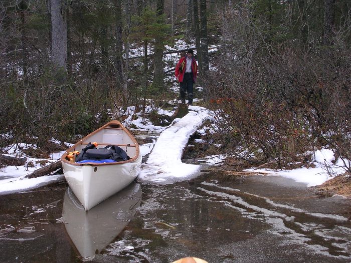
Within 15 minutes we were getting off at the newly constructed exit for Hwy 518 and the village of Kearney. We rolled through Kearney and made the turn at the LCBO outlet store at 7:45 to begin the 27 Km (16 Mi.) drive on roads that started out paved but that became increasingly worse, the closer we got to the put-in. The last 12 Km or so were extremely rough and we had to stop at one point and re-tighten the canoes’ bow and stern securing lines on the truck. The good news was that someone had been down this road before us and had cut out all the blowdown. This was the first time, in the five years we have been making this pilgrimage into the park in late fall that we didn’t have to stop and cut our way through. The rough road slowed us down considerably, however, and we arrived at the Rain Lake put-in at 8:30 AM.
There were two other cars in the parking lot and the back-country permit on their dash said they had arrived on November 3rd, would depart on November 5th and that they were somewhere out on Rain Lake. As we were unloading the canoes and emptying the vehicle we heard a wolf pack yipping and howling. Brian has studied wolves in Yellowstone and Poland and knows the difference between Coyotes and Wolves. Three years ago, we heard a solitary wolf while at camp on Daisy Lake so we know they are active on the western side of the park.
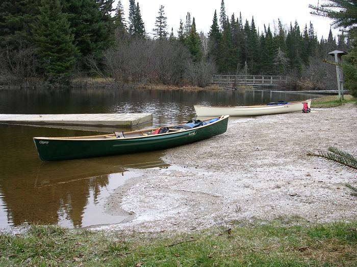
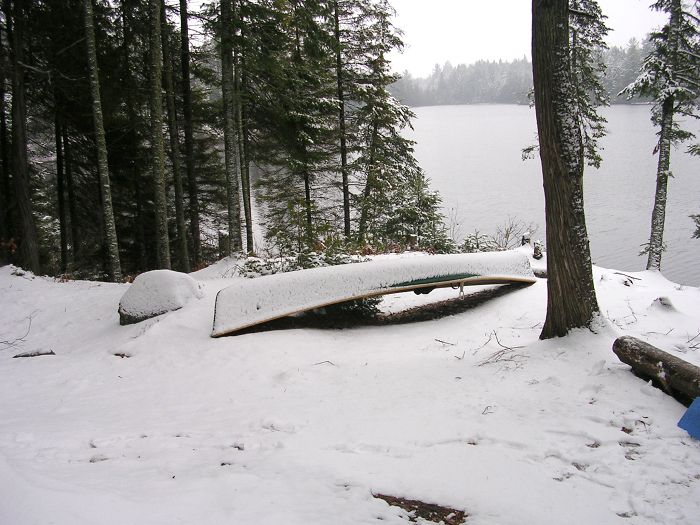
Put-in at Access #4
We put-in and departed at 9:15 with the barometer rising and the temperature at 4°C (Brian had brought along his Brunton Mini-Weather Station). Rain Lake is a narrow lake about 4 Km in length and we saw a fair amount of Eagle activity as we paddled our way toward the takeout. We saw both mature (with white heads) and immature (without white heads) Bald Eagles on three occasions as we paddled up Rain Lake. As we passed the island in the northeastern end of the lake, we saw the camp of the occupants of the only other vehicles in the access parking lot. They were up and working on their fire but we passed behind the island and their camp so no words were exchanged.
P310 Take-out over to Sawyer Lake
All the way up Rain Lake there had been a light 3 to 5 mph wind, dead astern, and at 10:30 we reached the takeout for the 310 meter portage over to Sawyer Lake. The takeout was very rocky and putting a couple new scratches on the canoes was unavoidable. After the rocky takeout, the trail was decent and the put-in to Sawyer was also decent. There are six campsites on Sawyer Lake and we didn’t see them all up close but of those we saw, some looked O.K. and some did not. I’m guessing in the prime season, Rain and Sawyer Lakes fill up pretty fast.
We arrived at the 550 meter portage into Jubilee Lake at 11:25 AM. This takeout was all roots and rocks, as was the entire trail as it undulated continuously through the wooded terrain and the final section to the put-in had a steep sideways lean making footing a bit treacherous. The put-in itself is clumps of marsh grass and since water levels were up it was easy to paddle right up to the landing but in lower water conditions, you would probably have to wade the boat out 10 meters or so before you could climb in. About 50 meters from the put-in the trail bends down to the shore of the marsh and there is a beaver dam at that spot. Our recommendation is to put in at the beaver dam and cut off the last difficult 50 meters of this trail. We paddled out onto the lower section of Jubilee Lake at 12:15 PM.
The narrows that separates the lower arm with the main body of Jubilee Lake was frozen over with a thin skin of ice about 6 mm (1/4”) thick and we sliced through it with little effort. Actually, close to shore and in the shadows, all the lakes but Rain Lake had this same 6 mm ice shelf. There are 6 campsites on Jubilee but the only one that really looked nice was the site on the north shore with its nice flat swimming rock. This site would also get sun all day which was a plus because most of the other sites had a dark, buggy look to them (in the summer, of course). When paddling in November in northern latitudes, it’s almost always cloudy 24/7 (but we were to be pleasantly surprised on our final day).
Runaway Osprey (mine) being rescued.
The day’s temperature was now at its high of 4°C as we cut through the 6 mm ice shelf about 30 meters from the takeout for the 450 meter trail over to Juan Lake. This was another rocky takeout with room for only one boat at a time. The trail proved to be fairly tough as well with short, steep, rocky uphills and downhills and one stretch over a boggy area on rotting planks as well as several small bogs with rocks and pieces of log for stepping stones. As hard as I tried avoiding it, with the canoe over my head, I picked up a soaked foot along this portage.
We ate lunch at the put-in to Juan Lake and at 2:00 PM paddled over this very small lake to the 185 meter take-out and our final portage for this day. The takeout to the 185 meter portage over to Moccasin Lake is very steep and rocky with no flat area to pull up the boat. This was quite possibly the most difficult takeout (and put-in for that matter) on this entire route. However, we discovered on our return (too late, unfortunately) that if you paddle around the house-sized boulder that creates this steep takeout, you will be halted at a beaver dam but there is a 5-foot wide flat beach between the boulder and the dam that is a perfect takeout and eliminates the other very nasty takeout. The rest of this portage is sharply undulating with many roots and rocks but it is only 185 meters long so the agony is brief.
Similar to Jubilee Lake, Moccasin starts out as a pond-like enclosure connected to the bigger lake by a short narrows and this was (as we by now expected) frozen over with the same 6 mm of ice. As he exited the frozen part, Brian came upon a mink swimming across the narrows. There are only two campsites on Moccasin and we selected the one on the northwest shore just in case there was any sunlight in the morning. We arrived at this site at 2:50 PM giving us plenty of time to set up camp and go on a firewood hunt.
There was no decent takeout for this camp and the only spot that worked was a narrow inlet, about one canoe length, that ended at a steep gully that led up to the firepit location. You had to crawl out and exit over the bow of the canoe as there were only rocks and brush on either side of the narrow inlet. As Brian negotiated this takeout, I paddled around to the east side of the site and found an even steeper spot that I thought I could pull out at. It turned out to be actually more difficult than where Brian was exiting and I found I had to hold the canoe in with one hand while I hefted my gear out with the other. Every time I pulled something out, the canoe and I slid down the steep, slippery bank and my foot went in the water. This happened three times and I uttered a judicious amount of swearing, which of course had no effect on preventing my foot from getting wet.
We popped up the tent, threw all our stuff inside (sleeping bags, pads, dry clothes, etc.) and went on the firewood hunt. We had to travel some distance from camp because a broad area around the site had been more or less picked clean. We found a suitable tree that had been dead for awhile and appeared to have recently been blown down by the wind. It was only about 4 inches in diameter and about 30 feet tall and we sawed it in half and dragged both halves back to camp. We also found a number of mature pine cones, which are natural fire starters, on the ground nearer to camp. Their resin catches as though they are soaked in kerosene and they burn very hot and very fast.
Camp 1 on Moccasin Lake in early evening.
At 5:00 PM the temperature was 3°C and we noticed some beaver activity in the lake around our camp. Beavers seem to be solitary creatures and in the span of 10 minutes two of them swam by the camp. I shined my flashlight at the second one and he gave the lake a mighty slap with his tail and dove under.
We broke out our headlamps and one of the bottles of wine. We decided on the (Italian) Cavit Pinot Noir. But before I poured a cup for myself, I needed to find the “thunderbox”. Now, usually I see no reason to chronicle this level of detail but I had to laugh at myself because I realized I was wearing no less than four pairs of pants. I was wearing my boxers (underpants); my poly-pro long underwear (innerpants); my nylon convertibles (outerpants) and finally my wind and water proof pants (overpants or as we began calling then: Überpants). That was a lot of pants.
I fired up my MSR Whisperlite stove and it only flared up on me for a moment before it settled down and functioned as it was designed. I had sent an e-mail to Cliff Jacobson, the very prolific author and expert on all things canoeing, and asked him if he could shed some light on why this stove of mine was so cantankerous. He thought my problem was contaminated fuel and so I had poured the fuel out of one bottle, through a filter and into another and there was in fact visible contamination in the form of dirt particles floating around in the bottle. If there was micro-contamination, I’m sure my filtering would have had no effect but I have to admit that, on this trip, my little stove worked the best it ever has. After eating our FD meals we burned up all the firewood as we finished the wine. By 7:00 PM the temperature had fallen one degree to 2°C.
By 8:00, a light sleet began to fall so we retired to the tent in order to remain as dry as possible. Once in the tent we put our wet socks into spare Zip-Loc bags and changed into dry things. The precipitation continued to fall and at one point I shined a light outside and the sleet had become falling wet snow. This precipitation continued all night without break and at midnight I woke up and checked the temperature inside the tent and it was 5°C. I shined a light out the tent door and everything was covered with wet snow that was still falling heavily.
Detail (Sunday, 11/5/05):
At 6:30 AM the temperature inside the tent was 4°C. We exited the tent at 7:00 and everything was covered with about 1 to 2 inches of heavy wet snow. The outside temperature was 2°C and if it had been two degrees colder we would have probably had 18 inches of snow accumulation.
Camp 1 on Moccasin Lake in the AM.
After wiping off the snow, I fired up the stove which I had left out all night covered with a pot. The Whisperlite worked flawlessly and as it began boiling the water for coffee and oatmeal, Brian started a roaring twig fire. As is our tradition, we generally always eat the packaged oatmeal with brown sugar, (cold) pop tarts, assorted breakfast bars and compliment all with Starbuck’s French Roast coffee out of our Lexan French Press. The coffee is the one luxury we treat ourselves to at breakfast, just as the wine is at dinner. As we worked our way through breakfast we were also breaking camp. The tent was so wet from the wet snow that we packed it separately (rainfly and tent) into two, 4 mil contractor trash bags. I had brought along straps to cinch them tightly and Brian carried the rainfly and poles inside his pack while I packed the tent inside mine.
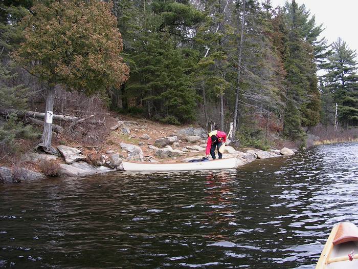
We loaded and launched both the boats, one-at-a-time, down the steep gully into the narrow inlet. The gully was now covered in slippery wet snow so the loaded boats took on the characteristics of loaded bobsleds. After a few out of control moments the boats were settled into the inlet and could be boarded. We departed the camp on Moccasin Lake at 9:30 AM.
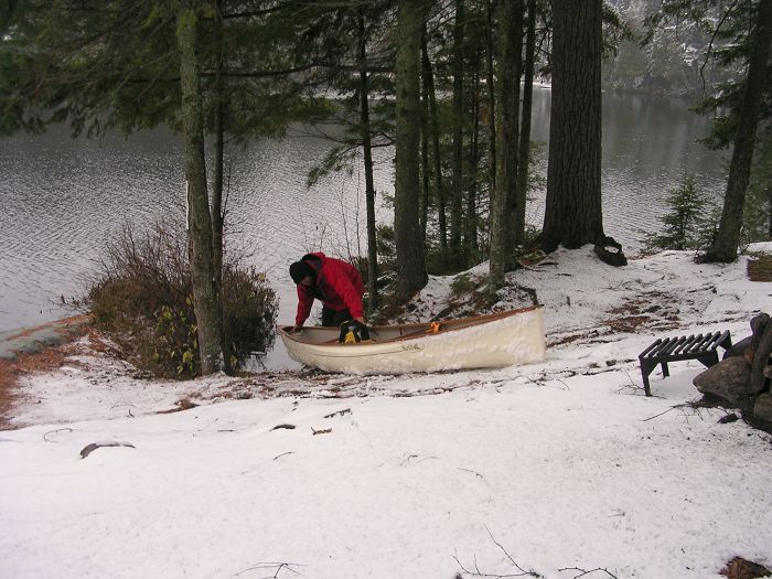
Launching Brian's Osprey from Camp 1.
It only took 10 minutes to paddle to the takeout for the 440 meter trail over to Bandit Lake. The takeout was very rocky but about 250 meters of this trail was in very good shape. We put in to Bandit at 10:30 and although there are two campsites on the eastern end, we didn’t check them out so their condition (to us) is unknown. About 20 meters in front of the takeout for the 540 meter portage trail over to Wenona Lake, we came on the usual shelf of ice but this time it was more like 13 mm thick and took a little more work to cut through. This was to be the thickest ice we encountered on this route.
The trail to Wenona was very rough, very muddy and had four blowdowns that we had to go around. On one of them I caught the stern of my canoe on the jagged stump and it disconnected the elastics that were securing my aft paddle and I had to set the boat down and reattach it. We put in to Wenona at 11:55 and arrived at the 370 meter takeout into Muslim Lake at 12:10 PM. This short trail was in good shape with easy up and down undulations and we put in to Muslim Lake at 12:50 PM.
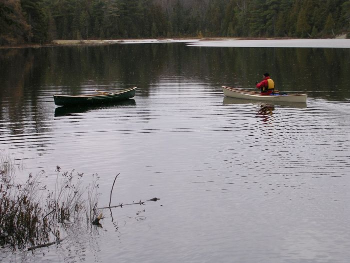
P370 over to Muslim Lake (Brian in background).
Ten minutes of paddling later and we arrived at the takeout for the 1030 meter portage into Misty Lake. The landing was very decent and the trail turned out to be the best of the entire trip. It was dry and slightly downhill all the way to Misty Lake. We arrived with our second loads at 2:15 and decided to eat lunch here. The afternoon temperature had climbed to 7°C and we were feeling pretty good about our day as we ate our salami and cheese sandwiches which we had pre-made in the motel two nights before.
We paddled out onto Misty Lake at 2:45 PM and deceptively paddled into the southwest bay before we realized our mistake. The 935 meter portage over to Little Misty Lake is in the western bay and starts right where the stream cascades into the lake with the audible sound of rushing water.
The takeout was really nasty because the entire trail was another cascading stream. This was a miserable takeout onto a miserable trail. Most of the trail was a running stream which forced us off the path and into the brush. It was tough, slippery, muddy and wet. We had begun the portage at 3:20 and departed out onto Little Misty Lake at 4:30 PM. The put-in was no more pleasant than the rest of trail had been with mud and puddles of standing water everywhere. The cryptic notes I made in my notebook summarized this as “a very shitty trail”.
As though this wasn’t bad enough, as I was making my second trip with the pack, my right foot came down on a protruding rock that was hidden under leaves and my ankle immediately twisted and to save myself from serious injury, I immediately collapsed to the ground. I have learned that if you try to resist this dynamic, you will serious sprain or even break your ankle. An ankle can only bend so far to the side and I had nearly taken it past that point. I had weighed my pack prior to departure and without food, water, wine or wet gear, it had weighed in at 43 pounds. I calculated that fully loaded it weighed 52 to 54 pounds and with that sort of weight you had to be really careful about where you put your feet while on the portage. My ankle remained sore for the rest of the day and night.
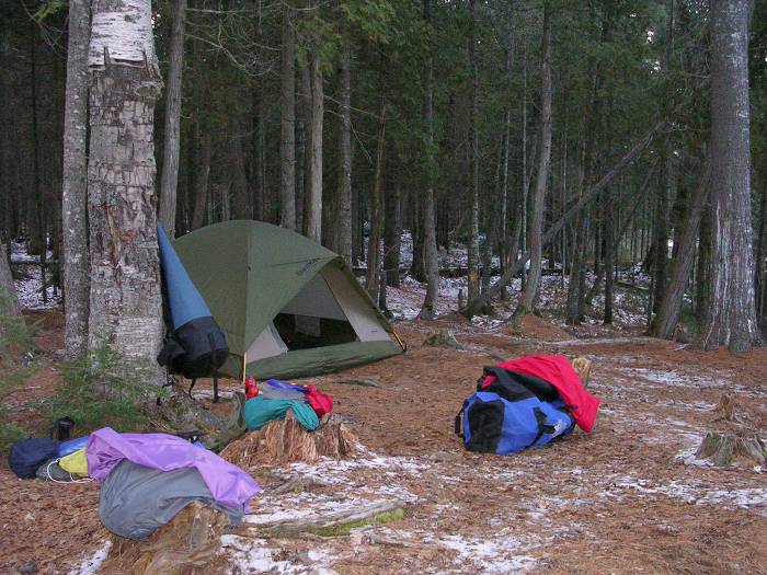
We arrived at the only campsite on Little Misty Lake at 4:50 PM with very little daylight left. The temperature was 5°C and we had very little time to find decent firewood but we set out immediately on the search. What we found burned alright but took a little more work to keep going and was smokier than the previous night’s fire. Still, we got our camp set up and settled in for our FD meals and our second bottle of wine (the Black Opal Shiraz) and by 8:00 PM a light rain began to fall so we were forced to retire into the tent.
As we settled into our sleeping bags, the temperature inside the tent got up to 12°C so we didn’t need all the extra materials we stuffed into our bags to facilitate our warmth. The night before, I had wrapped my feet in a fleece sweater and lined the inside of my bag with an ultralight fiber-fill liner. On this night my -7°C (20°F) rated sleeping bag was all I needed. There were off and on light rain showers most of the night but they ended by 3:00 AM.
Detail (Monday, 11/6/05):
The condensation in the tent in the morning seemed greater than usual. The temperature in the tent at 6:45 AM was 7°C while the outside temperature was 3°C. The morning sky was mostly cloudy with some open patches and the wind was calm. This held promise for the rest of the day which had been predicted to be decent. Surprisingly, my sore ankle from the day before felt fine in the morning. I had anticipated just the opposite.
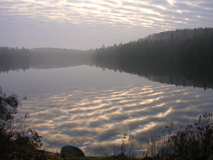
Camp 2 on Little Misty Lake at sunrise.
Following our normal morning drill, we departed camp at 8:45 AM and headed west up Little Misty to the Petawawa River. The day was looking very promising as the broken cloud cover cleared up and we saw the sun for the first time this trip (actually, for the first time in five years of these November trips). Where the lake joins the river, there was some blowdown in the water against the south shore and there was an entire family of river otters jabbering at us from behind this barrier. It’s hard to actually say whether it was friendly banter or not but as we paddled over to this blowdown they disappeared in unison after taking one, final parting shot.
This stretch of the Petawawa is all marsh grass on both sides about 20 meters out from the shore. There were a number of waterfowl inhabiting this area and at 9:25 we arrived at the 805 meter takeout over to the unnamed lake. There are two portage signs here; one on an old snag out where the marsh grass meets the river and one on shore at the trailhead. The landing was on either side of a double plank walkway over the bog and in spite of the fact the sky had by now completely cleared up, the walkway through the bog was in perpetual shadows and was covered in a sort of black ice from the daily freezing, thawing and re-freezing of the snow cover.
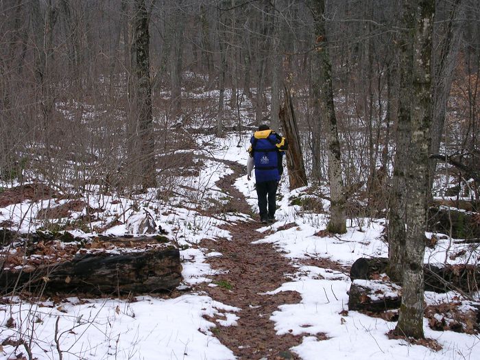
P805 take-out over to unnamed lake.
Most of these planks were alright but some were in various stages of rotting away and the whole walkway ran for about 50 meters where it abruptly ended at a sharp, short uphill to a ridgeline. On its own, this was fairly treacherous but it would have been alright except there was a large tree blown down across the start of this uphill. There was no way around the blowdown because one end trailed off into the bog and the other was half way up the ridge in thick undergrowth so we had to bring our canoes up to the deadfall, then with Brian on one side of the blowdown and me on the other, we did a two man shuttle with each canoe.
This portage trail was rough and wet, much the same as the others, but the hardest part had been the first 50 meters and the blowdown at the takeout. About midway along this trail we saw several well-defined bear footprints that were fresh that morning. It looked as though the bear had followed the trail for about a hundred meters or so and then went off to the left. There were some large rock outcroppings jutting out of the ridgeline on the left of the trail so perhaps the bear was building his den up there. We maintained extra vigilance for the duration of the portage and at 10:40, we put in to the no-name lake.
The temperature had climbed to 8°C and even though it was still chilly, the sun was getting high in its arc so we had shed our warmer outer shells and were down to just one clothing layer on the portages. We put another layer back on for the paddling portions because along with the clear sky came an increase in wind. It was blowing 6 to 8 mph out of the southwest and although it wasn’t yet on the nose, we knew that once we made our turn in the center of Moccasin Lake, we’d be paddling right into it.
We paddled down the no-name lake toward the 140 meter portage into Moccasin and from 50 meters out, the narrows that connected the two looked choked with tree debris. We scouted it anyway and found that with some delicate maneuvering, we could sneak through and in doing so, we realized that the “no-name” lake was actually part of Moccasin connected by a narrows. By 10:55 AM we were paddling out onto “greater” Moccasin Lake.
We paddled past our campsite of two nights prior and at 11:25 we arrived at the takeout for that miserable little 185 meter portage. The temperature continued to climb and checking it before our first load we found that it was now 10°C. We carried our boats over first and it was after we had set them down at the difficult put-in that we realized they could be put in between the house-sized boulder and the beaver dam. We didn’t feel like hauling them back up the sharp little hill, however, so this note is just for future reference. This put-in (or takeout, whichever way you are going), as I stated earlier in this report, is possibly the most difficult on this route. After a shaky launch and a few new scratches on the canoe, we crossed little Juan Lake arriving at the 450 meter trail at 11:55. We spent about ten minutes eating a snack and then made our carries.
There is no need to be redundant as I have already spoken to the poor condition of this trail with its 100 meters of semi-rotting planks and those boggy parts that made us wish that they did have (at least) semi-rotting planks. Just as I did on this trail on our way out two days ago, I once again slipped off a log and got a soaked foot.
Checking the temperature again at 12:45 PM, as we were putting into Jubilee Lake, we found that it had increased to 13°C and we just couldn’t believe our good fortune with this weather. As we paddled out onto Jubilee, the wind was becoming more of a factor as it steadily gusted between 6 and 11 mph.
At 1:05 we arrived at the 550 meter portage over to Sawyer Lake. We slid down to the beaver dam and unloaded our gear and as we carried our packs over the trail we kept studying the stream (that connected Jubilee with Sawyer) as it meandered through the marsh. We couldn’t see the lower part of it but the upper part looked like it could be run with minimal difficulty. We made a snap decision and decided to try to run the thing.
The drop down the first beaver dam was about 6 feet and I went first getting out on the dam and lowering the boat. Brain used his paddle and without exiting pushed his boat over the brink and at the crux point it looked like it was going to roll over on him but he made it intact. We paddled through a very narrow meandering channel until we came to another beaver dam which was smaller than the first. Getting over it was the easy part but the stream channel below it had some choked spots so we had to get in and out of the boats to clean a way through. We paddled another 30 meters and encountered some serious logjams closing off all possible routes through. Looking beyond this blowdown, the channel was absolutely choked with even more log jams and blowdown.
It was the end of the line for our decision to run the creek and we paddled over to the shore in the general direction of the portage trail. The shore required some bashing to pull out the boats and then it was up a steep hill through the tangled undergrowth to a ridgeline. This was a tough slog because the climb up the ridge was steep and the undergrowth kept snagging the boats. From the ridge we could see Sawyer Lake through the trees so that was the direction we headed. It was more of the same thick undergrowth although it was more or less downhill and there was one large deadfall that proved to be especially difficult. Brian bashed past this with a fair amount of swearing and yelled back to me that I should find a better way; however, I couldn’t see any easier way around this big downed tree so I followed his path. At one point the downhill was so steep that I slipped down onto my back under the canoe and waited for the boat to come down on my head but there was so much undergrowth that it got caught before it could fall all the way.
I did find a good launching point into the lake, however, and paddled over to the portage put-in. There wasn’t any decent place to pull out so I selected a semi-submerged tree growing out of the bank and turning around, I backed the canoe up on the trunk which was nearly level with the water. Spinning around to climb over my gear and exit out the stern, I didn’t realize that the boat was only balanced on its stern skid plate and as I turned, the boat rolled and flooded and suddenly my entire left side was submerged. At that point I just stepped into the lake and emptied the boat of gear and flipped it over to empty it of water and the “emergency” was over. The up side if there was one, was that my boat was now quite clean inside of mud and debris.
We ate lunch here and I changed into dry clothes and at 3:00 PM we put in for the paddle across Sawyer Lake. The wind was still blowing 6 to 11 mph and we arrived at the 310 meter trail over to Rain Lake at 3:30. The takeout was steep and very slippery wet clay and I slipped three times caking a fair amount of mud on my “Überpants”. This consumed energy I didn’t really have because I was more or less spent from our bushwhack. When I flipped my canoe over my head it suddenly felt like it weighed 80 pounds instead of 50. I didn’t have a whole lot left in me that day but we just had one more lake to paddle and the paddling part didn’t really cause me any hardship.
We put in to Rain Lake at 4:00 PM and the temperature was still at its daytime high of 13°C but the wind had piped up and was now at 8 mph with continual gusts to 13 mph. This probably slowed us a little but it was still not enough wind to cause us to struggle. Once we cleared the broad section of Rain, we hugged the southeast shore and the wind became more or less a non-issue.
It was dark before we reached the end of the lake and at one point the lake opens a little and we thought we had reached the end because in the darkness we couldn’t make out the narrows that continued on. The moon had not risen yet so we had to feel our way along the shore until we came on the narrows and paddled through. At 5:23 we grounded out at Access #4 and to our good fortune, our truck was still there.
We donned our headlamps one last time and loaded gear and boats and by 6:00 PM we were on our way back out to civilization. Within an hour we had returned to Huntsville checking into the Rainbow Inn, again, and after cleaning up we went back to Three Guys and a Stove for dinner (just to continue the dejavu) and we even ordered the same very good and very reasonably priced bottle of a South African Shiraz.
Detail (Tuesday, 11/7/05):
We were on the road at 8:00 AM and got breakfast to go at (where else?) Tim Horton’s and the remaining drive home was uneventful with the exception of rain that came down harder as we got closer to the border.
By 3:00 PM we were back in Dearborn exchanging canoe and gear from Brian’s truck to my car and I was home by 3:45. We had made only gas stops along the way and this turned out to be our fastest travel time between our home and the park.
Miscellaneous:
Trip Cost Per Person: Total spent: $422CDN ($374USD)
$128CDN ($114USD) spent in cash (USD weakening against CDN $1.00CDN=$0.885USD):
Food and other backcountry provisions
Bridge toll
Lunch at Firkin & Fiddle (Cambridge)
Breakfast at the Huntsville Tim Horton’s (2)
Fuel fill-up on 401
Coffee & snacks on the road (both ways)
$294CDN ($260USD) spent on credit card:
Algonquin backcountry registration ($35.68CDN for two overnights)
Rainbow Inn (Huntsville) motel
Dinner at Three Guys and a Stove in Huntsville (2)
Fuel fill-up in Cambridge
Other Misc:
Park registration: You can now pay your registration fee over the phone, after the satellite park offices have closed for the season, by calling the park information number at 705-633-5572 (East Gate) or 705-633-5583 (West Gate). If you are planning to enter the park backcountry from the east you will call the East Gate number and from the west, call the West Gate number. This saves valuable time eliminating a drive into the park information office (the only facility that is still open off-season). The park service asks for your route, dates of travel, lakes you will camp on, number in the party, canoe color, tent color, vehicle description, vehicle license plate number and credit card number. They then give you a permit number and ask you to write it down legibly and also state that it was “purchased by phone from East (or West) Gate of Algonquin Park”. Once you get to the Access point, you then place this on your dash so that it is visible through the windshield. Our dash permit looked like this:
Permit Number # 684105
PURCHASED BY PHONE FROM WEST GATE OF ALGONQUIN PARK
Route: (11/4/06) Rain L. – Moccasin L. – Misty L. –
Petawawa R. – Moccasin L. – Rain L. to take-out
(11/6/06)
Permit Expires November 7, 2006
Paddlers: Neil (Last name) & Brian (Last name)
Canoe rentals:
In the past 5 years of late fall paddling I have rented solo canoes from Algonquin Outfitters at their Oxtongue Lake HQ; however, this was the first year that I have owned my own canoe. This year, we didn’t rent anything from AO (although we did make some purchases at their Huntsville store Friday night when we arrived).
Water levels:
It had been such a wet fall that water levels were up to normal spring levels. Generally, the Rangers or the outfitters might have the most current water level information and then of course there are always the paddlers on the CCR website (www.myccr.com).
Random thoughts:
On portaging . . . The portage trails along this route deserve further dialogue. First of all, consider a “1” to “10” rating system for portage trails, with “1” being a broad, flat, smooth pathway and “10” being no visible trail at all. Three of the trails fell into a 3 to 4 rating and the remaining seven trails would rate 5 to 6. First of all, they are Algonquin trails; i.e., clearly marked and reasonably maintained but the seven poorest were uneven, muddy, boggy, rooty, rocky and with steep little inclines. On top of this, there had been a lot of moose activity on nearly all the pathways and they had really chewed up the already muddy trails and in some places had created a real quagmire. Then there were the boggy areas. Most of these were going to need to have some of their planks replaced for the next paddling season and other areas had nothing but random stones and pieces of log to cross on and could have used some planks to facilitate the crossing. I would rate the best trails in Algonquin as a “2” so the “3” to 4” rating really doesn’t require further discussion. I’m also well aware that one paddler’s misery is another’s joy and that it’s the condition and length of a portage trail that keeps the crowds out of the interior of the park and so the serious wilderness paddler would probably prefer not to see a refurbishment of these trails. Honestly, Brian and I place ourselves in that category of wilderness paddlers and would be just fine with leaving everything as is; however, for the sake of an honest assessment of trail conditions, I find it necessary to have this dialogue. For instance, if a paddler has spent all winter convincing their significant other to paddle into Misty Lake, they should both be aware of what they are facing in the way of portages so that their relationship doesn’t die somewhere out on the trail over to Wenona Lake.
On blowdown . . . As for the blowdown we encountered in several areas, it has been my experience that in Algonquin, the backcountry rangers will have all of this removed by June 15th. We were portaging a designated “unmaintained” trail in the first weekend of June, 2005 and met two backcountry rangers clearing the trail ahead of us. This was the height of blackfly season and these two appeared to have little or no protection against the little buggers and yet we found these rangers to be pleasant, amiable and without complaint. I don’t know what their operating budget is but they really do an amazing job taking care of this park.
On adding new scratches to a new boat . . . This being the maiden voyage of my newly purchased Swift Osprey, I was extremely cognizant of everything that would put new scratches on her shiny forest green hull. Despite this attentiveness, there just was no way to avoid adding new scratches because most the takeouts were unavoidably rocky and it was impossible to land the boat without scraping something. I was pleasantly surprised to find that slicing through 6 to 13 millimeters of ice did not put any marks on the hull but it did take a toll on our paddles. The outside edges of our paddle blades got pretty ragged as a result of chopping through the ice. If you know you are going to be cutting through ice sections, you might want to consider purchasing one of those inexpensive plastic paddles (such as Sawyer makes for about $25 USD). You definitely do not want to utilize your $350 carbon-fiber bent shaft paddle for this task.
On bushwhacking . . . Our little bushwhack around the 550 meter portage was a good eye-opener on carrying a “10” rated portage. In the summer of 2007 we are tentatively planning on canoeing several rivers that will have to be connected by up to three kilometers of bushwhacking where no trail exists. We verified the difficulty on this trip by trying to find our way through the bush with canoes on our shoulders. It really is not the way to approach this situation. In this case we only had a couple hundred meters to go and once we got up on the ridgeline we could see our destination but this summer, we will plug in our starting point and destination point as waypoints on our GPS and we will make the first trip across with packs and some sort of machete or brush clearing tool. We will also mark our route with surveyor tape so that we can both find our way back and then bring our boats across. And finally we will remove the surveyor tape as we go to remove the impact of our passage (the brush will grow back).
On gear carried . . . I weighed my Osprey at home (I stood on the scale, then I stood on the same scale with both boat, then pack on my shoulders) and it weighed exactly 50 pounds, not the 44 pounds advertised in the catalogue. My boat has bow and stern skid plates and Ash gunnels so this must account for the additional six pounds. The demountable yoke weighed exactly two pounds as did each of the two paddles that I fixed to the thwarts so the actual portage weight of the boat was 56 pounds. As I said earlier in the narrative, my pack weighed 43 pounds but that was without a quart of water, two quarts of wine, food and any moisture on the packed gear. My estimate is that the pack ended up at about 52 to 54 pounds in weight. I’m not sure how I could cut out an appreciable amount of weight unless I cut back on things like repair items, first aid gear, spare cordage and straps, spare overpants, spare socks, etc. The problem with a lot of this stuff is you never need it until you need it (now, that’s profound) so I haven’t arrived at the point where I’m secure enough to leave it behind. I believe if I made a concerted effort, I could shave 10 pounds out this pack but not much more. One final thing I should mention concerning gear. We always decant the wine out of their glass bottles and into the standard one quart (1000 ml) nalgene bottles. After the transfer, I tightened the lids in the motel room where it was warm and in the cold pack the lids loosened ever so slightly as the plastic contracted. It was just enough to spill a tiny amount of wine through the threads and I had to air out a couple of things at our first camp. This was purely a law of physics thing about how materials contract and expand in different temperatures.
And finally: A few kilometers outside of Kearney on the road to Rain Lake, there is a Bed & Breakfast called Echo Ridge B&B that looks fairly new and inviting. Although I’ll never break my strange attraction to the Rainbow Inn, this would be a comfortable place for an involved couple to stay on the eve of departure for any one of the three access points into Algonquin that are accessed through Kearney. You could get breakfast right there; the Kearney Park Registration office is within a few kilometers and you would be a half hour closer to the first put-in than if you stayed in Huntsville.
The contact information is:
Echo Ridge Bed & Breakfast
516 Rain Lake Rd.
Kearney, Ontario P0A 1M0
705-636-5228
This was a year for firsts. We have been making this trip into the west side of the park every November since 2002 and this is the first time we ever had one completely clear day with temperate weather. This was the first year we approached one of the access points and somebody else had cut out all the blowdown across the road. It was also the first time I didn’t have to rent a canoe and this gained us a half day of paddling because in the past, we always had to drive to Oxtongue Lake to rent the canoe from AO. And finally, this was the first season we didn’t make a spring and summer canoe trip because Brian had injured his hand in a freak knife accident and didn’t get the green light to hold a paddle from his “Orthopod” until September. (He was opening a vacuum sealed plastic toy package for one of his kids and the knife slipped and . . . well you can figure out the rest.)
I know I’m redundant when I end these trip reports by always stating the wonder and beauty of going into this magnificent park late in the season. If you can time it right, just before freeze-up, and if you have decent warm and foul weather gear, we believe there really is no better time than November to be inside Algonquin Park.
![]()
Neil Miller, November 25, 2006 . . nmiller6@ach-llc.com