|
|
Opeongo - Happy Isle - Merchant - Big Trout - Longer - Burntroot (Red Pine Bay) - Hogan - Big Crow - Little Crow - Proulx - OpeongoAugust 5th-8th, 2015 By: Cam Penman |
|
|
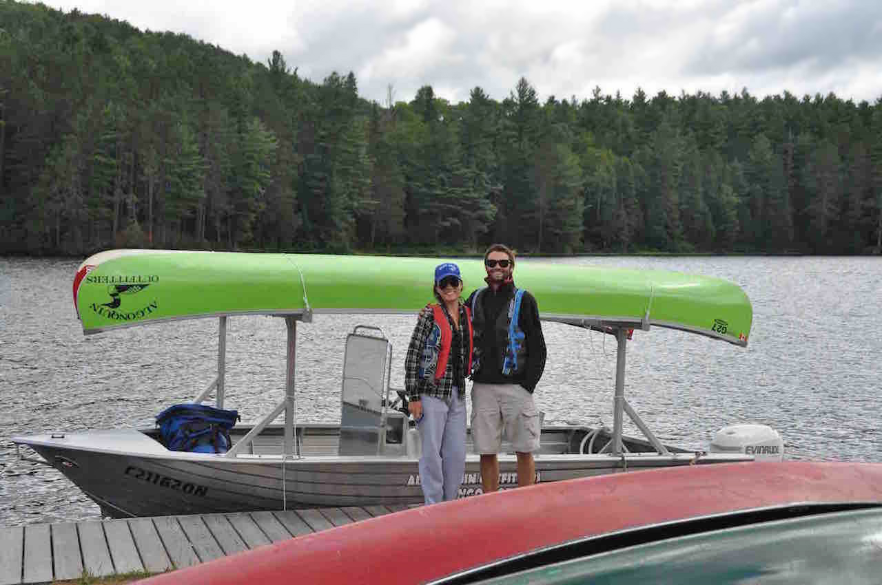
Introduction: This was the first Algonquin Park canoe trip that my girlfriend and I would do together. Jen has some tripping experience, so we settled on a loop that would have us traveling about 5 hours/day on average, with some smaller portages and one long one. I have been on a few Algonquin trips, but most of the territory we would cover would be new for both of us. Day 1: We woke up at 6:15 and left Jen's family cottage on Lake Muskoka at 6:50. When we arrived at the Algonquin Outfitters location at the Opeongo access point, we were quickly taken care of and set up with our canoe for the trip. We had also arranged for a water taxi to the Happy Isle portage and we were on the boat by 10:10.
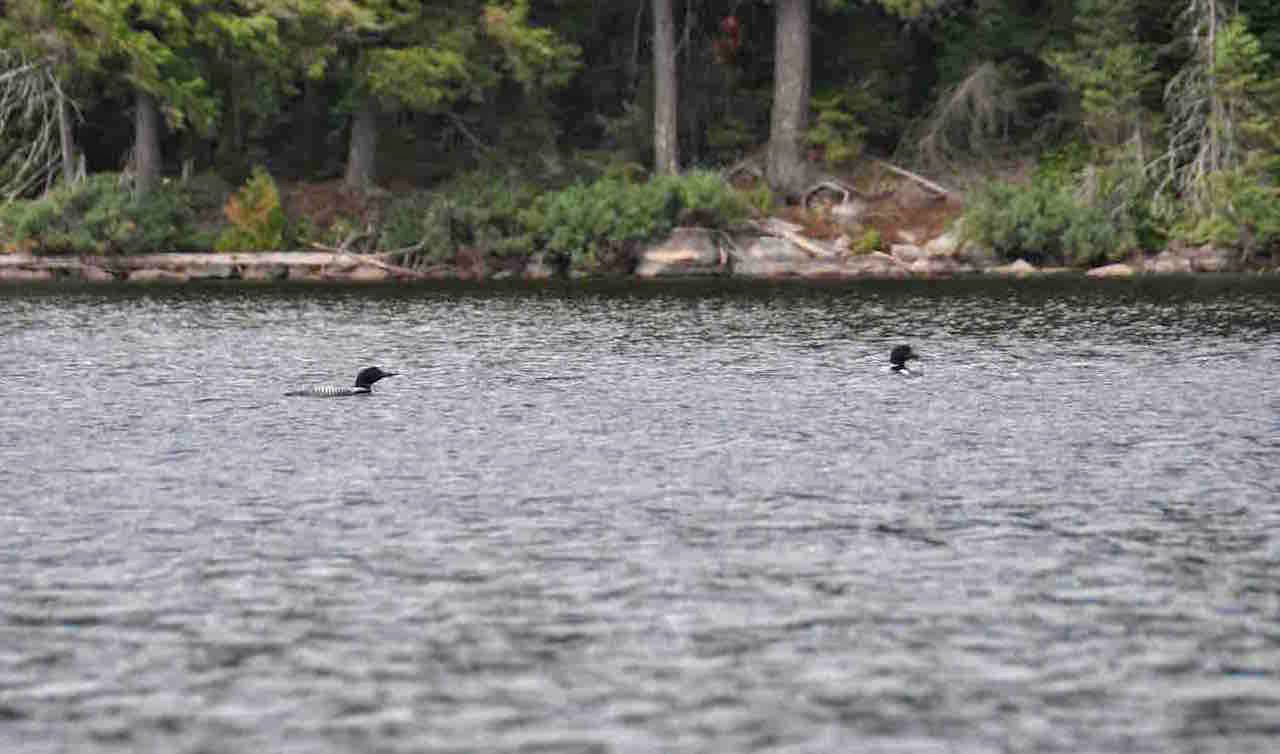
We talked with Trevor, our water taxi driver, for much of the ride. He was very helpful and friendly. He even gave us a couple of campsite suggestions, as we shared our route with him. We reached the Happy Isle portage at 10:40, after we dropped another group off at a campsite in Hailstorm Bay. The portage to Happy Isle Lake was relatively long at 2180m. But the terrain was flat and the trail was well traveled. As we put in on Happy Isle we had our first experience of the stiff headwind which would slow us down for the next 2 days. We paddled up to the north shore in an attempt to stay out of the northwest wind. We ended up making pretty good time across the lake and we finished the 340m portage into Merchant in only about 10 minutes. I thought to myself how great a job that Jen had been doing so far. She was trucking along the portages with a pack that must have been half her weight and was paddling away at a great pace despite the headwinds. The put in at the end of the portage to Merchant is not great. It was quite rocky and there weren't many good spots to get the canoe into the water. About halfway up Merchant, we were greeted by a couple of loons that really seemed interested in us. We snapped a few photos and continued on our way.
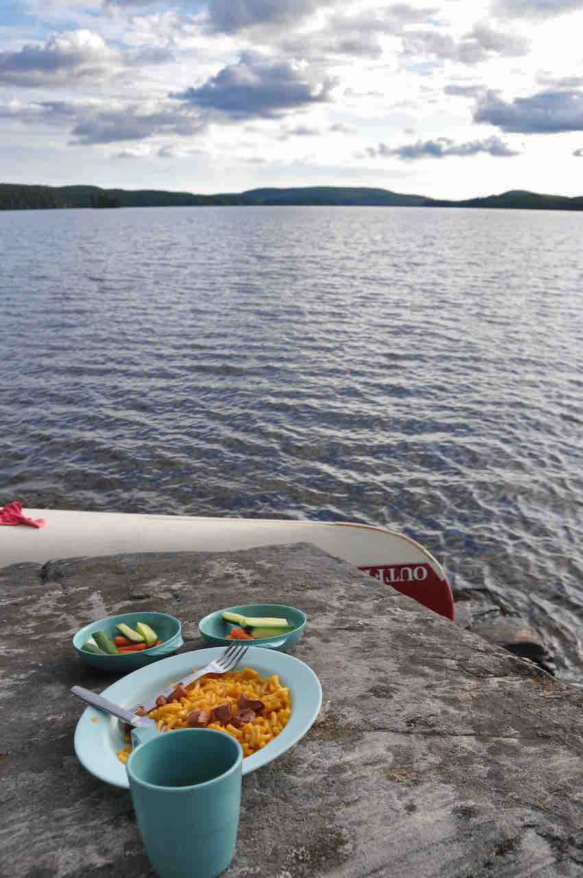
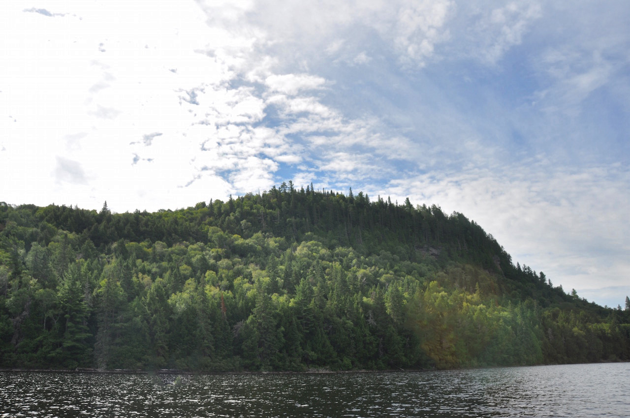
We made it to the Merchant-Big Trout portage by 1:45 and we decided to stop for a quick lunch. The portage to Big Trout, although slightly shorter than the Opeongo-Happy Isle portage, was actually much more difficult due to the terrain and the rocks that littered the trail. We were very happy to reach the put in to the creek leading to Big Trout. We had to negotiate a couple of small beaver dams along the creek, but nothing major. Once the creek opened up into Big Trout, that headwind was back! We had our eyes on the campsite on the island, at the very east end of Big Trout. We were desperately hoping it wasn't occupied, as it was a serious struggle paddling into the teeth of the wind. As we crossed the southern shoreline, we noticed it was unoccupied! We reached camp at 3:40. It had great views of the lake, good swimming, a large fire pit and lots of room for our tent.
We set up camp and went for a dip. Then I got a fire going, while Jen began to prepare dinner. We had steak, potatoes, corn on the cob and red wine. Gotta love first night dinners! After dinner, we enjoyed banana boats which are absolutely delicious. Banana, chocolate chunks and marshmallows! We put the fire out, hung our food pack and shut it down for the night. What a great first day in Algonquin! Day 2: We woke up with the sun and stepped out of the tent to a cool but clear morning. Bacon, eggs, oranges and coffee were on the menu for breakfast. This would have us fueled for a long day on the water, as we had our sights set on Lake La Muir that afternoon. We left our campsite at 10:15 and headed out on to Big Trout. We stayed out of the strong northwest wind as best we could, by hugging the north shore and passing the big island in the middle of the lake to the north. It was a relief to get to the 350m portage into Longer Lake and out of the wind. This portage was easy from what I remember. We made good time up Longer to the bend to the east and into what I believe is part of the Petawawa. We were hoping to spot a moose in this area and kept really quiet but we had no such luck.
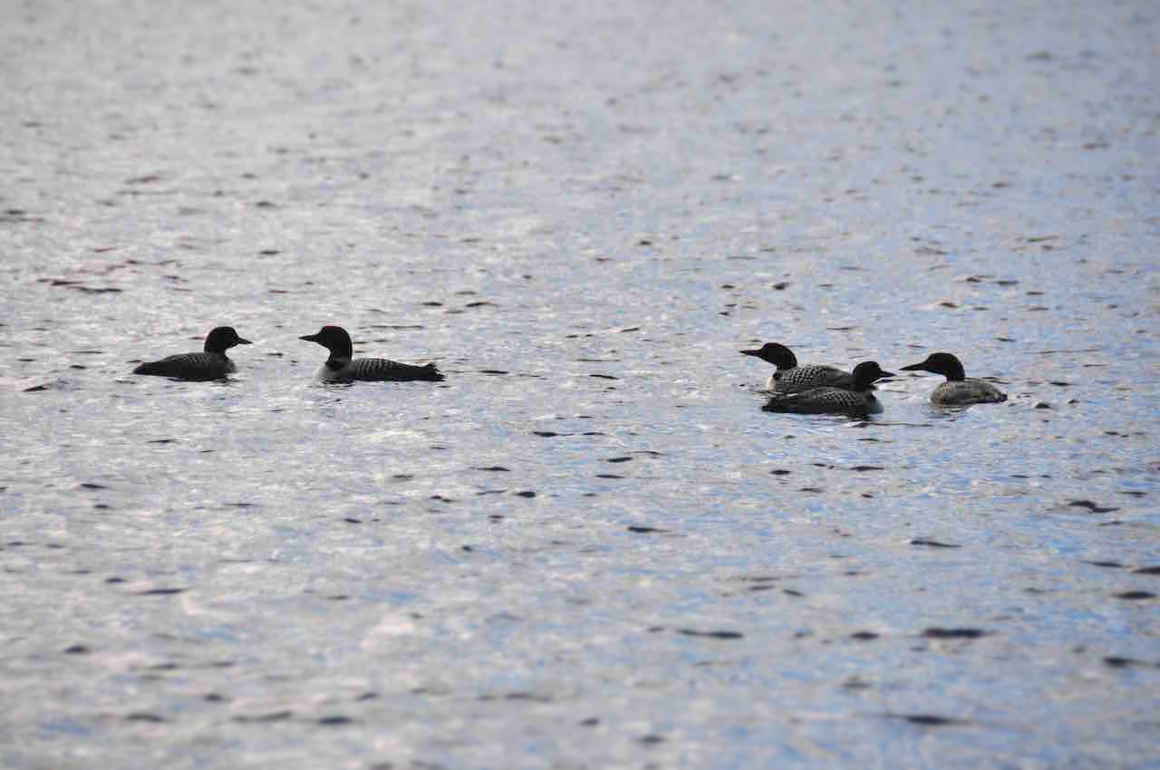
We hit the 40m portage which skirts around some small rapids and decided to stop for lunch on the rocks. It was a really nice place to stop and overlook the rushing water. We put back in, paddled another 5 minutes down the river and made quick work of the 75m portage and we were off again into Red Pine Bay. If you are heading into La Muir from this portage, play close attention to the quicker route into Red Pine Bay. There are a few rocks that partially block the small opening on the south side of an island and at first glance it looks like it's not passable. But it is. So, after the portage, take the first small opening on your right and you'll save yourself a few minutes going south through Red Pine Bay. As we got into the bay we both had huge smiles on our face because we had a tailwind for the first time on our trip! We breezed Red Pine Bay and reached the portage into La Muir in no time. Although relatively short at 735m, this portage is no picnic. The path goes straight up hill quite steeply at the start and then descends just as steeply at the end. To boot, it was buggy at the end. At first glance, La Muir looked to be such a beautiful lake. It's quite big with large hills on its western shore. We inspected the first couple of campsites on the north shore. They seemed okay. But given that we had to tackle a 3750m portage the next day, we wanted to get as far along La Muir as we could to shorten our next day. So, we took advantage of the tailwind we had and made the push across La Muir to the campsite on a point located almost at the east end of the lake. When we finally got there at about 4:15, we were so glad we'd made the decision to paddle across the lake. It was a beautiful campsite! The rocks on the point afforded a great sitting area from which to take in some great views of the expanse of the lake. The fire pit was great and there was lots of room for tents. We set up camp and went for a swim. Then we enjoyed some Kraft Dinner with chopped up hot dogs and red wine, while out on the point overlooking the lake. We were joined by a group of 5 loons while we watched the sunset over the lake. It was absolutely beautiful. We stayed out there for a while, took in the stars and then headed to bed.
Day 3: We woke up once again shortly after sunrise, to another cool and clear morning. We made some more eggs, while Jen prepared some oatmeal with brown sugar and sliced apples. It was such a calm morning and there wasn't a cloud in the sky as we set off.
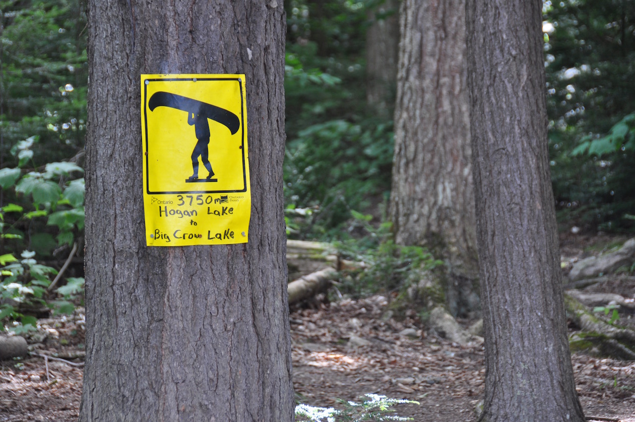
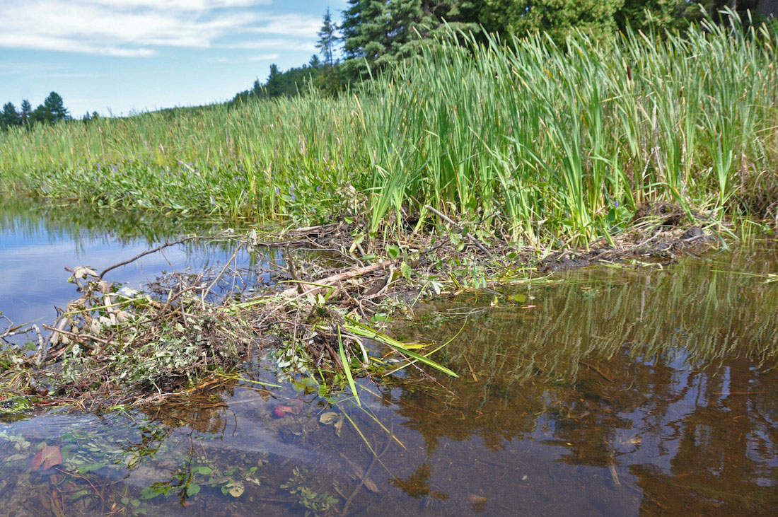
It was tough to say goodbye to such a great campsite but alas we were off towards the east end of La Muir and into Muddy Bay. We made it to the 685m portage pretty quickly. This portage was quite easy as it was downhill the whole way but Jeff's Map was right, this portage was extremely buggy!! We put in on the river, I think it's the Little Madawaska, as fast as we could before we got eaten alive. This was another river we thought we had a good chance of seeing a moose but as we wound around toward Hogan Lake, we again had no luck. However, we did run into a very curious beaver that swam right up to our canoe before ducking under the water. As we reached the mouth of the river and into Hogan we realized how big of a lake it was. Luckily, we only had to paddle a small section of the lake towards the dreaded 3750m portage into Big Crow. We made good time to the put out and decided to stop to refuel with GORP and water before starting the portage.
This portage was not fun! It started out with what seems like about 600-700m of steep incline! I was exhausted by the time I got to the first canoe rest. Jen seemed to be doing a little better than me and this was the first portage where she would have to wait for me. We decided we would break at the 2 cart trail intersections, as they were located at approximately 1/3 and 2/3 of the way. We took a quick break and the first cart trail intersection but couldn't stay long because the bugs were getting to Jen pretty badly. The second 3rd of the portage was no treat either. Fallen trees littered the trail. It was extremely difficult to get around with the canoe, particularly the trees that were across the boardwalk in the swampy section! I was thinking to myself why park staff would not have maintained a portage such as this a little better. But I guess recent storms must have caused the issues and they hadn't had a chance to clear the debris yet. Once we hit the 2nd cart trail intersection, the rest of the way was actually a breeze. The path was flat and wide and before we knew it we were at the Big Crow put in. I looked at my watch and figured it took just over an hour to tackle the portage. Once on Big Crow, we set our sights on the beach campsites on the east shore close to the entrance to the Crow River. I had read on trip logs that these were nice sites. We arrived at the site closest to the river. But when we inspected it, we noticed that there was next to no flat ground and it looked run-down. As we were pondering what other site to choose, we noticed that the occupants of the other beach site on the east shore were leaving. So we made a bee line for it. This site was much better than the other, so we decided to settle here for the night. It had a nice beach, a good size fire pit area and flat ground for tents. However, the resident chipmunk there was very daring!! Clearly he was used to being fed and he didn't leave us alone whenever we had food out! We did not feed him even a crumb!
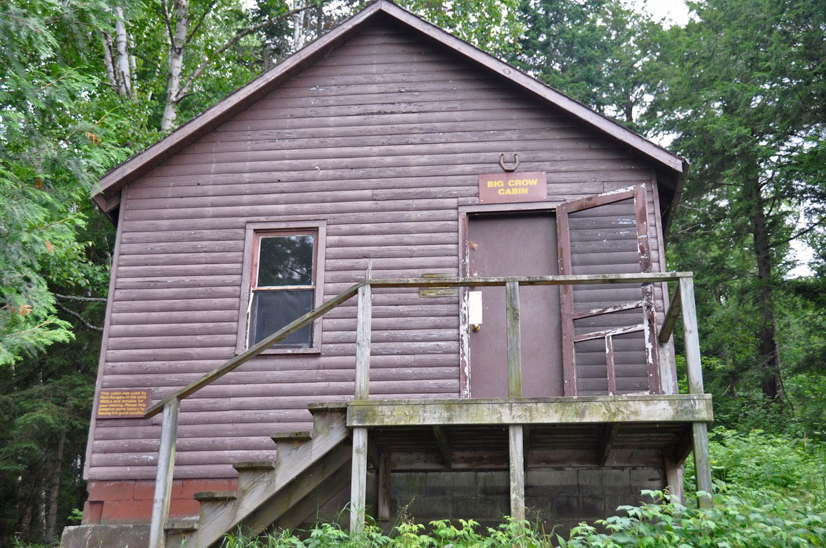
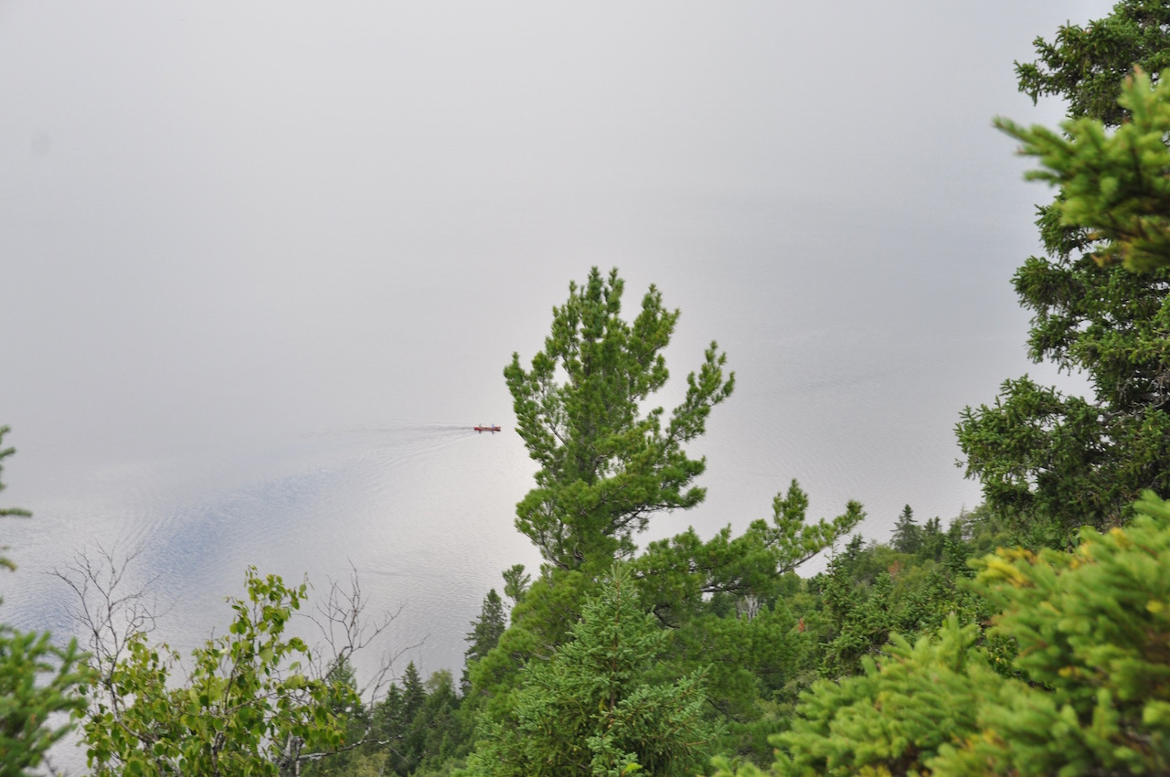
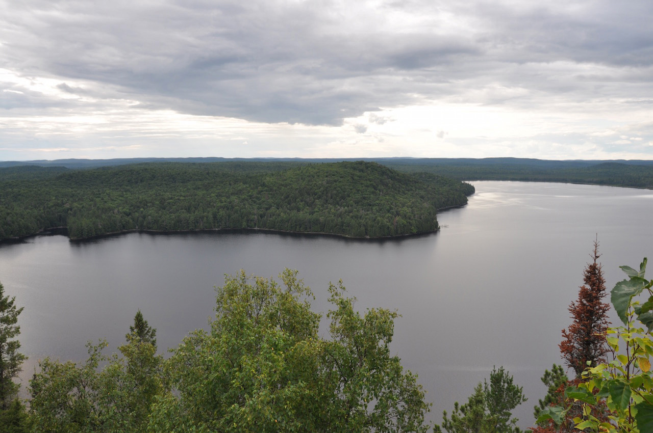
We had planned to hike up the trail to the old fire tower that afternoon. So I woke Jen up from a nap at 5:15 and we headed across the lake to the ranger cabin to find the trail. The trail starts right behind the cabin and is marked quite well the whole way up, with orange ribbons tied to the trees lining it. It's not a difficult hike. I think it took about 20 minutes at most. The tower at the top is pretty neat but you can't climb it. We wanted to get some views of the park from a lookout point on top of these cliffs but we took a couple trails to the right of the tower and couldn't get much of a view at all. We went back to the tower and tried the trail behind the tower and voila! What an amazing view!! We took some pictures and then headed back down as we were getting hungry for some dinner.
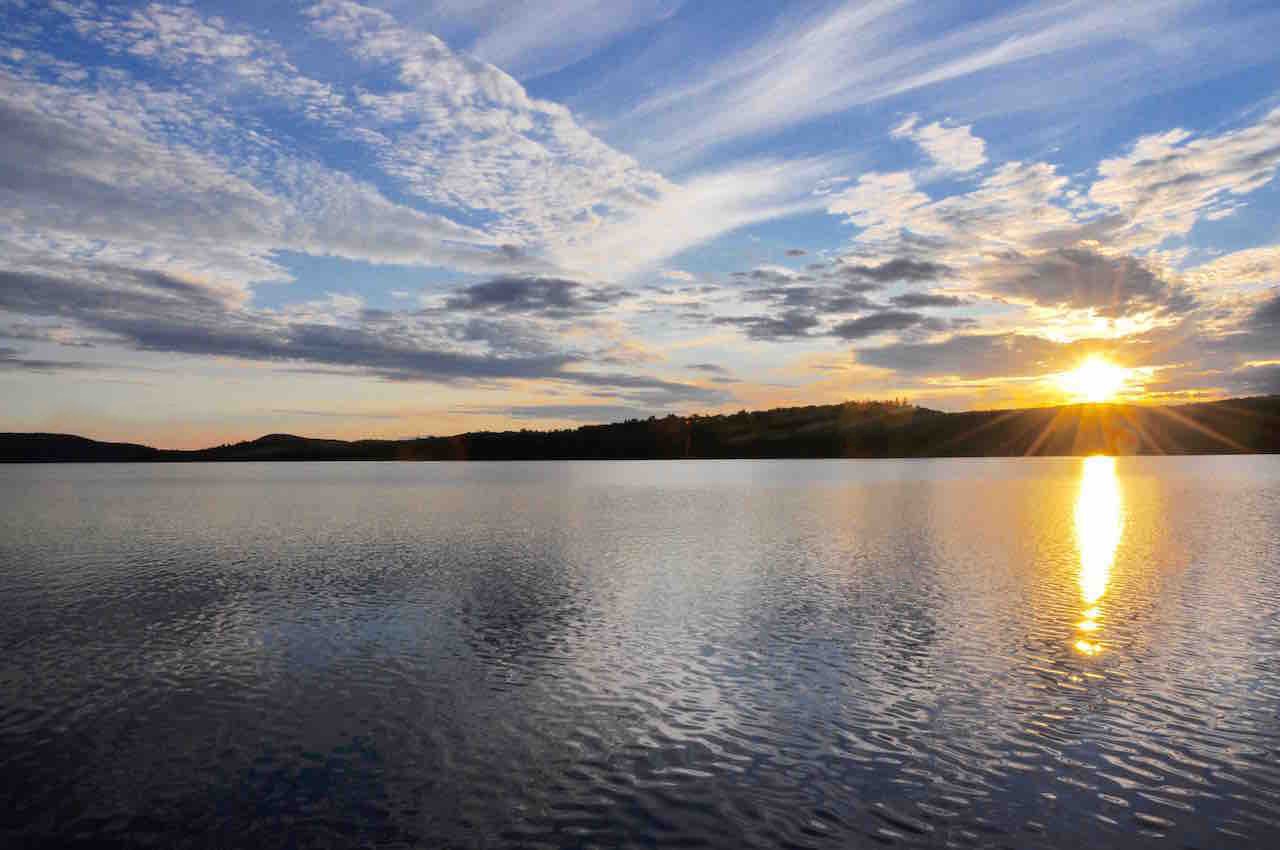
Jen prepared some pasta with tomato sauce and grated parmesan. And we had smores for dessert. We decided to paddle out to the middle of the lake for the sunset, which was again beautiful. Nothing beats Algonquin sunsets! Once the stars came out, we headed back to camp and I hung the food pack. Then we headed to the tent for the night. Day 4: We woke up to another cool, clear and calm morning. We had pancakes and coffee for breakfast. We were a little quicker getting ready today, as we had a 1:30pm pick up scheduled with the water taxi in the north arm of Opeongo. We left our campsite at 9:30 and had a quiet and peaceful paddle across Big Crow and Little Crow.
By the time we paddled into the Crow River at the end of Little Crow, it was getting quite hot. By far this was the hottest day of our trip. It took quite some time to weave through the Crow River into Proulx Lake. We ran into one beaver dam that we had to carry over.
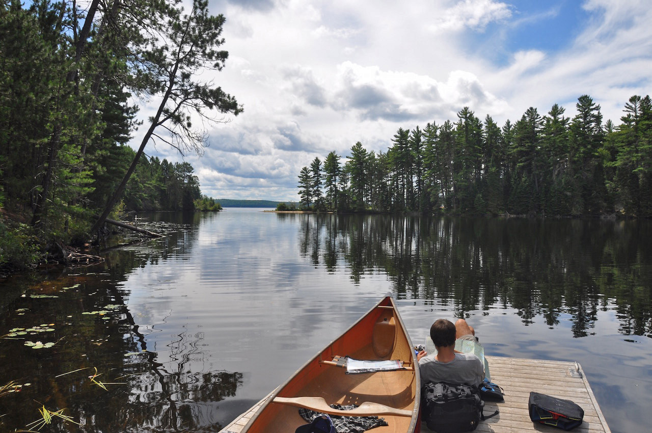
We stopped for a snack at a campsite about halfway across the lake. Then we made our way to the 1395m portage to Opeongo. This portage is very well traveled and in good shape. We were at the dock on Opeongo in no time and had to wait about 35 minutes for our water taxi. We took the time to reflect on the great trip and were already looking at the map, planning our next trip into the interior of Algonquin!
|
||||||||||||||||||||||||||||||||||||||||||||||||||||||||||||||||