|
|
|
 |
|
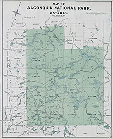
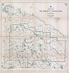
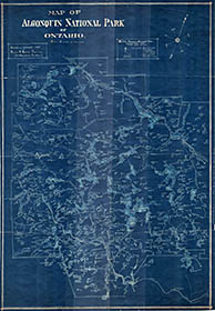
This 1893 map is from the Department of Lands and Forests Report on Algonquin National Park.
Original scanning paid for by Stephen Molson.
Downloadable image file is 788 x 2087 pixels (788 kb).
|
|
|
|
 |
|
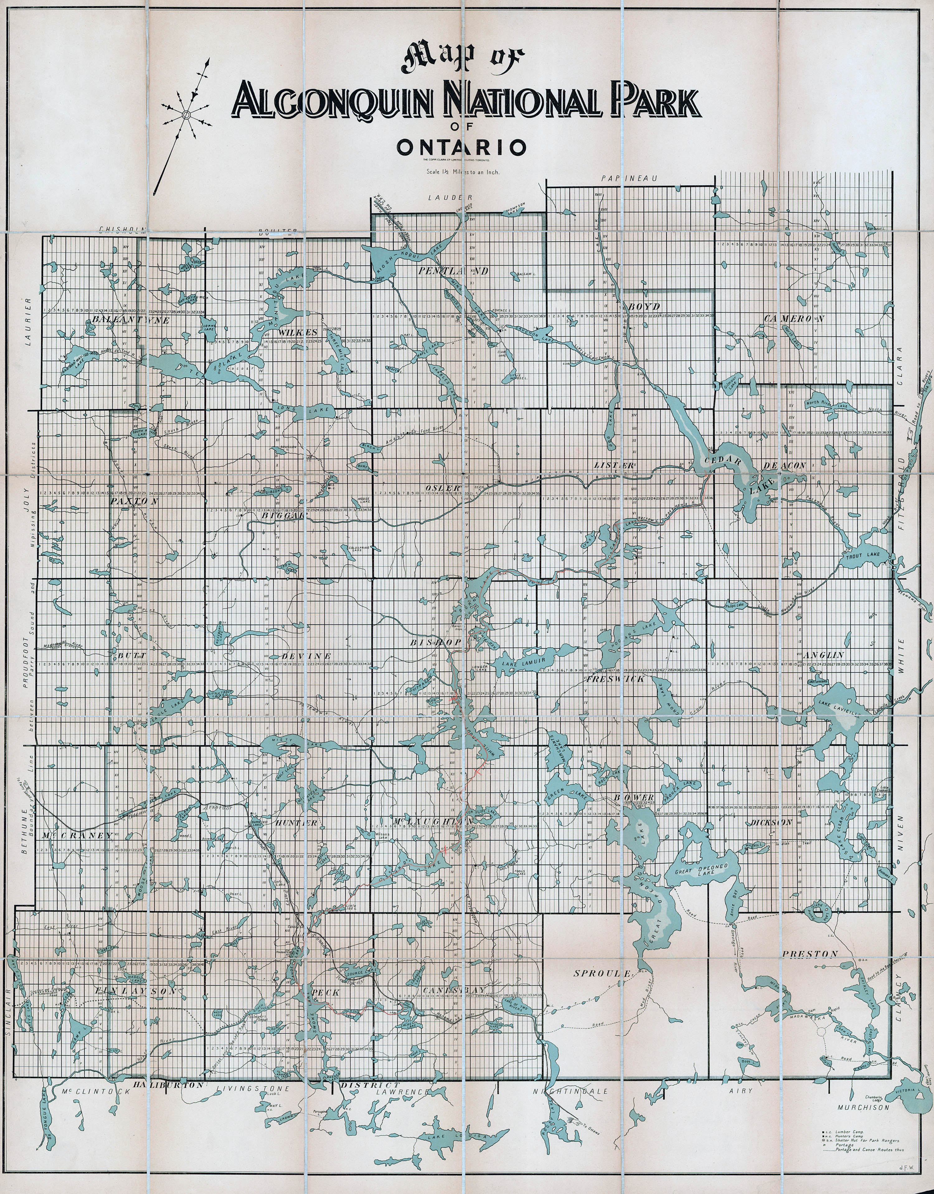
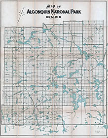
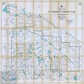
This is the 1900 Copp Clark Co. Algonquin Park Map.
Scanning services paid for by Algonquin Outfitters.
Downloadable image file is 3000 x 3834 pixels (2.3 mb).
|
|
|
|
 |
|
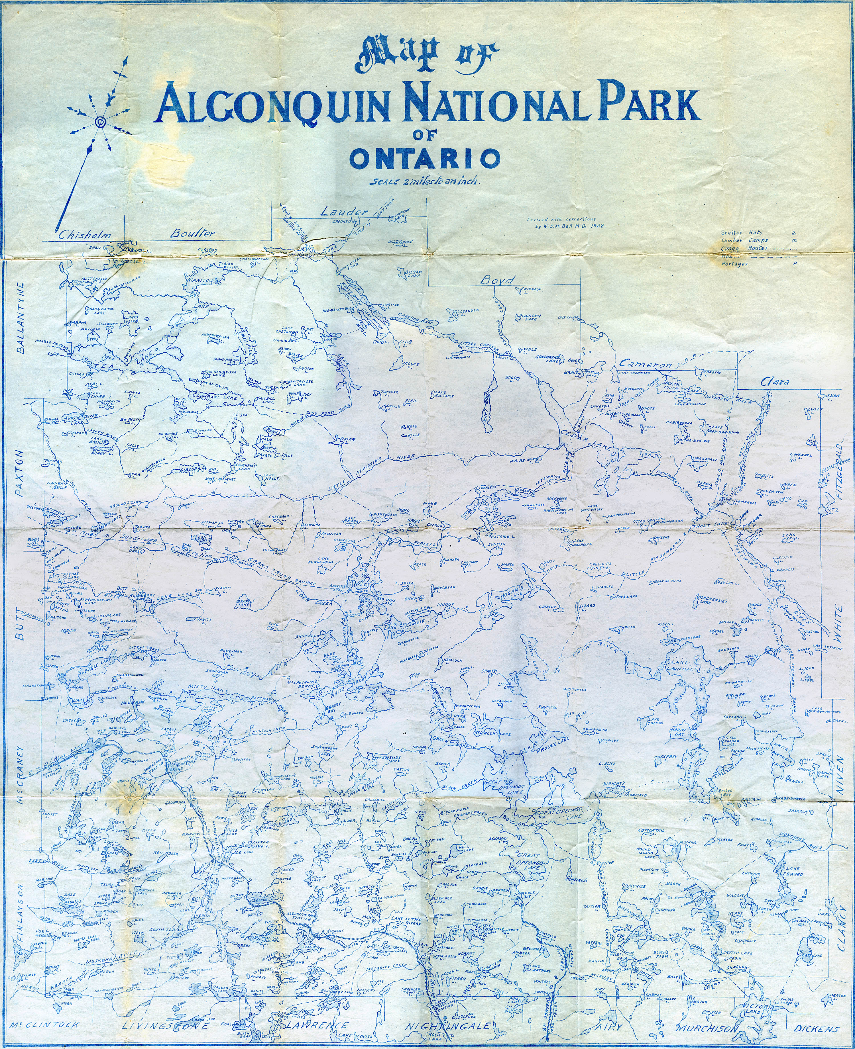
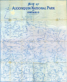
This is a 1908 Algonquin Park map by Dr. Bell.
Map provided by Bruce Sutton, scanned by Mark Rubino and edited by Jeffrey McMurtrie.
Downloadable image file is 3000 x 3686 pixels (2.6 mb).
|
|
|
|
 |
|
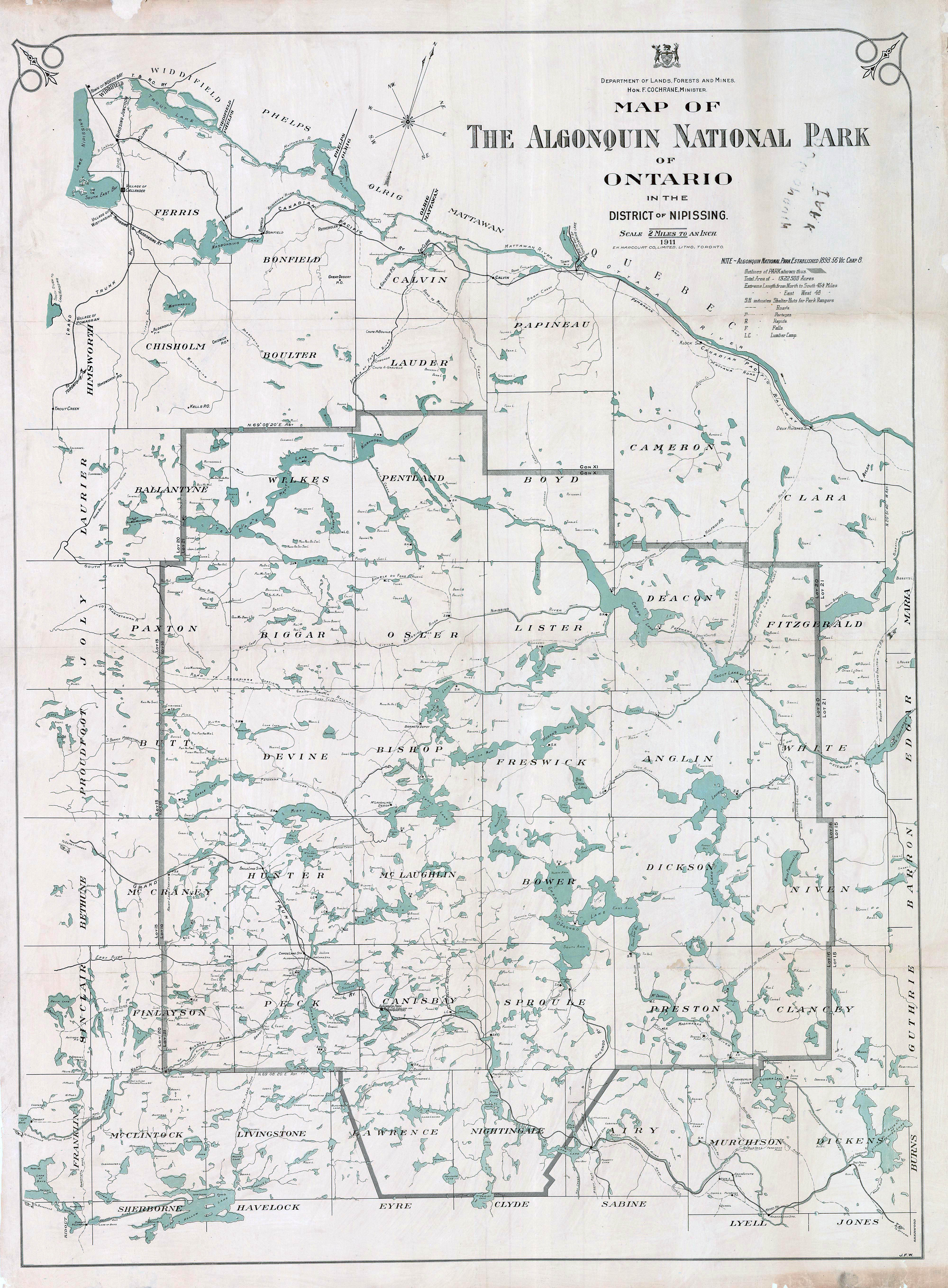
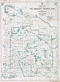
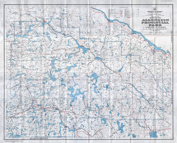
This is a 1911 Department of Lands, Forests and Mines Algonquin Park Map.
Scanning paid for by Stephen Molson
Downloadable image file is 4000 x 5434 pixels (3.36 mb).
|
|
|
|
 |
|
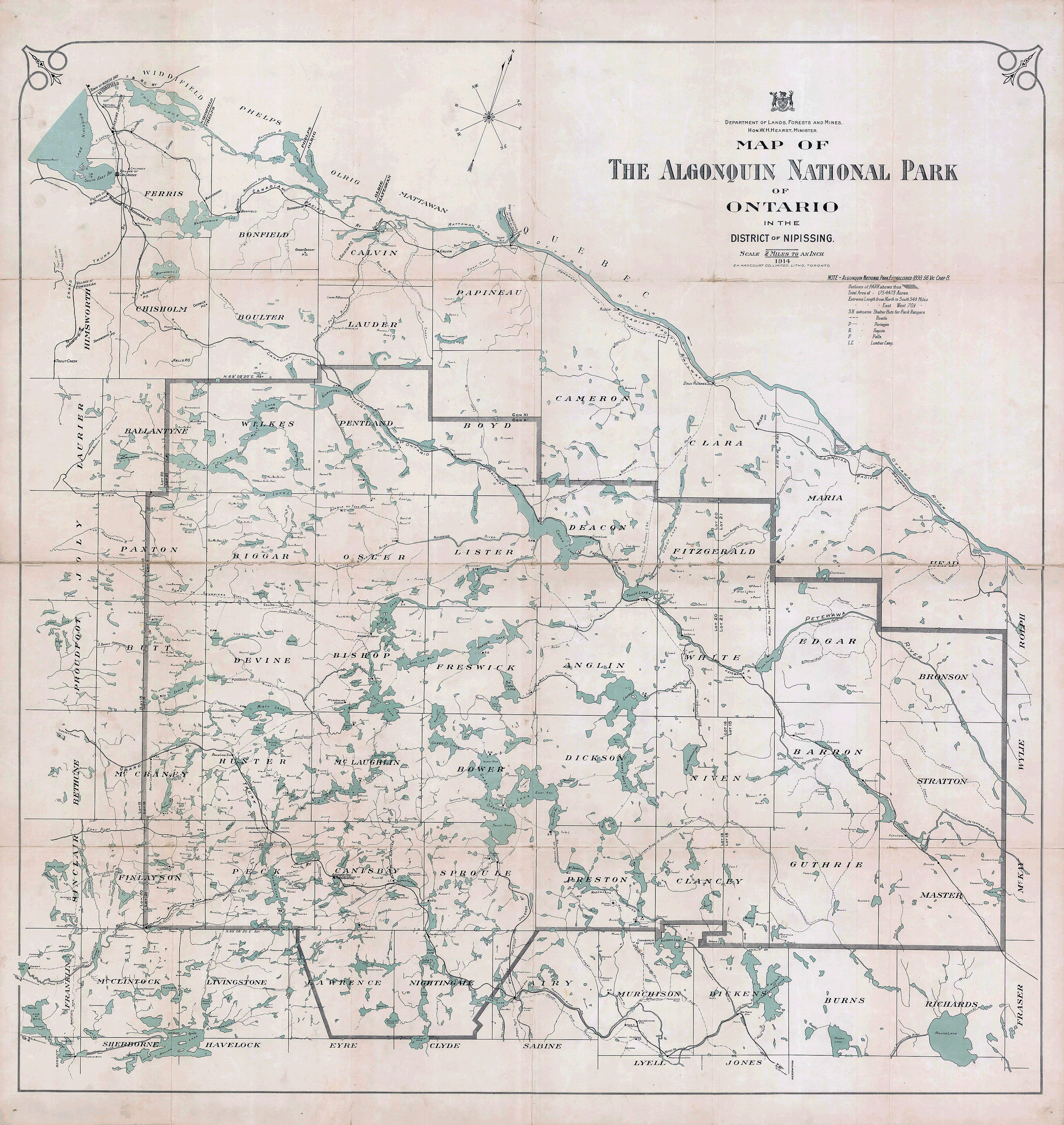
This is a 1914 Department of Lands, Forests and Mines Algonquin Park Map.
Map provided and scanned by Mark Bagu.
Downloadable image file is 4000 x 4230 pixels (3.15 mb).
|
|
|
|
 |
|
This is a 1919 Department of Lands, Forests and Mines Algonquin Park Map.
Map provided and scanned by Diana McElroy, and edited by Jeffrey McMurtrie.
Downloadable image file is 4000 x 4024 pixels (3.44 mb).
|
|
|
|
 |
|
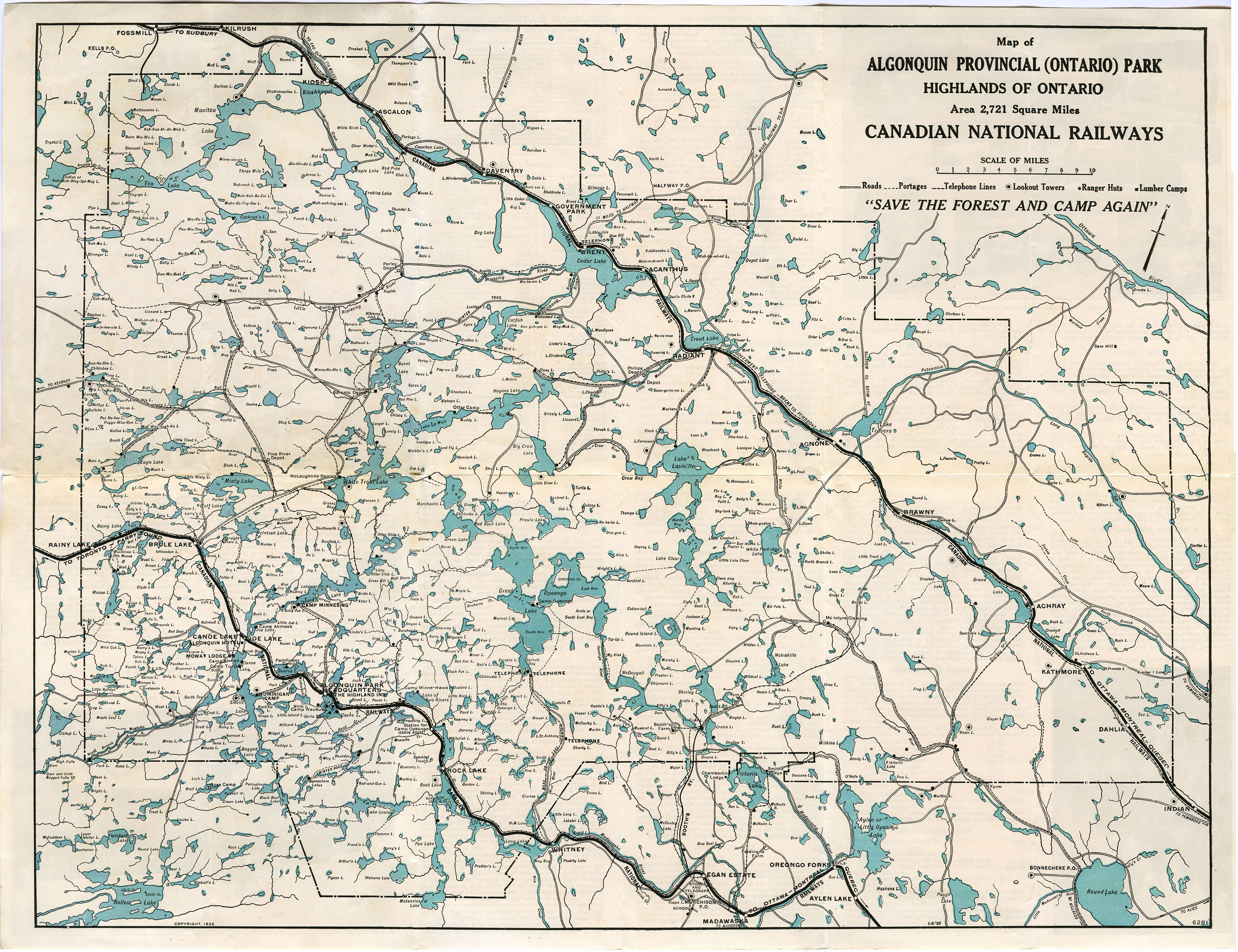
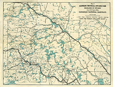
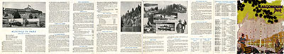
These are the "front-and-back" of a 1922 Canadian National Railways(CNR) travel guide for Algonquin Park. The fold-out guide was on the reverse side of the map.
The item was provided by Jeffrey McMurtrie and scanned by Mark Rubino.
The map's downloadable image file is 3251 x 2500 pixels (2.07 mb).
The guide's's downloadable image file is 12939 x 2484 pixels (7.44 mb).
|
|
|
|
 |
|
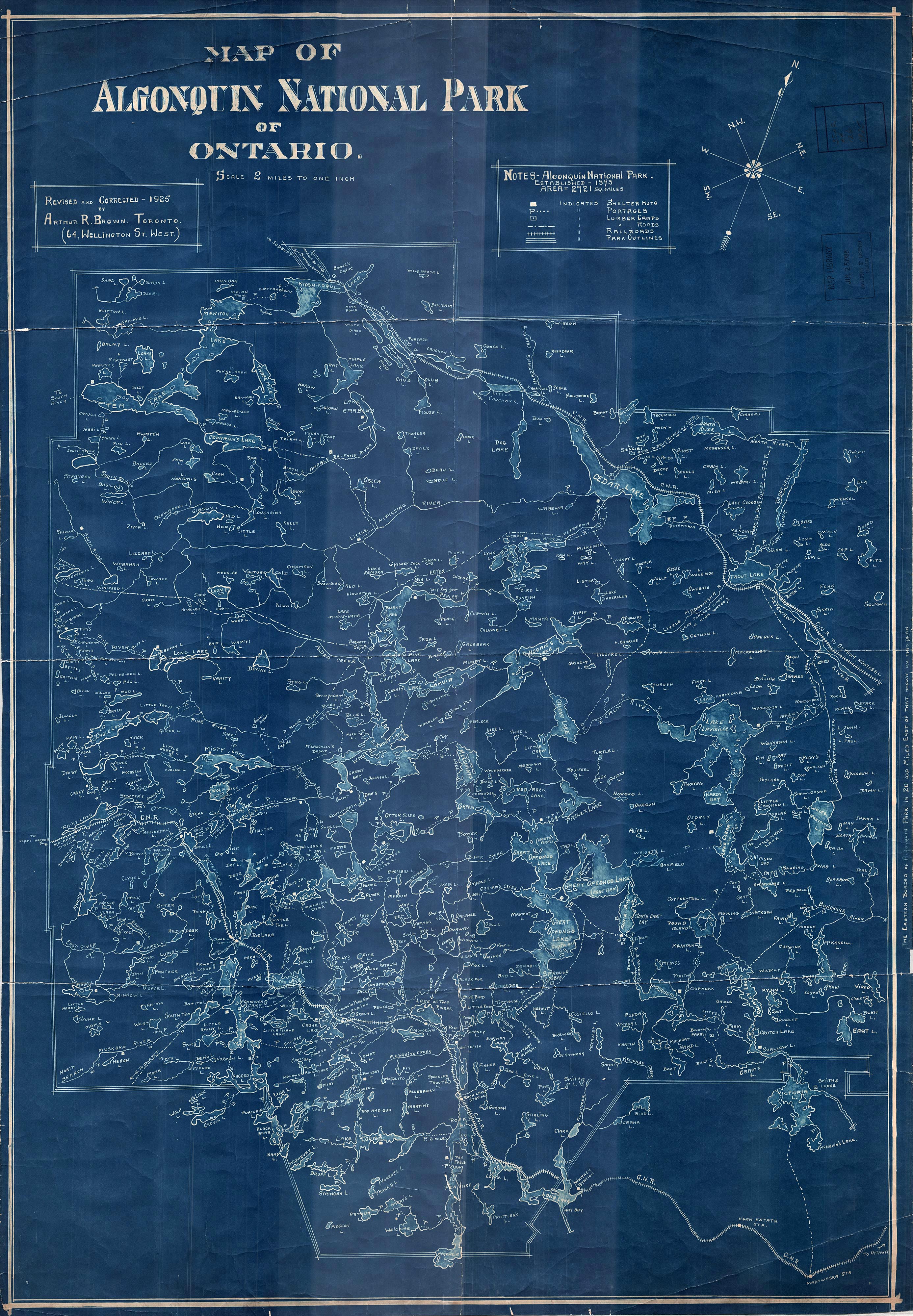
This is a 1925 Arthur Brown Algonquin Map.
The map was originally scanned by Jeffrey McMurtrie.
The downloadable image file is 2774 x 4000 pixels (1.95 mb).
|
|
|
|
 |
|
This is a 1934 Algonquin Park Map from the National Topographic Series.
Scanning of the map was paid for by Stephen Molson
The downloadable image file is 4000 x 3199 pixels (2.8 mb).
|
|
|
|
 |
|
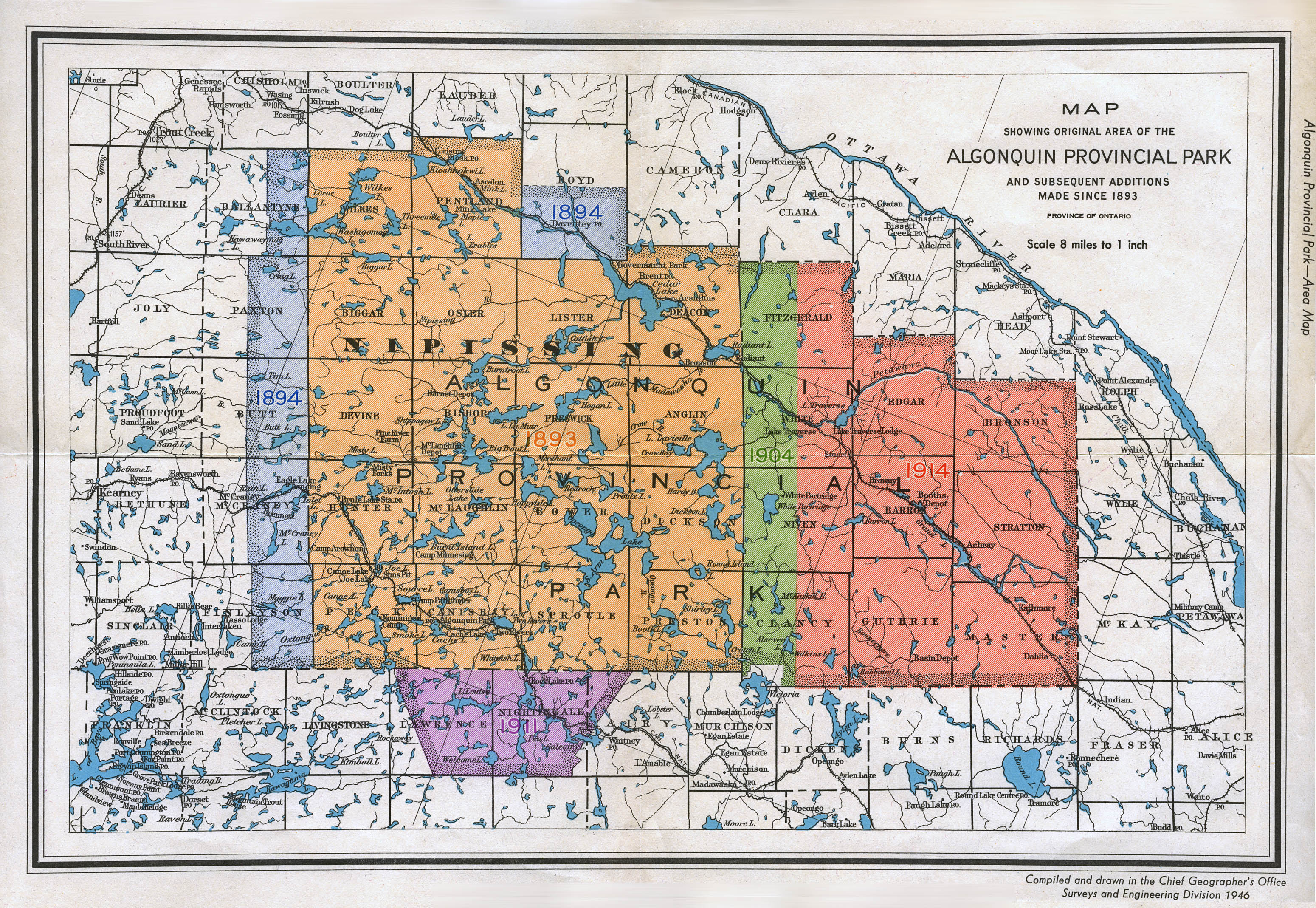
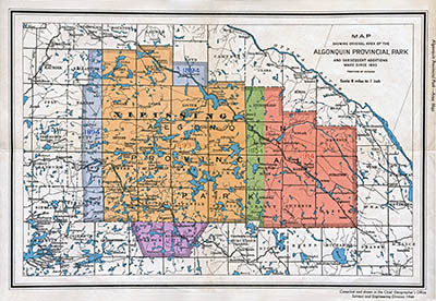
This map is a 1946 Algonquin Park Area Map from the Chief Geographer's Office (Surveys and Engineering Division).
The map was provided by Bruce Sutton. And it was scanned & edited by Mark Rubino.
The downloadable image file is 3099 x 2137 pixels (1.97 mb).
|
|
|
|
 |
|
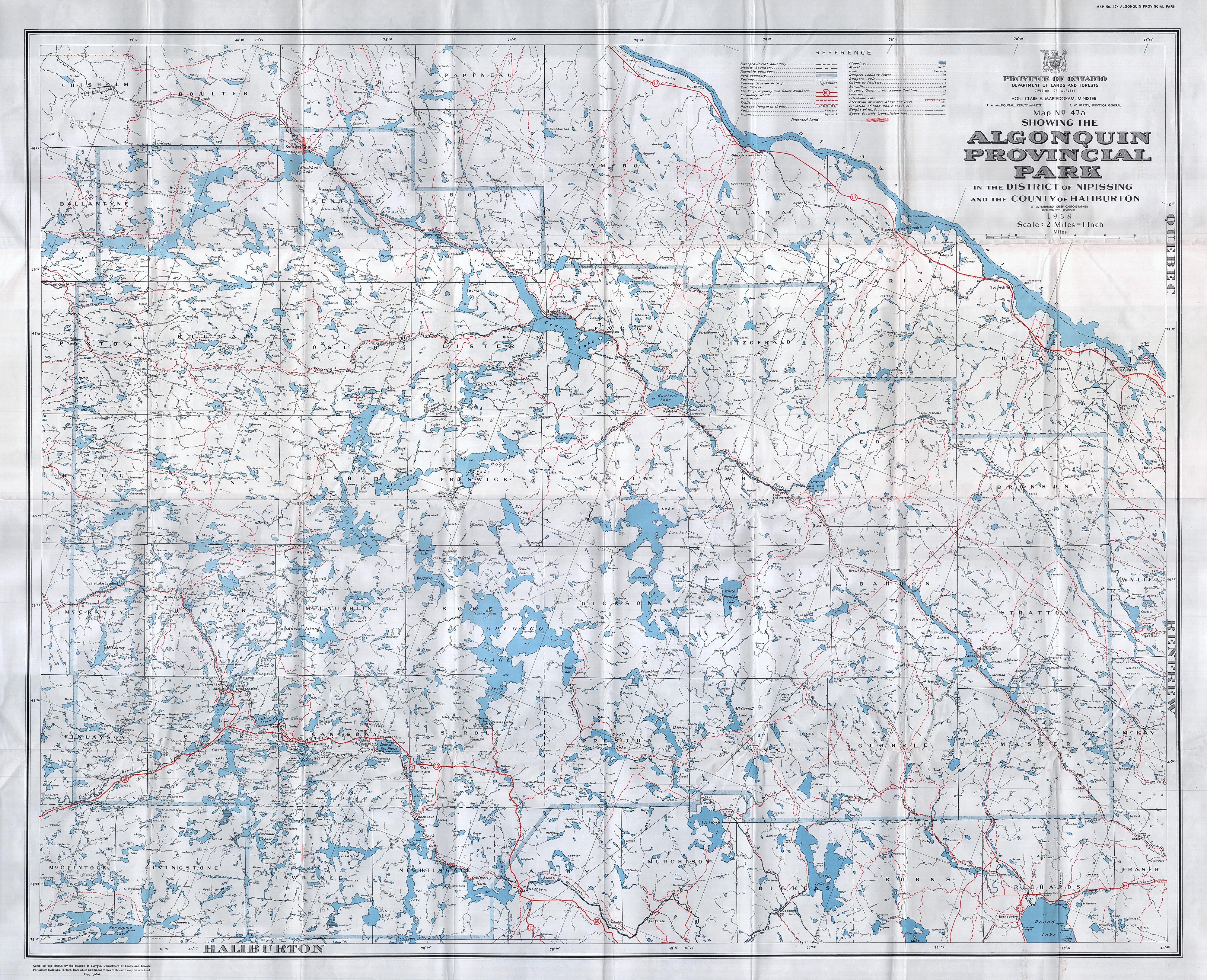
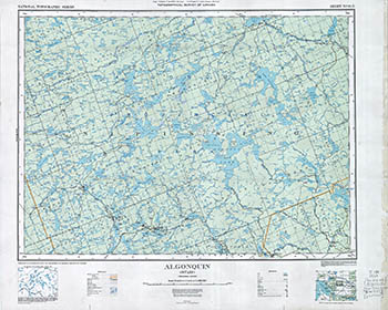
This is a 1958 Algonquin Park Area Map .. the Department of Lands and Forests Map 47a.
The map was provided, scanned and edited by Jeffrey McMurtrie.
The downloadable image file is 4000 x 3246 pixels (3.4 mb).
|
|
|