| |
| |
 Saturday, July 21st, 2012
. . . . . Saturday, July 21st, 2012
. . . . .
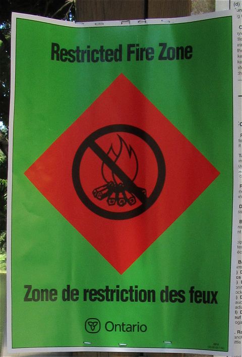
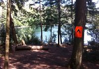
Effective July 18, 2012 at 12:01am, Algonquin Park was declared a Restricted Fire Zone, until further notice. The most important thing to remember about a Restricted Fire Zone is that open fires in Algonquin Park are illegal. The editor of this website was in the backcountry of the park from Monday, July 16th until yesterday afternoon and became aware of the "fire ban" upon returning to the access point, where a number of these green-and-red signs were posted. The following is paraphrased from the official Algonquin Park website ... "You can use your portable gas, propane or naphtha stove anytime during a Restricted Fire Zone, provided the stove is at least 1 metre from any flammable material. The stove must also be designed to use gas, propane or naphtha and you must be able to extinguish the flame by a control valve or by closing the stove. You can continue to enjoy barbecuing during a Restricted Fire Zone provided you are in an organized campground and your propane BBQ is able to be extinguished by the use of a control ("shut off") valve. Use of hibachis, wood and charcoal burning stoves or BBQs are not permitted. |
| |
 Friday, July 13th, 2012
. . . . . Friday, July 13th, 2012
. . . . .
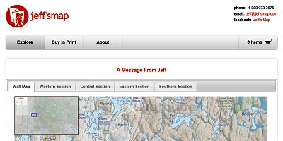
Jeff McMurtrie has outdone himself. This Version 4 of his phenomenal Canoeing and Exploring Map of Algonquin Park is truely FIVE STAR ! Following is a quote from Jeff's website .. "I've been canoeing in Algonquin since I was 8 and have always enjoyed it profoundly. That love coupled with my frustration with the errors I'd found on other maps of Algonquin caused me to dedicate the time to create the best map of Algonquin that I possibly could - the map that I always wanted for myself. I went about combining hundreds of books, maps, trip reports, and GPS data sets with the knowledge and experience of the hundreds of Algonquin enthusiasts who submit thousands of comments and corrections each year and ended up with the map you'll find on this website." Visit Jeff's website http://algonquinmap.com from where you can view the map online, download a free JPG of the map, or purchase a printed copy either as a Canoe Map or as a Wall Map. |
| |
 Tuesday, July 10th, 2012
. . . . . Tuesday, July 10th, 2012
. . . . .
Last year, Sam Barkwell participated in a Camp Wendigo 11-day canoe trip. It looped from Cache Lake north through Burnt Island, Burntroot, Cedar, Allan, Francis, North River, Lavieille, Opeongo, Little Rock, and Lake of Two Rivers .. returning westward to Cache Lake via the Madawaska River valley. His trip-log is on his own blog and is packed with great "clickable" large photos .. 11 Days: Cache to North River and Back "The site was very nice, but was we were setting up, one of our guides noticed that there was a bear warning sign on the site. The sign was old, and by now, packing up and searching for a camp site could just leave us searching for a site at 7pm with the sun going down. We decided we would have to play it very safe and always travel in pairs with whistles." |
| |
 Friday, July 6th, 2012
. . . . . Friday, July 6th, 2012
. . . . .
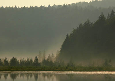
Back in June, Barry Bridgeford enjoyed a solo 6-day canoe trip to Clydegale Lake. Rather than a conventional trip-log, he compiled a 40-image photo-essay of his get-away ... Solo To Clydegale Lake Amongst the photos' captions are ... "At the north end of Clydegale, this moose was chomping weeds. I had to struggle to keep the wind from blowing me back towards him." ... "Across the south bay I could see a moose feeding, not realizing at the time that two light-coloured wee-ones were just behind their 'Mom'." ... "Arising early, I was able to catch the mist being burned off the swampy bay to the east." ... "By early afternoon, the wind was up again .. but this time with blue sky and puffy white clouds!" |
| |
 Tuesday, July 3rd, 2012
. . . . . Tuesday, July 3rd, 2012
. . . . .
The judging for the Algonquin Outfitters' "New Arrivals" Photo Contest has been completed. The winners are .. Darren Dare .. with his shot of a mother merganzer and chicks resting on a log on Cedar Lake. George Berking .. with his shot of a black bean sprout from the ashes of a fire pit on Burnt Island Lake. Chuck Hammill .. with his shot of a mother moose and calf, along Highway #60 during mid spring. Check out the official announcement at .. http://promoshq.wildfireapp.com. And, view all the entries at www.facebook.com . |
| |
 Tuesday, July 3rd, 2012
. . . . . Tuesday, July 3rd, 2012
. . . . .
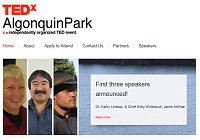
TEDxAlgonquinPark is a one day conference, which will be taking place on September 6th, 2012 at the Algonquin Park Visitor Centre off Highway 60. Speakers form the conservation, recreation and forestry groups will be presenting their findings, experiences and contributions as they relate to Algonquin Park. Applications to attend will be accepted up until July 14th, 2012. Due to limited seating and space, an application and selection process is being implimented to ensure a diverse and balanced audience. For more details and information, please go to ... www.TEDxAlgonquinPark.com |
| |
 Tuesday, June 12th, 2012
. . . . . Tuesday, June 12th, 2012
. . . . .
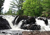
Les Dempsey did a solo trip in the Barron Canyon area this spring. He's placed a substantial, well-written and photo-illustrated account of the trip online .. May 27 - Jun 1, 2012 Solo - High Falls & The Barron Canyon. "I made my way back up the portage passing the Brigham Chute. That is one steep trail, and riding the edge of the banks, I might add. And man, my stuff was feeling extra heavy. It was hot, steep, and buggy. Still, this time, I made my way to the bottom of the falls for a closer look and WOW, what a sight! I have to say it was a big surprise to see the grandeur of this set of falls. This was as visually stunning as High Falls, through not as large. The chute is split into two sections, left and right and what a thunderous sound coming from it. " |
| |
 Tuesday, June 12th, 2012
. . . . . Tuesday, June 12th, 2012
. . . . .
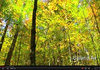
Adam Ruzzo has produced a nine-minute video based on his 6-day solo backpacking trip on the Western Uplands Backpacking Trail in October of last year ... An Original Music and Video Tribute To Algonquin Park. It's a wonderfully soothing and mellow representation of Algonquin Park's solitude and tranquility .. all put to equally soothing music! |
| |
 Saturday, May 19th, 2012
. . . . . Saturday, May 19th, 2012
. . . . .
Jason Chesworth took a 3-day solo camping hike on the Western Uplands Trail. His first campsite was on Guskewau Lake and his second night's was on Norah Lake ... Western Uplands Trail Loop #1 May 9-11, 2012.. "There were lots of fallen trees that hadn’t been cleared yet and presented some real challenges while carrying a heavy pack (yes, it was lighter, but it’s still too heavy!). Some trees, you could just straddle over, but some required crawling under that would require taking the pack off. I did notice out of the dozen or so people that I encountered throughout, that I was the only one using hiking poles. I can’t imagine hiking without poles and admire those who just hike using nothing but the strength of their legs. Having bad knees, I’m thankful for my poles several times every hour." |
| |
| Barry Bridgeford (Site-editor) |