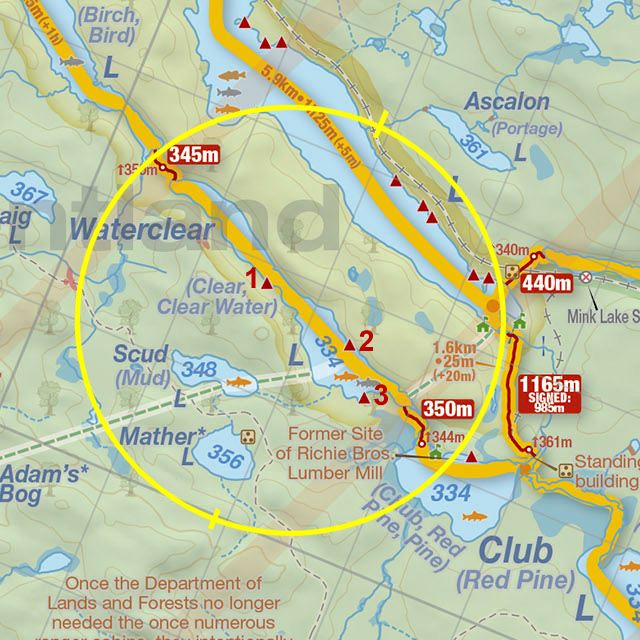
 Waterclear Lake Campsite #3
Landing
Topography of under-water approach: Shallow water, rock and sand bottom.
Impediments to disembarking from and/or unloading a canoe: Some medium size rocks, has area to place gear.
Topography to tent sites: A 2m climb up a short tiered path .
The landing and tiered path are on the left ...

![]()
Campsite
Campsite maintenance: Regular.
Size of open area: 8m x 5m.
Extent of tree cover: 40% (all on the firepit side of site).
Degree of levelness: Tenting area is quite flat. Firepit side of site has a slight slope.
Number of level tent sites: 3.
North exposure: Trees.
East exposure: Trees.
South exposure: Trees.
West exposure: open view of lake.
General description: A small site that is sloped, but with 3 flat sandy tentpads. A large boulder separates the firepit from the tenting area. The open view of the lake gives a good view of the setting sun.
Overall accessibility: No real issues, as the tiered path to the site is not a severe climb.
of the slope of the site and the path behind the boulder ...

![]()
The smaller tentpad and the path to the thunderbox ...

![]()
A couple of rocks divide the tentpads ...

![]()

Thanks to Jeffrey McMurtrie of Jeff'sMap for supplying the base-layer map component by Creative Commons licensing.
Submitted by Chris Taylor .. Visited July 2016 .. Submission September, 2016

