 Portage 320 meters - Kawa to Upper Kawa
Length of portage: 320 meters.
Portage maintenance regular or low: Regular.
Landing on Kawa Lake (elevation 399m)
Topography of under-water approach: Mud and rock in knee-deep water.
Impediments to disembarking from and/or unloading a canoe: Shoreline and landing/staging area is very rooty.
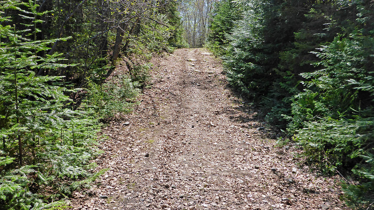
Topography of the ascending grade: A wide but rooty path.
Impediments to moving gear to portage trail: Just the tree roots.
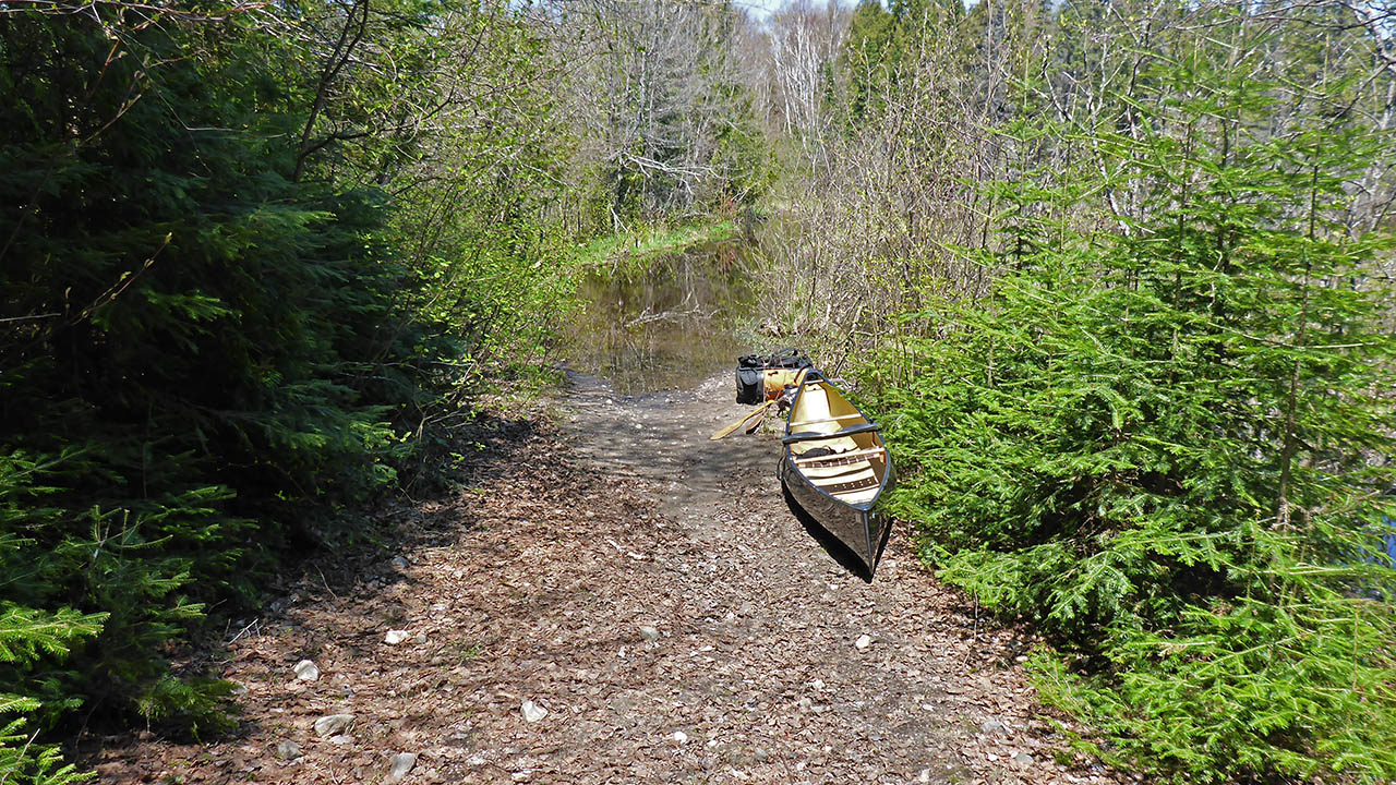
Room for a couple of canoes ...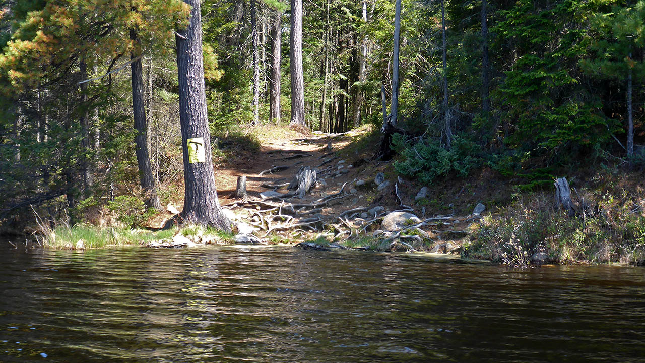
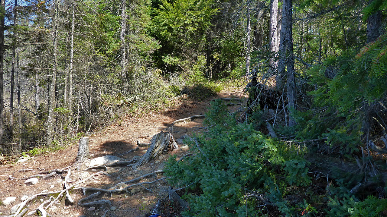
Portage Trail (peak elevation 404m)
Elevation profile ...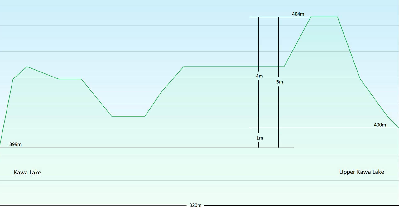
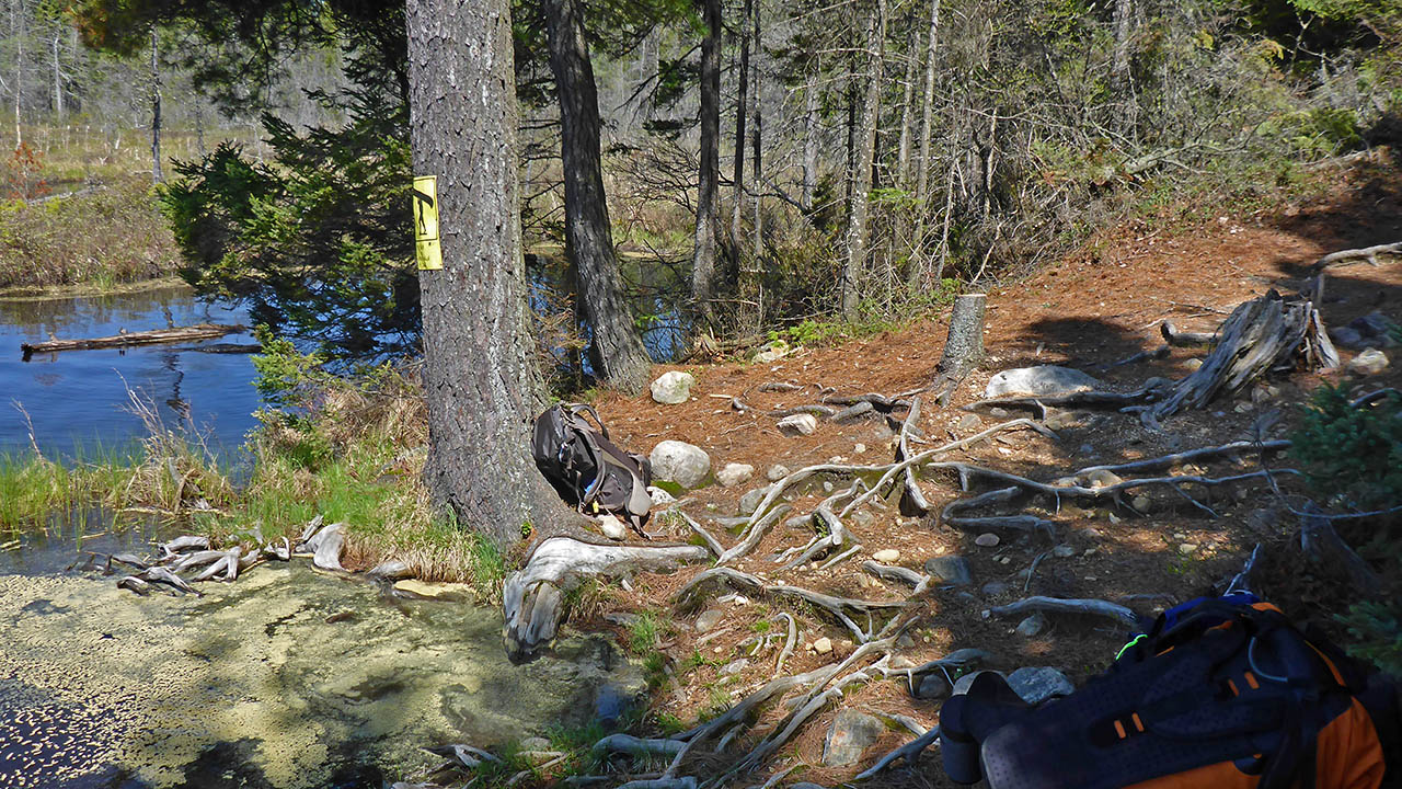
Landing at Upper Kawa Lake (elevation 400 meters).
Topography of under-water approach: Gravel in shallow water. During low water levels, loaded canoes will need to be lined out to deeper water.
Impediments to disembarking from and/or unloading a canoe: None. Landing/staging area is a road that becomes the launching area.
Topography of the ascending grade: Wide gravel road.
Impediments to moving gear to portage trail: None.
A long, wide, and shallow waterway leads to the landing ...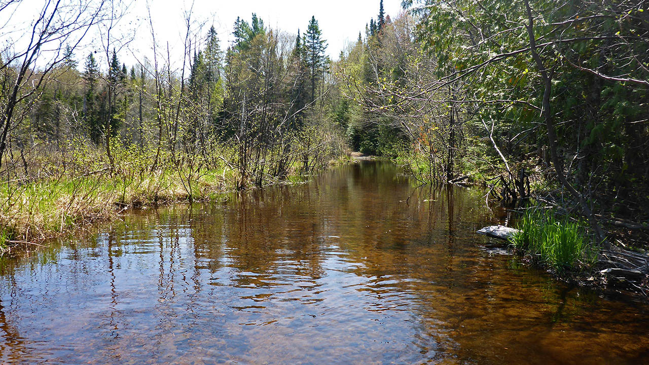
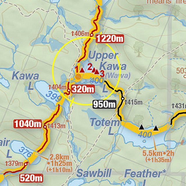
Thanks to Jeffrey McMurtrie of Jeff'sMap for supplying the base-layer map component by Creative Commons licensing.
Submitted by Chris Taylor, visited May 2015, submitted November, 2019