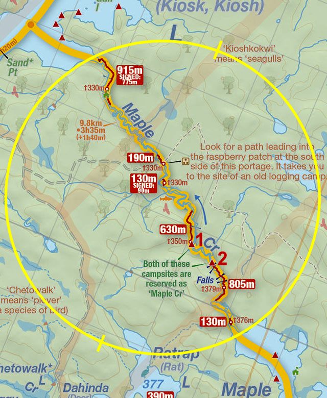
 805 Meter Portage On Maple Creek
Length of portage: 805 meters.
Portage maintenance regular or low: Regular.
Upstream elevation above Sea Level on Maple Creek is 373 meters (est.).
Downstream elevation above Sea Level on Maple Creek is 349 meters (est.).
Difference in elevation: 24 meters (estx.).
Elevation of highest point: 379 meters. Overall rise/fall: 30 meters (est.).
(Above data is extracted from 'Jeff's Map'.)
Upstream Landing on Maple Creek
Co-ordinates of location: N46° 02.043' W78° 50.709'
Topography of under-water approach: Large flat rock, knee to ankle deep water.
Impediments to disembarking from and/or unloading a canoe: None.
Topography of the ascending grade: Large flat rock landing can handle numerous canoes. Impediments to moving gear to portage trail: A small area of roots marks the start of an otherwise smooth trail.
A nice landing in calf deep water ...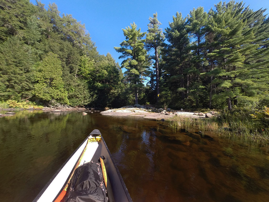

Portage Trail
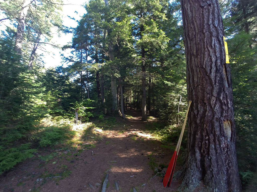
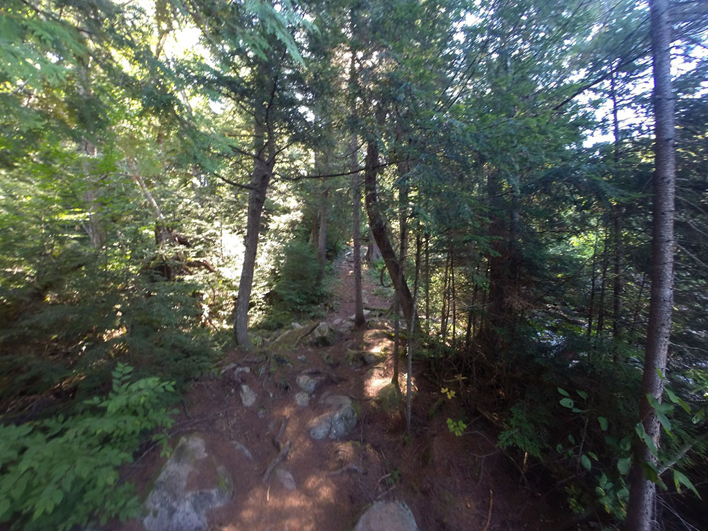
General description: The first 150 meters is a pleasant walk. Then the trail turns into an obstacle course of rocks, roots, and sudden drops. Parts of the trail are at a 50 degree incline/decline. There is a section of the trail that angles sideways toward the creek, and it looks like park staff have done some work to remedy this somewhat. There is a very small campsite about 50 meters from the north end of the portage that has 2 levelled tent pads.
Topographical impediments to travelling: This is a very difficult portage. The climb starting at the north end requires a level of physical fitness. It is that steep, and the path is littered with rocks and roots. In some areas, each step must be planned.
Areas susceptible to impact by periods of rain or beaver flooding: With a heavy or long rainfall, and because of the steepness and the make up of the ground, this trail would require caution to be exercised.
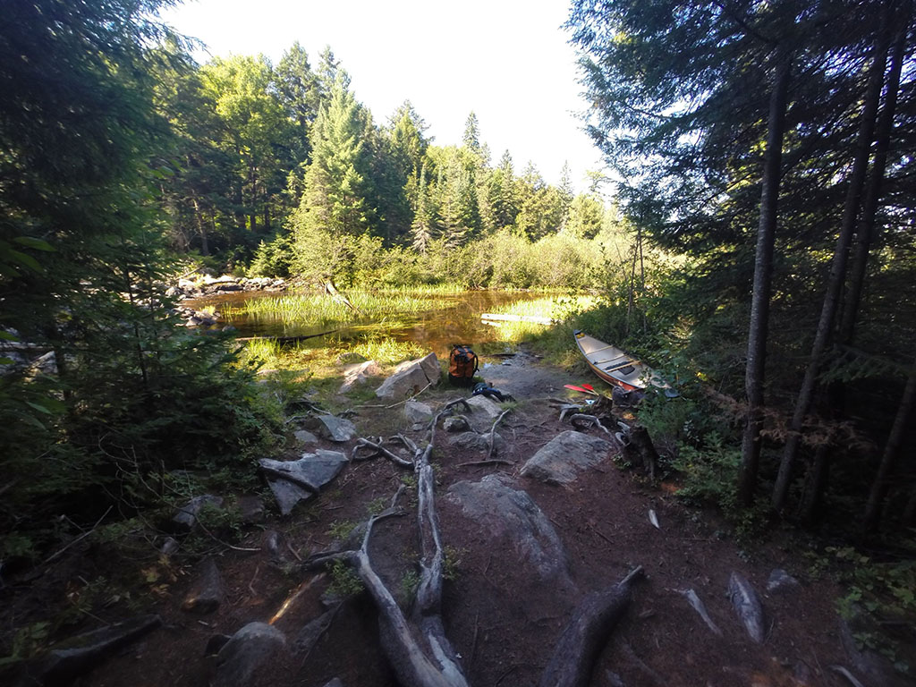
An emergency campsite ...
Landing at Maple Creek
Co-ordinates of location: N46° 02.343' W78° 50.926'
Topography of under-water approach: Mud, rock, and silt.
Impediments to disembarking from and/or unloading a canoe: None.
Topography of the ascending grade: Steep climb on rocks and roots.
Impediments to moving gear to portage trail: Landing and haulage area is made up of large rocks and roots.
Landing is a little muddy ...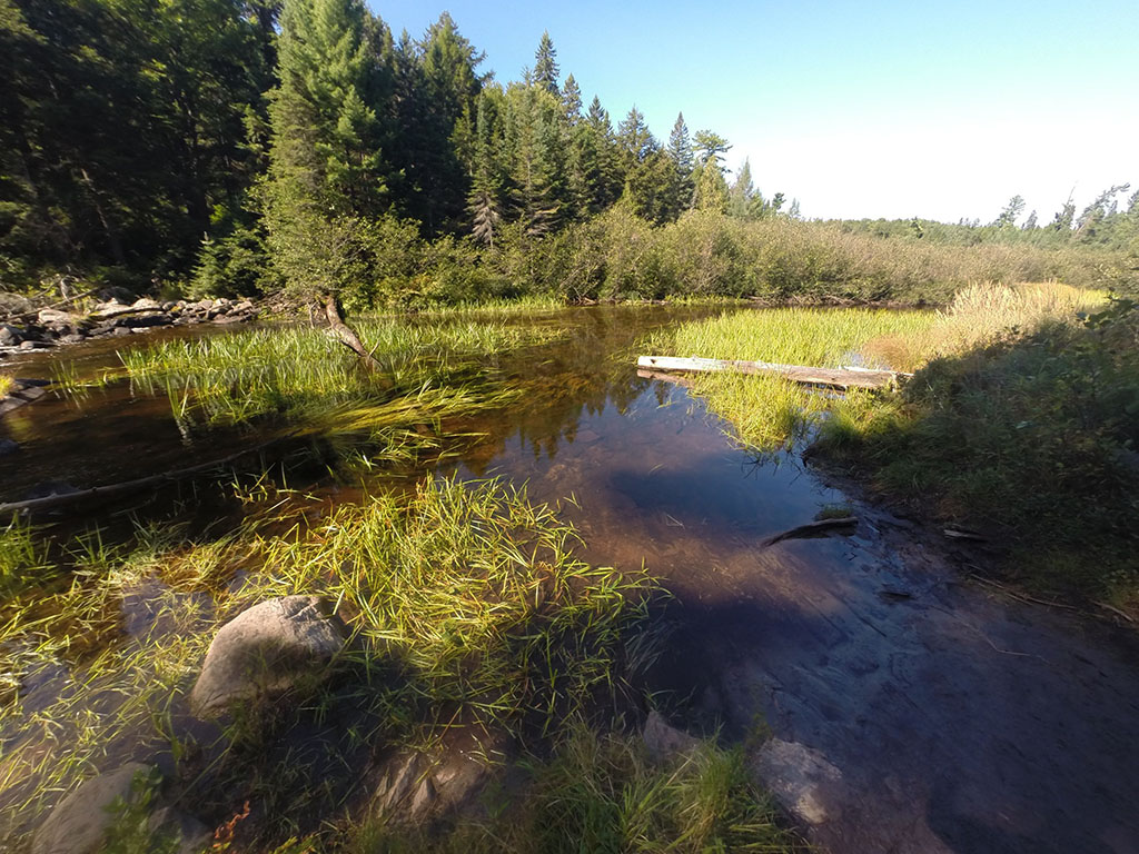
Thanks to Jeffrey McMurtrie of Jeff'sMap for supplying the base-layer map component by Creative Commons licensing.
Submitted by Chris Taylor, visited September 2014, submitted November 1, 2014