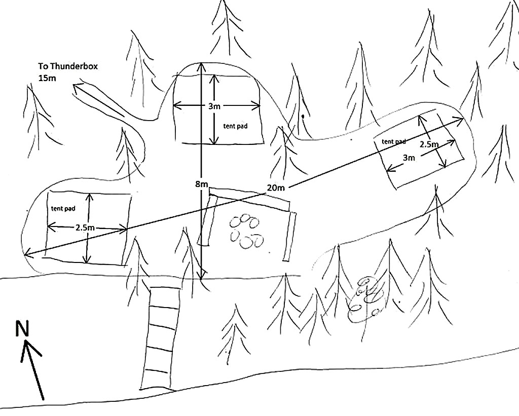
 Maple Lake Campsite #1
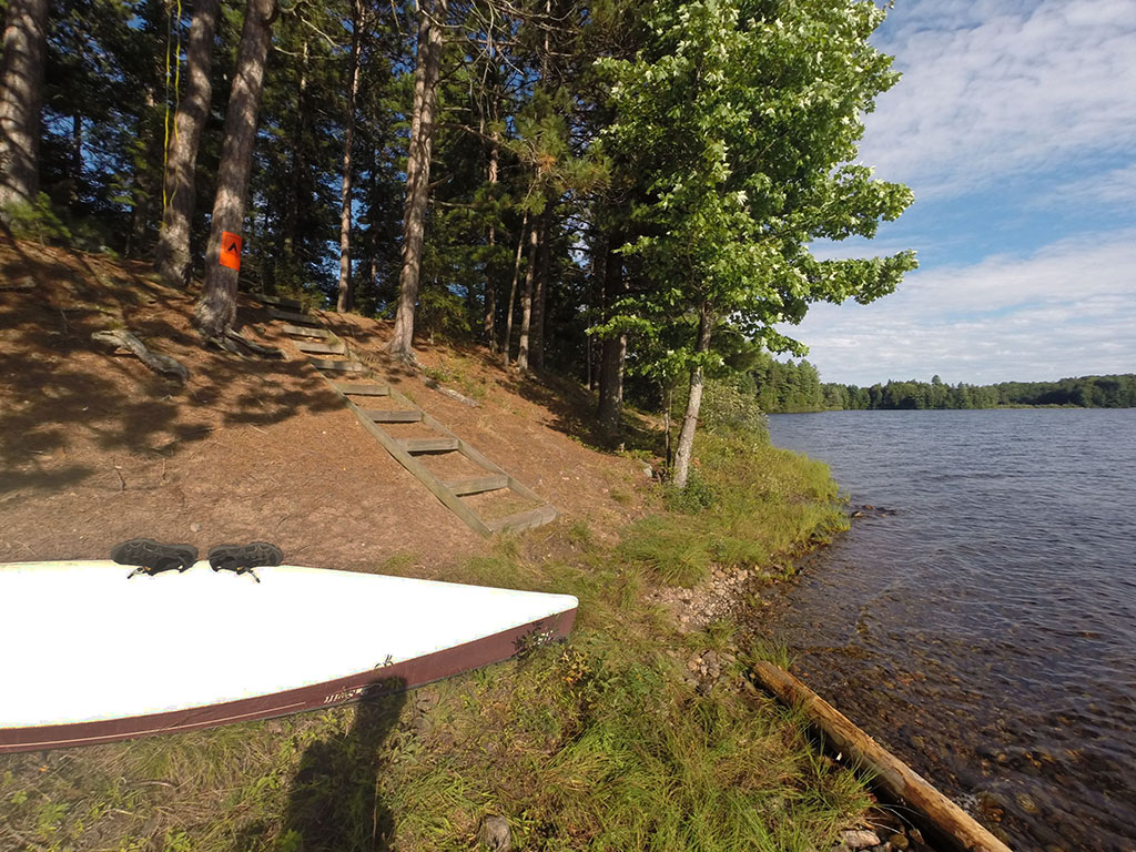
Landing
Topography of under-water approach: Small rocks and gravel.
Impediments to disembarking from and/or unloading a canoe: None, room for 3+ canoes.
Topography leading to tent sites: Steep climb of 5 meters.
Landing area looking east ...
![]()
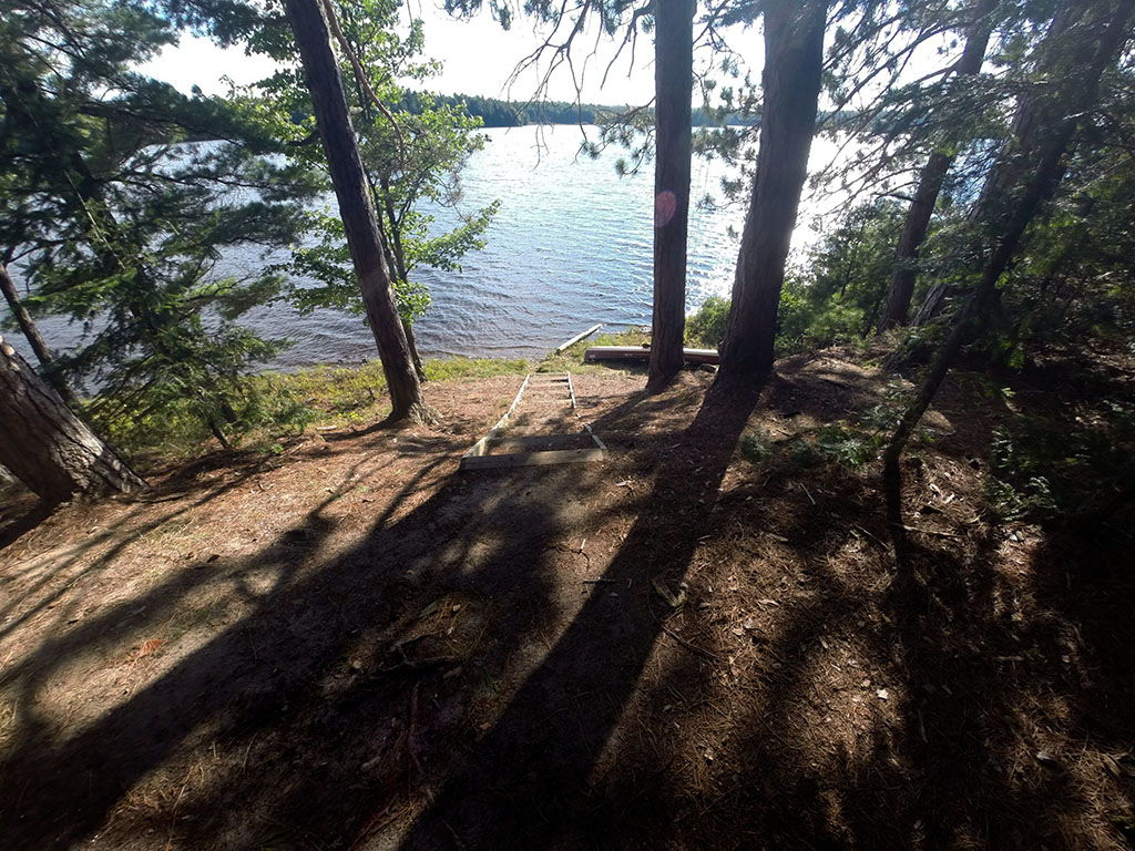
A steep climb ...
![]()
Campsite
Regular or low-maintenance: Regular.
Size of open ground area: see sketch.
Extent of tree cover: 50%.
Degree of levelness: : Quite level with the front of the site sloping significantly toward the lake.
Number of tent sites: 3 pads (2 levelled).
North exposure: Trees with a view of the thunderbox.
East exposure: Trees.
South exposure: Open view of lake.
West exposure: Trees and some view of lake.
View of west and north tent pad, and path to thunderbox ...
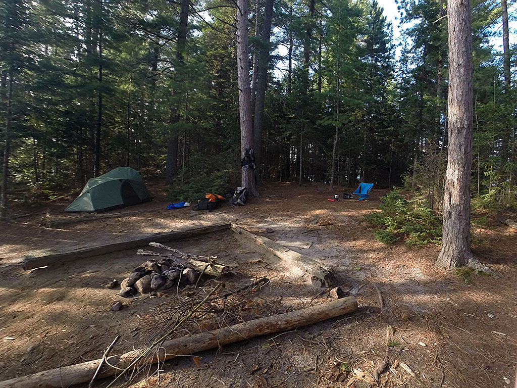
![]()
View of the eastern tent pad ...
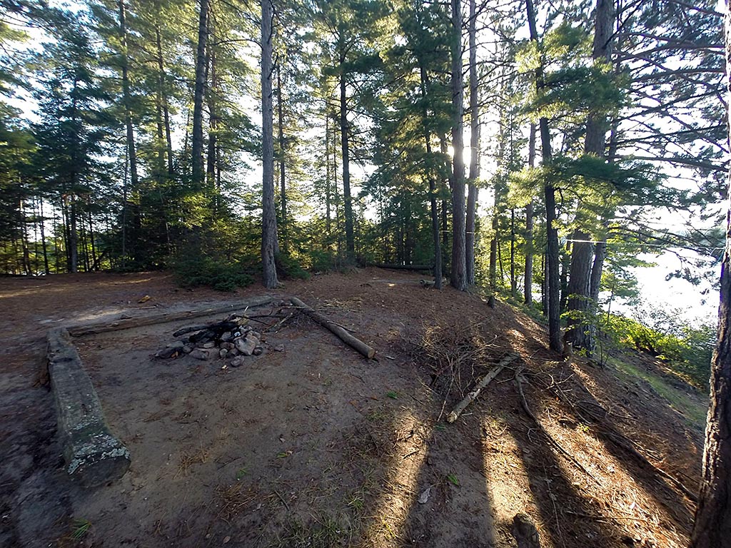
![]()
General description: An open site that offers moderate protection from the wind. Lots of sun on the majority of the site. Overall, not a bad site, but the thunderbox is a little close due to the size of the island.
Overall accessibility: Without the stairs this site would have limited access. Even with the stairs, the climb is steep.
![]()
Thanks to Jeffrey McMurtrie of Jeff'sMap for supplying the base-layer map component by Creative Commons licensing.
Submission October, 2014 by Chris Taylor .. visited July, 2014