 Lake Louisa Campsite #4
Landing
Topography of under-water approach: This campsite has a sand beach northwest of its rock point.
Impediments to disembarking from and/or unloading a canoe: A number of canoes can be brought ashore and unloaded at one time.
Topography leading to tent sites: A gently-graded trail curves around from the beach to the actual campsite.
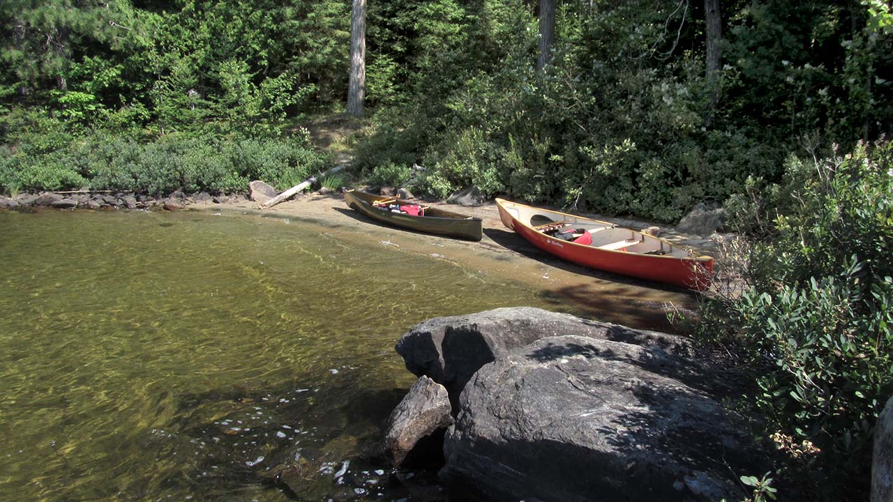
While the campsite is quite visible from the lake, its landing beach is tucked behind the rock point ...

![]()
Enough room on the beach for up to three canoes to unload ...
![]()
Campsite
Regular or low-maintenance: Regular
Size of open ground area: Approximately 15' x 40'.
Extent of tree cover: 30%
Degree of levelness: Quite level.
Number of level tent sites: 3+.
North exposure: Forest.
East exposure: Shoreline trees and open lake.
South exposure: Open to the lake.
West exposure: Shoreline trees and lake.
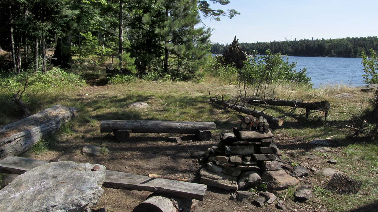
Firepit and a grassy tentsite area beyond ...
![]()
Firepit, another tentsite area and the view southwest across the lake ...

![]()
Another tentsite amongst some tall pines which will support sheltering tarps ...

![]()
General description: The rock point, sandy beach and great view down the lake make this campsite a popular one, particularly in summer. The tentsites and firepit are rather exposed, but part of the site can be augmented with sheltering tarps.
Overall accessibility: Given its levelness and moderate trail from the beach, this campsite is quite accessible..

Thanks to Jeffrey McMurtrie of Jeff'sMap for supplying the base-layer map component by Creative Commons licensing.
Submitted by Barry Bridgeford .. Nov. 1st, 2013 .. visited August, 2011