 Little Trout Lake Campsite #11
Landing
Topography of under-water approach: Smooth slab of rock with gentle slope.
Impediments to disembarking from and/or unloading a canoe: None.
Topography leading to tent sites: At left side of landing is smooth slightly inclining path that leads away from the water for a short distance then turns right to parallel with the shore to where it meets with the path from the right side of the landing, which is a shorter, rooty path.
The "right" path to firepit is immediately to the left of the sign. At far left a 2nd path runs 1m behind the small bushes ...

One of many landing options ...

Landing options and path to firepit ...

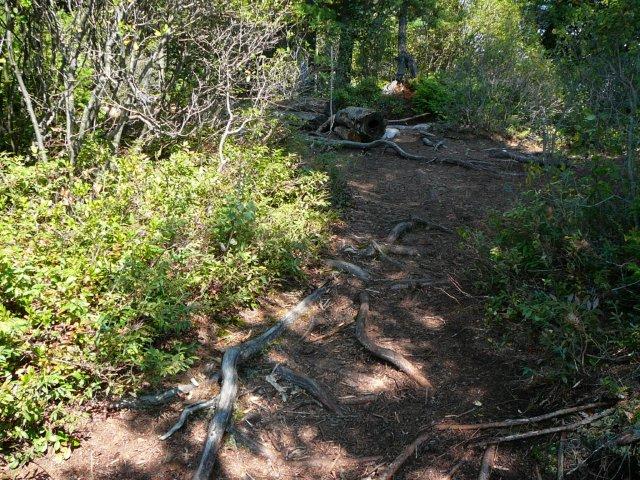
Last part of path to firepit. Some roots to watch for ...
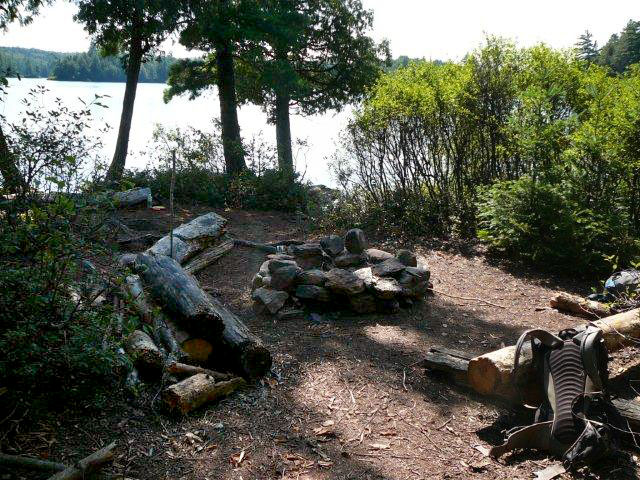
Campsite
Regular or low-maintenance: Regular
Size of open ground area: 8m x 6m.
Tent area: 20m x 8m
Extent of tree cover: Firepit area has very little tree cover. Tent area has 80% cover.
Degree of levelness: Firepit area is level. Tent area slopes significantly from back to front.
Number of level tent sites: : 2 tent pads. 2 more small pads could be used, but these smaller pads tend to collect water during heavy rain and can accommodate a 1-man tent at most.
North exposure: Trees.
East exposure: Trees, obscurred view of lake.
South exposure: Open view of lake.
West exposure: Trees, obscurred view of small bay.
General description: Site is divided into two areas. The firepit and tent area are separated from each other by a 20m corridor. Choice of tent pads is limited. Most of the tent area is sloped and uneven. One tent pad could accommodate a 3-man tent, while the upper tent pad is good for a 2-man tent. The firepit area has full day exposure to the sun and the rocks at the landing are a nice place to relax in the afternoon sun.
Overall accessibility: The landing area is a large smooth rock with no impediments to be considered. There is an easy path up to the firepit, as well as a slightlly more rugged path that can be used. It is quite a distance from the firepit area to the back of the site where the first tent pad is located. Access between the landing and the tent area is thru the firepit area only.
Looking to the south. Access to the tent area is thru here ...
Tent pad at back of site ...

Looking to the south. Upper tent pad at back of site ...

Overhead campsite diagram ...

![]()

Thanks to Jeffrey McMurtrie of Jeff'sMap for supplying the base-layer map component by Creative Commons licensing.
Submitted by Chris Taylor .. October 26, 2013 .. visited July, 2013