 Little Coon Lake Campsite #2
Landing
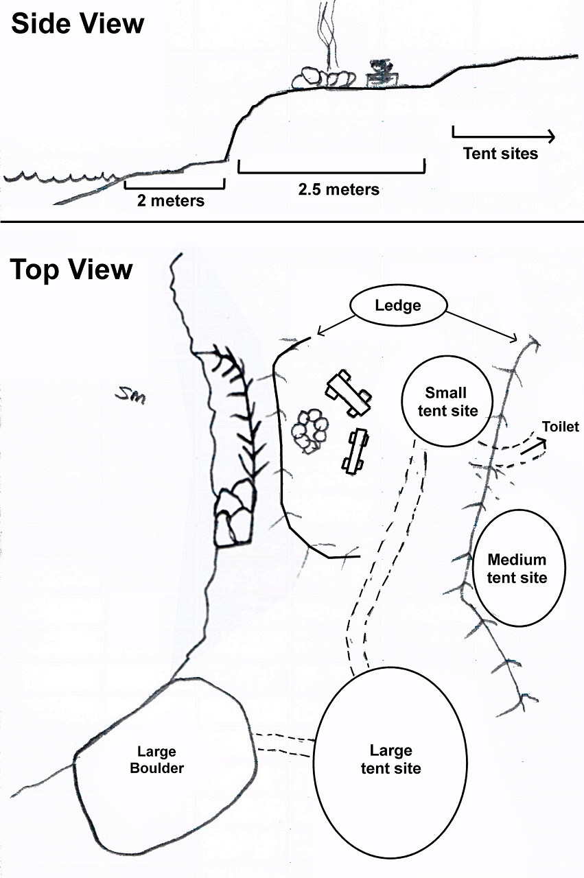
Topography of under-water approach: Steep drop-off, rocky.
Impediments to disembarking from and/or unloading a canoe: Fairly narrow, steep and rocky landing.
Topography leading to tent sites: Access to the firepit requires a climb on top of the Canadian Shield shelf. The tent sites are a fairly level with the firepit.
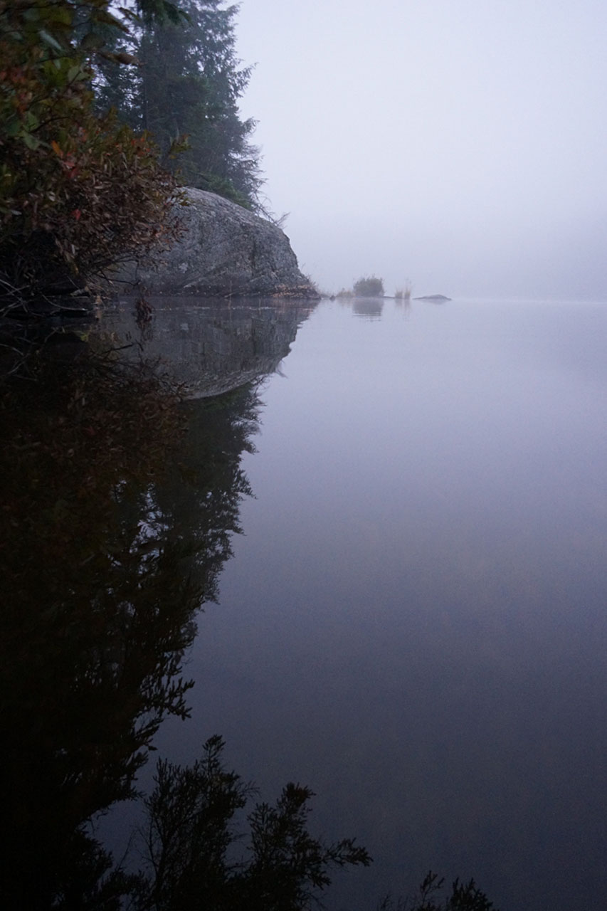
View from water. Note the steep rise from the landing. The large boulder is to the right. ...

![]()
Looking west .. reasonably open, but with only one seating place.

![]()
Looking south towards the large tentsite among birch trees.

![]()
Campsite
Regular or low-maintenance: Regular. However, it’s a poorly maintained site. Thunderbox was rotten, I called the park staff upon departure.
Size of open ground area: medium sized.
Extent of tree cover: The tent sites are sheltered by trees. The firepit is partially sheltered.
Degree of levelness: There is a small landing, then a climb to the firepit. The two tent sites are level with the firepit, and there is a third tent site that is further inland, that is even higher and much more sheltered.
Number of tent sites: 3.
North exposure: Shoreline.
East exposure: Trees.
South exposure: Shoreline.
West exposure: Lake.
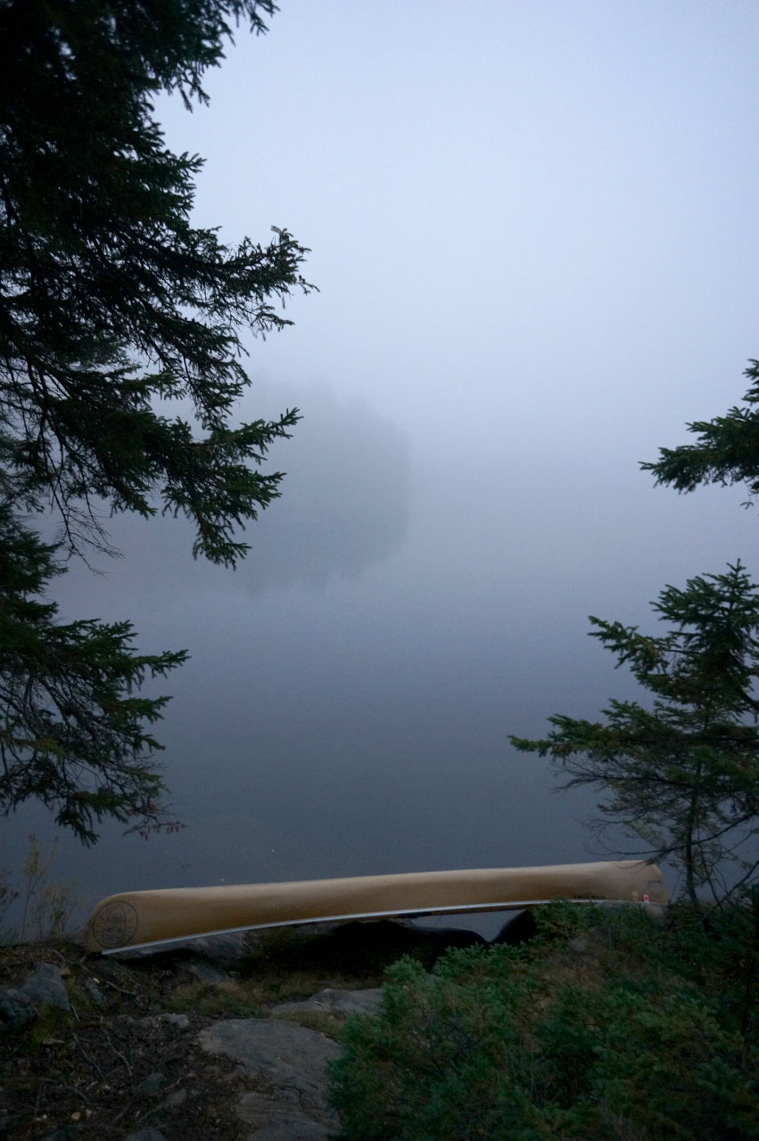
Looking north up the lake ...
![]()
Looking west across the lake ...
![]()
Looking south down the lake ...

![]()
General description: A medium-sized campsite with a small rocky landing, and a steep climb to the main campsite. The boulder is a lovely place to have dinner and breakfast, with a westerly view. The large tent site sits among birch trees and is quite scenic.
Overall accessibility: Poor.
![]()

Thanks to Jeffrey McMurtrie of Jeff'sMap for supplying the base-layer map component by Creative Commons licensing.
Submission October, 2014 by Marko Mrkobrada .. visited 2014