 Kioshkokwi Lake Campsite #12
Landing
Topography of under-water approach: Sloped rock shelf with smaller underwater rocks.
Impediments to disembarking from and/or unloading a canoe: The rock shelf is on an angle, is slippery in places and drops off fairly quickly.
Topography to tent sites: Significant slope up to the fire pit with big steps up over exposed tree roots.
 |
|
| View of the campsite from the water.jpg | |
 |
|
| Canoe landing from the water.jpg | |
 |
|
| Profile view of the canoe landing.jpg | |
Campsite
Campsite maintenance: Regular.
Size of open ground area: We didn't measure, but this is a large site with two levels and could accommodate a large group.Ā The fire pit level slopes up from the water and is quite exposed.Ā There are two separate fire pits.Ā
Extent of tree cover: The fire pit area is quite exposed. The tent sites are more sheltered.Ā
Degree of levelness: Not very level.ĀThe fire pit area is on a steep angle, and even the tent sites have some waves to them.Ā We camped in hammocks and our backs don't have first hand experience, so I don't feel qualified to comment further.
Number of level tent-sites: 3 - 4.
North exposure: Open view of the lake.
East exposure: Open view of the bay.
South exposure: Trees.
West exposure: Open view of the lake.
 |
|
| Main tent site area.jpg | |
 |
|
| Second tent site area.jpg | |
 |
|
| First fire pit. | |
 |
|
| Second fire pit. | |
 |
|
| 'Back porch' viewed from the water. | |
General description: This is a large, pretty site that could easily accommodate a large group.ĀThere are two levels, the fire pit area which is quite exposed and the tent site area which is more sheltered.Ā The exposed fire pit area is a good place to enjoy the sunrise and sunset, and there is a "back porch" set up on a cliff that is surprisingly sheltered while still offering a nice view of the lake where you can take in the sunset. A trail runs along the water and back into the woods and there was still a fair bit of good firewood back there in late August.
Overall accessibility: Moderate - a tricky put in, exposed tree roots and elevation challenges could make this a challenging site.
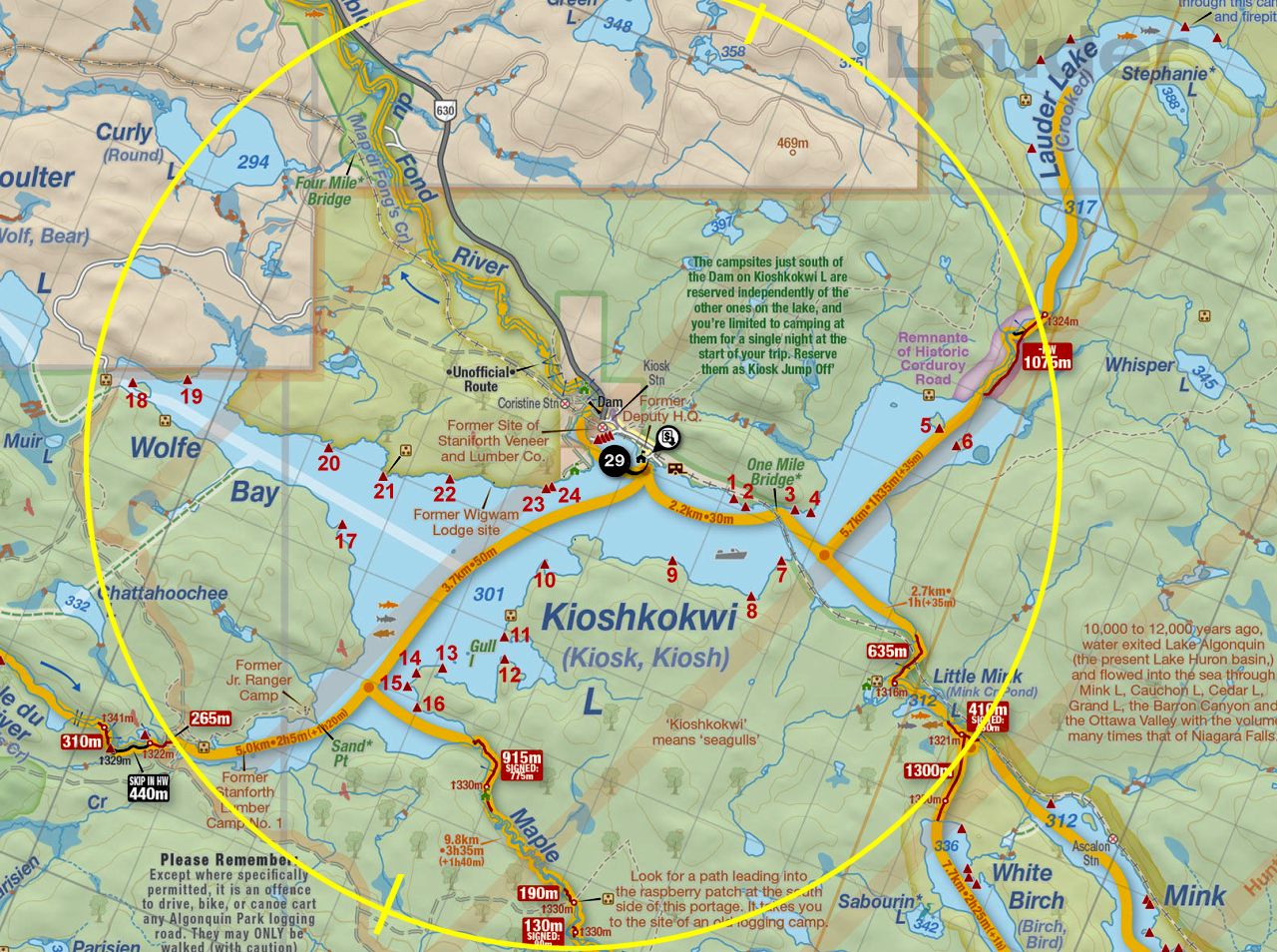
Thanks to Jeffrey McMurtrie of Jeff'sMap for supplying the base-layer map component by Creative Commons licensing.
Submitted by Andrew M. .. Visited: August 26-29, 2021 .. Submission: August 30, 2021