 Delano Lake Campsite #1
Landing
Topography of under-water approach: Deep drop off with a small shelf of rocks and pebbles approximately 1 ft wide and 2 ft under water.
Impediments to disembarking from and/or unloading a canoe: Little room for footing, most of which is underwater. Deep water drop off. Wind funnels into the small bay and can push canoes towards the build up of dead logs piled up at the mouth of the small stream behind the site.
Topography to tent sites: Narrow uphill path, approximately 10m long.

|
|
| Landing & path to campsite from where it levels out near to fire pit. | |

|
|
| Top of path, with flat area .. good for washing and drying dishes. | |
Campsite
Campsite maintenance: Regular.
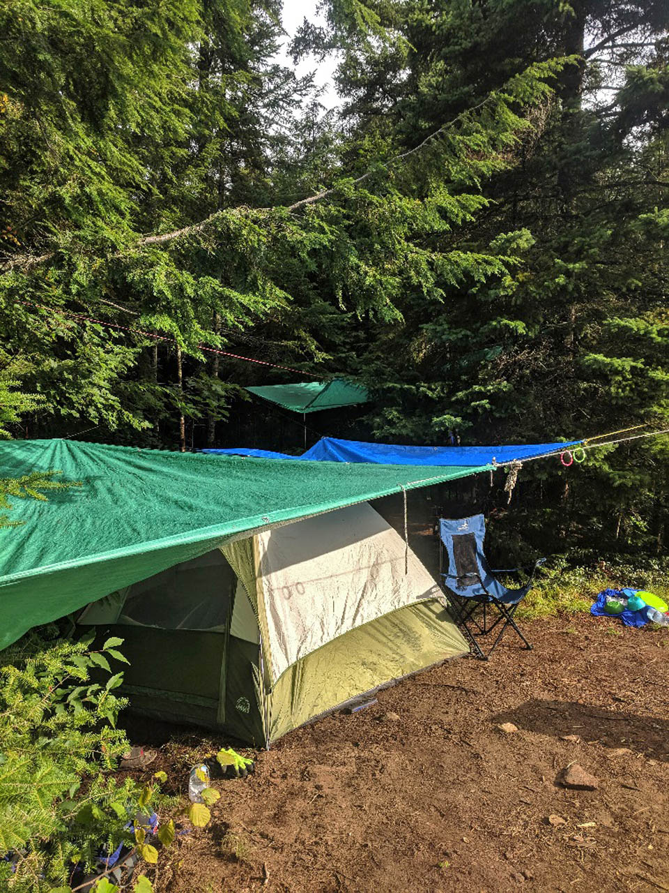
Size of open area: 15m x 8m tentsites in a dog-leg shape. 15x10m steep, rocky area with fire pit and grass.
Extent of tree cover: Heavy tree cover, primarily hemlock.
Degree of levelness: Tentsites and fire pit are on a very slight north-south incline.
Number of level tent sites: Two, with a cooking area/makeshift table separating the two. A small tent could fit along a second in the more northern tent site, but roots and rocks limit the space.
North exposure: Dense forest rising to a knoll of boulders.
East exposure: Forested area down small incline to thunderbox. Delano Creek, with evidence of muskrat or beaver activity, approximately 5m from thunderbox.
South exposure: Open to the fire pit area, steep rock face and lake.
West exposure: Steep, densely forested 5m hill leading to impenetrable bush and the lake.

|
|
| Fire pit and seating area, looking northeast towards landing. | |

|
|
| Firepit view is east across the water .. generally open to the north, east and south. | |
|
|
| Front tent site with slight slope to the west. Fire pit and view to the right. | |

|
|
| Open tent site area at the rear is relatively flat but has roots that limit the usable space. | |

|
|
| Makeshift table, cooking area and bar. | |
General description: Lone campsite at the north end of Delano Lake, nestled into a small peninsula next to the mouth of a stream. The fire pit is open at the “front” of the site and largely exposed to the elements. The exposure allows constant gusts to feed the fire, even in strong rains. Erecting tarps near the fire pit is very difficult due to a lack of suitable trees. The topography of the fire pit area provides a view of the forested 35m wide bay.
A large tent site is set back 20m from the fire pit, surrounded by trees and connected to the other tentsite via an open, root-covered area. The smaller tent site is adjacent to the fire pit, slightly southwest of the open area, and suitable for a 3 or 4 person tent at most. A small shelf/table area had been erected when the site was visited in August 2018.
The thunderbox is fairly close to the site down a slight incline to the north of the site. A small stream (Delano Creek) runs behind the site and can be heard from all areas of the campsite. Firewood can be found by following the stream into the woods.
Overall accessibility: Reasonable physical fitness is required to access the landing area and thunderbox.

|
|
| Sketch of campsite from the water. | |

|
|
| Overhead sketch of the campsite's layout. | |

Thanks to Jeffrey McMurtrie of Jeff'sMap for supplying the base-layer map component by Creative Commons licensing.
Submitted by Joshua Guthrie (aka 'El Dude Brother') .. Visited August, 2018 .. Submission March 3rd, 2019
Barry Bridgeford: Prior to the start of this PCI project part of the website, I stayed on Delano Lake for two nights in August of 2003.
I've chosen to augment this PCI report with a few photos I took at that time. An account of that trip can be accessed here .. Delano & Head 08/2003.

|
|
| Campsite from the water (2003), photo by B. Bridgeford. | |

|
|
| 3:27 AM looking down moonlit Delano Lake (2003), photo by B. Bridgeford. | |

|
|
| Visited by an MNR float plane (2003), photo by B. Bridgeford. | |