 Burnt Island Lake Campsite #28
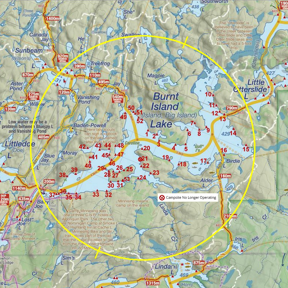
Note: As of 2013, this campsite is incorrectly located on many maps as being far to the south. Campsite & thunderbox signage and firepit have clearly been in the location as shown in the diagram below for a number of years. The absence of this campsite's true location on the maps apparently can lead some campers to doubt the 'legitimacy' of this campsite and to not respect its occupants' privacy. Over my stay here in 2013, a woman approached from campsite #27 while I was hoisting my food-pack and asked me what I was doing there. Once she realized it was a legitimate campsite, she left. On another occasion, young boys from campsite #27 took to frequenting the trail to my thunderbox. So as to assure my privacy, I flagged the trail. On still another occasion, a group of three young girls from campsite #29 walked across the shallows from the island and indignantly announced they intended to gather firewood, apparently considering me a squatter of sorts. I promptly indicated the official campsite sign, firepit and my tent .. and said I didn't want them on my campsite and that they should immediately return to their own campsite. As long as this campsite is not properly located on the maps, this kind of attitude and behaviour will probably repeat.
Locations of campsites 27, 28 and 29 ...

Landing
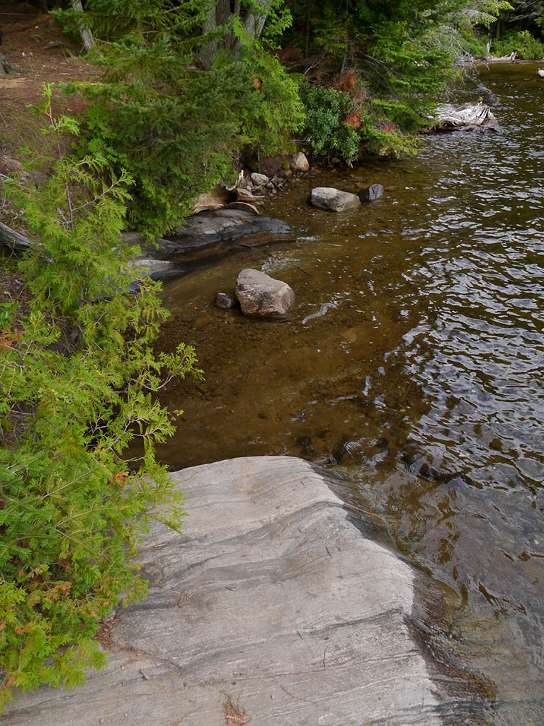
Topography of under-water approach: Sandy approach alongside large sloped rock.
Impediments to disembarking from and/or unloading a canoe: The sandy bottom is at a depth and the shore is slightly abrupt .. typically requiring a feet-in-the-water unloading of gear up on to the adjacent shore and pulling of the canoe out of the water.
Topography to tent sites: Once the shoreline's four-foot high sloped rock is climbed, one is at the campsite's level.
The sandy-bottomed approach is to the right of the sloped rock area ...

![]()
The sandy-bottomed approach is visible beyond the sloped rock ...
![]()
This sloped rock catches the early afternoon sun, while the tentsite at the rear remains in the shade ...

![]()
Campsite
Regular or low-maintenance: Regular
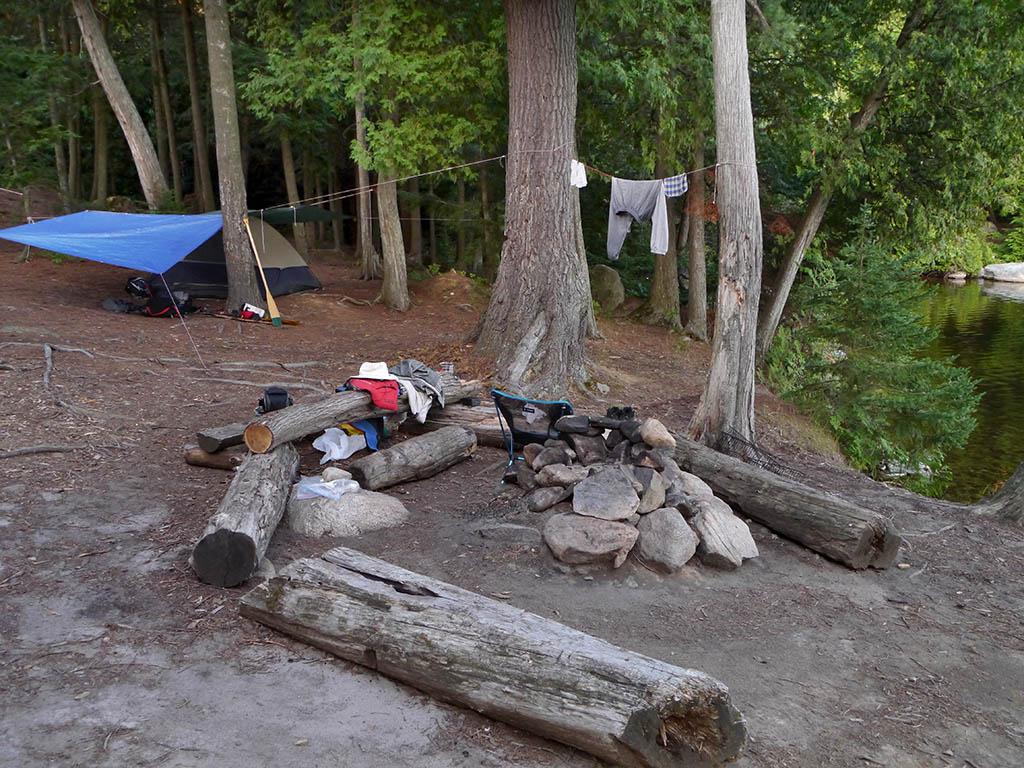
Size of open area: Main open area is approximately 40 x 80 feet.
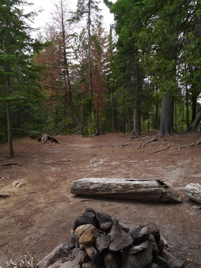
Extent of tree cover: East end tentsite (at rear) has mature tree cover. Northwest tentsite area has only partial tree cover.
Degree of levelness: Generally smooth level surface.
Number of level tent sites: 3 tent sites.
The firepit overlooks the water and is somewhat open to the sky ...
![]()
Room for a couple more tents northwest of the firepit ...
![]()
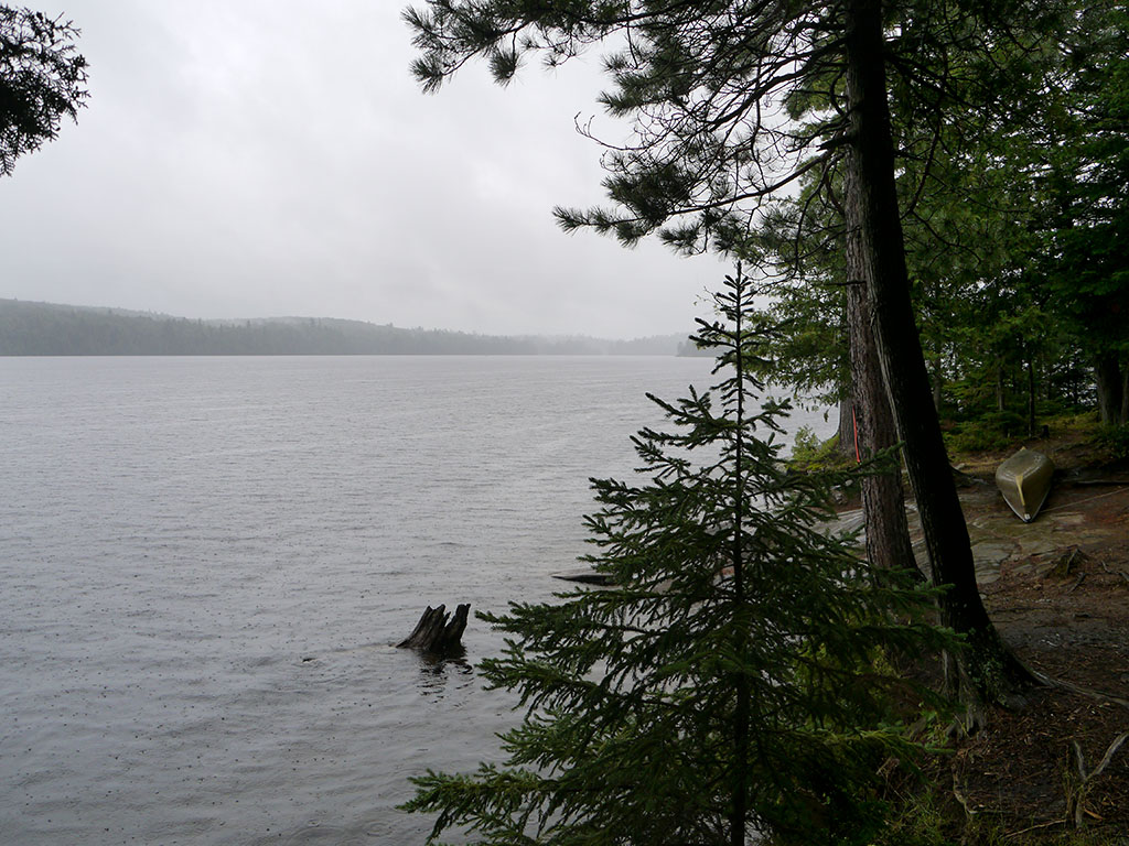
View to the southwest, from the shore beside the firepit ...
![]()
North exposure: Trees block view and wind.
East exposure: Mature forest.
South exposure: View of the lake and mainland across small bay.
West exposure: Trees block view of adjacent island, while the island blocks northwest wind and sunset.
General description: While the campsite is level and somewhat spacious, it has few overhead sheltering trees, it has a limited view of the lake and its privacy is compromised by being improperly located on maps (see opening comments).
Overall accessibility: Disembarking and unloading is a bit of a challenge. Accessing the thunderbox is a lengthly hike around the small bay to the south.
Thanks to Jeffrey McMurtrie of Jeff'sMap for supplying the base-layer map component by Creative Commons licensing.
Submitted by Barry Bridgeford .. January 2014 .. Visited July, 2013