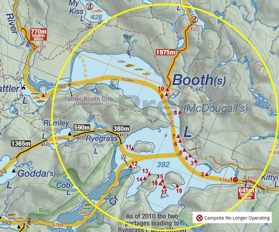
 Booth Lake To Kitty Lake Portage
Length of portage: 550 meters (645 meters as per 'Jeff's Map')
Portage maintenance regular or low: Regular.
Elevation above Sea Level @ Booth Lake is 392 meters.
Elevation above Sea Level @ Kitty Lake is 391 meters.
Difference in elevation: 1 meter.
Elevation of highest point: 399 meters (as per 'Jeff's Map').
Overall rise/fall: 8 meters.
Portage Cross-section .. taken from Kitty Lake to Booth Lake ...
Landing at Booth Lake
Co-ordinates of location: N45 39.159 W78 09.625
Topography of under-water approach: Sand and silt with some small rocks.
Impediments to disembarking from and/or unloading a canoe: None.
Topography of the ascending grade: Roots and rocks
Impediments to moving gear to portage trail: Gear has to lifted over roots and rocks to area along path with enough room for 2 or 3 canoes.
Take-out at Booth Lake ... Start of portage at Booth Lake and rise to portage trail ...
Portage Trail
General description: A mixture of smooth trail and rock/rooty sections. Some moderate elevation changes. There are 3 areas, when after a heavy rainfall and probably in the spring time, that are quite muddy and need the boardwalks to walk over.
Topographical impediments to travelling: Some areas are a little rough due to rocks and roots and at least 3 (potential) muddy areas.
Areas susceptible to impact by periods of rain or beaver flooding: 3 definite areas (see elevation graph).
Typical terrain on portage ... After a good rain, these boardwalks are needed ...
  End of portage, looking down to landing at Kitty Lake, where the river spills out ...
Landing at Kitty Lake
Topography of under-water approach: Gravel .. water is somewhat fast moving, particularly during high water levels.
Impediments to disembarking from and/or unloading a canoe: None .
Topography of the ascending grade: Smooth rise, with some rocks present.
Impediments to moving gear to portage trail: None, room for 2 or 3 canoes.
Organization area and beginning of portage ... Looking downstream, over landing and river's flow, at September 2013 low water levels ...
  July 2008, high water & fast current make for dramatically different dynamics at the landing ... Photo by Bill Warren
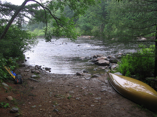
Thanks to Jeffrey McMurtrie of Jeff'sMap for supplying the base-layer map component by Creative Commons licensing.
Submitted by Chris Taylor, visited September 2013, submitted October 19th, 2013