 Big Trout Lake - Campsite #33
Landing
Topography of under-water approach: Flat, smooth rock that extends underwater.
Impediments to disembarking from and/or unloading a canoe: None, items can be unloaded to a flat, smooth area.
Topography leading to tent sites: 5m elevation on 20m trail to tent site. Path is somewhat "sidesloped" at the landing, and some obstacles were present at the time of this visit.

|
|
| Nice landing with room for gear. | |

|
|
| At this time, the path leads under this tree to get to campsite. | |
Campsite
Campsite maintenance: Regular.
Size of open area: 15m (long) x 3m (northeast) x 10m (southwest).
Extent of tree cover: 30%.
Degree of levelness: Fairly level and flat.
Number of level tent sites: 4+.
North exposure: large treed hill.
East exposure: open view of lake.
South exposure: open view of lake.
West exposure: open view of island to the west.
General description: A pie shaped campsite that has some protection from northerly winds, is otherwise very open to the elements. Situated on the southern point of the island, the view of the lake is unobstructed. The flat area leading to the landing area can accommodate 3 tents while another area beside the firepit could also be used.Overall accessibility: The trail from the landing area can pose a challenge as (at this time) you must carry your gear under a semi-felled tree, and the beginning of the trail is somewhat "side sloped".

|
|
| Firepit. | |

|
|
| A nice place to view lake...or...another tentpad. | |

|
|
| Lots of space for tent placement and path to landing. | |

|
|
| Path to thunderbox. | |
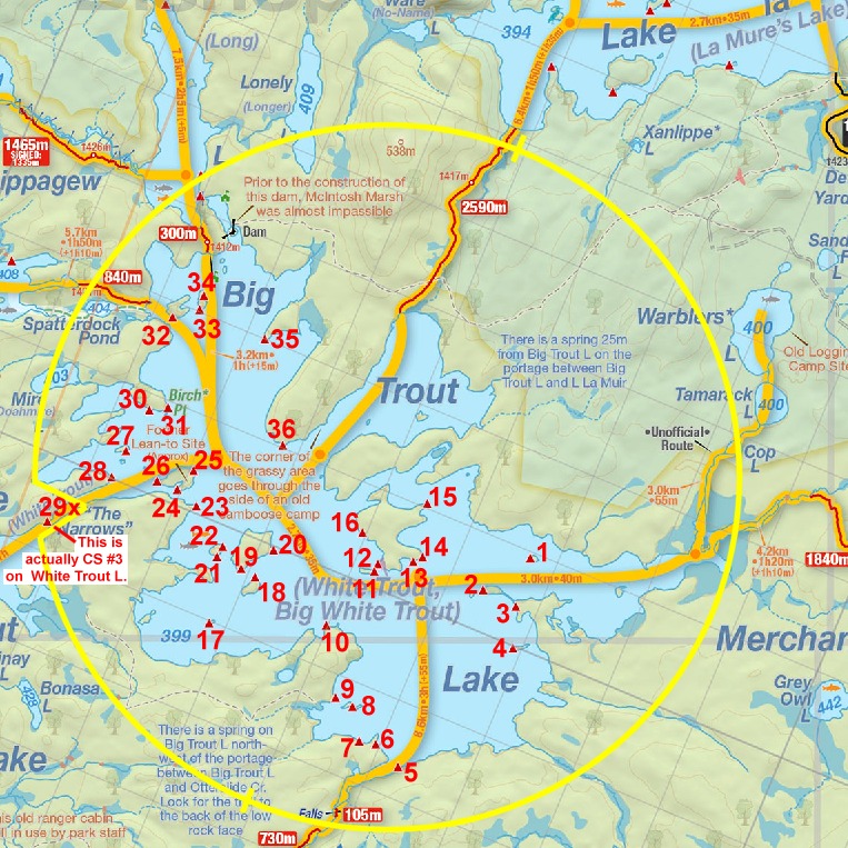
Thanks to Jeffrey McMurtrie of Jeff'sMap for supplying the base-layer map component by Creative Commons licensing.
Submitted by Chris Taylor .. Visited July, 2017 .. Submission April, 2020