 Big Porcupine Lake Campsite #12
Landing
Topography of under-water approach: Shallow water approach with some small rock and gravel (Edit: sandy beach in summer's lower water).
Impediments to disembarking from and/or unloading a canoe: Some medium sized rocks at the shoreline.
Topography to tent sites: A short level path (approx. 5m).
Landing and climb to site ...

![]()
View of firepit from water on west side of site ...

![]()
Campsite
Campsite maintenance: Regular.
Size of open area: 25m x 10m.
Extent of tree cover: 50%.
Degree of levelness: very level site.
Number of level tent sites: 5+.
North exposure: Trees.
East exposure: Trees.
South exposure: Trees.
West exposure: able to see lake thru trees, open at firepit for nice view of lake.
General description: A large, level site with numerous possibilities for tents to be pitched. A great view of the lake and the setting sun from the firepit. A second firepit exists at the back of the site, and should serve as a good example of what NOT to do, as the stump still has a root system attached to it (Edit: and obviously no sand/gravel pit was dug below it. It should not be used!).
Overall accessibility: The water at the landing is shallow, and a slight step over some rocks are the only issues.
View of firepit from water on west side of site ...

![]()
Not a good idea! ...

![]()
Looking north from the firepit ...

![]()
Looking south from the back of the campsite ...

![]()
Looking south from the back of the campsite ...

![]()

Thanks to Jeffrey McMurtrie of Maps By Jeff for supplying the base map.
Submitted by Chris Taylor .. Visited July 2016 .. Submission August, 2016
Supplementary photos ...
Landing with summer low water (Photo: B. Bridgeford 2011) ...

![]()
View due west from firepit (Photo: B. Bridgeford 2011) ...
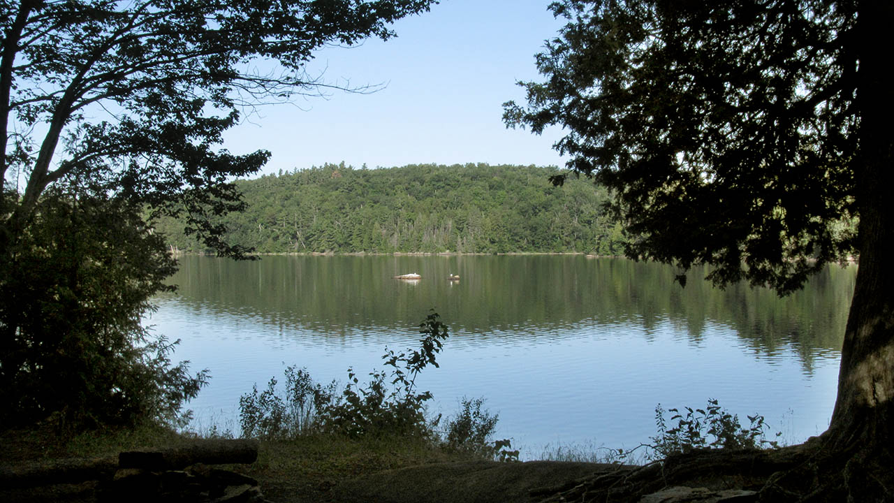
![]()
View looking SW from firepit (Photo: B. Bridgeford 2015) ...

![]()